
A municipality is usually a single administrative division having corporate status and powers of self-government or jurisdiction as granted by national and regional laws to which it is subordinate.

Local government is a generic term for the lowest tiers of governance or public administration within a particular sovereign state.

A town is a type of a human settlement. Towns are generally larger than villages and smaller than cities, though the criteria to distinguish between them vary considerably in different parts of the world.

A metropolitan area or metro is a region consisting of a densely populated urban agglomeration and its surrounding territories which are sharing industries, commercial areas, transport network, infrastructures and housing. A metropolitan area usually comprises multiple principal cities, jurisdictions and municipalities: neighborhoods, townships, boroughs, cities, towns, exurbs, suburbs, counties, districts and even states and nations in areas like the eurodistricts. As social, economic and political institutions have changed, metropolitan areas have become key economic and political regions.
In many countries, a mayor is the highest-ranking official in a municipal government such as that of a city or a town. Worldwide, there is a wide variance in local laws and customs regarding the powers and responsibilities of a mayor as well as the means by which a mayor is elected or otherwise mandated. Depending on the system chosen, a mayor may be the chief executive officer of the municipal government, may simply chair a multi-member governing body with little or no independent power, or may play a solely ceremonial role. A mayor's duties and responsibilities may be to appoint and oversee municipal managers and employees, provide basic governmental services to constituents, and execute the laws and ordinances passed by a municipal governing body. Options for selection of a mayor include direct election by the public, or selection by an elected governing council or board.

The municipalities of Brazil are administrative divisions of the Brazilian states. Brazil currently has 5,570 municipalities, which, given the 2019 population estimate of 210,147,125, makes an average municipality population of 37,728 inhabitants. The average state in Brazil has 214 municipalities. Roraima is the least subdivided state, with 15 municipalities, while Minas Gerais is the most, with 853. Northern states are divided into small numbers of large municipalities, and therefore they cover large areas incorporating several separated cities or towns that do not necessarily conform to one single conurbation. Southern and eastern states on the other hand, are divided into many small municipalities, and therefore large urban areas usually extend over several municipalities which form one single conurbation.

An unincorporated area is a region that is not governed by a local municipal corporation. There are many unincorporated communities and areas in the United States and Canada.

Halifax is the capital and most populous municipality of the Canadian province of Nova Scotia, and the most populous municipality in Atlantic Canada. As of 2023, it is estimated that the population of the Halifax CMA was 518,711, with 348,634 people in its urban area. The regional municipality consists of four former municipalities that were amalgamated in 1996: Halifax, Dartmouth, Bedford, and Halifax County.

Municipalities are the lowest level of official territorial division in Germany. This can be the second, third, fourth or fifth level of territorial division, depending on the status of the municipality and the Land it is part of. The city-states Berlin and Hamburg are second-level divisions. A Gemeinde is one level lower in those states which also include Regierungsbezirke as an intermediate territorial division. The Gemeinde is one level higher if it is not part of a Gemeindeverband.
In the United States, the meaning of village varies by geographic area and legal jurisdiction. In formal usage, a "village" is a type of administrative division at the local government level. Since the Tenth Amendment to the United States Constitution prohibits the federal government from legislating on local government, the states are free to have political subdivisions called "villages" or not to and to define the word in many ways. Typically, a village is a type of municipality, although it can also be a special district or an unincorporated area. It may or may not be recognized for governmental purposes.

The municipality is one of the two fundamental territorial divisions in Spain, the other being the provinces.
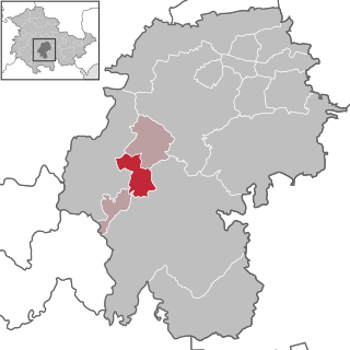
Martinroda is a municipality in the district Ilm-Kreis, in Thuringia, Germany. The former municipality Angelroda was merged into Martinroda in December 2019.

Wirrbach is a river of Thuringia, Germany. It flows into the Zahme Gera in Angelroda.

The Plaue–Themar railway is a 62 kilometre-long, single-track, non-electrified, standard-gauge branch-line in the Thuringian Forest in Germany. The Stützerbach–Schleusingerneundorf section was built as the first Prussian rack railway between 1879 and 1904 and connects the Erfurt–Schweinfurt railway in the north via the towns of Plaue, Ilmenau, Schleusingen and Themar with the Eisenach–Lichtenfels railway in the south.
Ilm-Kreis I is an electoral constituency represented in the Landtag of Thuringia. It elects one member via first-past-the-post voting. Under the current constituency numbering system, it is designated as constituency 22. It covers the southern part of Ilm-Kreis.


