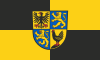
Thuringia, officially the Free State of Thuringia, is a state of central Germany, covering 16,171 square kilometres (6,244 sq mi), the sixth smallest of the sixteen German states. It has a population of about 2.1 million.
Gotha is a Kreis (district) in western central Thuringia, Germany. Neighboring districts are Unstrut-Hainich-Kreis, Sömmerda, the Kreis-free city Erfurt, Ilm-Kreis, Schmalkalden-Meiningen and the Wartburgkreis.
Greiz is a Kreis (district) in the east of Thuringia, Germany. Neighboring districts are Saale-Holzland, Saale-Orla, district-free city Gera, the Burgenlandkreis in Saxony-Anhalt, Altenburger Land, and the two Saxon districts Zwickau and Vogtlandkreis.
Hildburghausen is a district in Thuringia, Germany. It is bounded by the district of Schmalkalden-Meiningen, the city of Suhl, the districts of Ilm-Kreis, Saalfeld-Rudolstadt and Sonneberg, and the state of Bavaria. Located roughly halfway between the mountain chains of the Rhön and the Thuringian Forest, the district is densely forested and covered by hilly countryside. Its territory is similar to that of the former Ernestine duchy, Saxe-Hildburghausen.

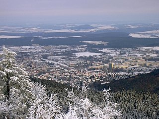
Suhl is a city in Thuringia, Germany, located SW of Erfurt, 110 kilometres NE of Würzburg and 130 kilometres N of Nuremberg. With its 37,000 inhabitants, it is the smallest of the six urban districts within Thuringia. Together with its northern neighbour-town Zella-Mehlis, Suhl forms the largest urban area in the Thuringian Forest with a population of 46,000. The region around Suhl is marked by up to 1,000-meter-high mountains, including Thuringia's highest peak, the Großer Beerberg, approximately 5 kilometres NE of the city centre.
Saale-Holzland is a Kreis (district) in the east of Thuringia, Germany. Neighboring districts are the district Burgenlandkreis in Saxony-Anhalt, the district-free city Gera, the districts Greiz, Saale-Orla, Saalfeld-Rudolstadt, Weimarer Land and the district-free city Jena.
Saalfeld-Rudolstadt is a Kreis (district) in the south of Thuringia, Germany. Neighboring districts are the districts Weimarer Land, Saale-Holzland, Saale-Orla, the district Kronach in Bavaria, and the districts Sonneberg, Hildburghausen and Ilm-Kreis.
Schmalkalden-Meiningen is a Landkreis in the southwest of Thuringia, Germany. Its neighboring districts are the districts Wartburgkreis, Gotha, Ilm-Kreis, the district-free city Suhl, the district Hildburghausen, the Bavarian district Rhön-Grabfeld, and the district Fulda in Hesse.
Unstrut-Hainich-Kreis is a Kreis (district) in the north of Thuringia, Germany. Neighboring districts are the districts Eichsfeld, Kyffhäuserkreis, Sömmerda, Gotha, Wartburgkreis and the district Werra-Meißner in Hesse.
Wartburgkreis is a Kreis (district) in the west of Thuringia, Germany. Neighboring districts are the districts Unstrut-Hainich-Kreis, Gotha, Schmalkalden-Meiningen, and the districts Fulda, Hersfeld-Rotenburg and Werra-Meißner-Kreis in Hesse. The district has 30 municipalities, including Eisenach.
Weimarer Land is a Landkreis (district) in the east of Thuringia, Germany. Neighboring districts are the district Burgenlandkreis in Saxony-Anhalt, the district Saale-Holzland and the district-free city Jena, the district Saalfeld-Rudolstadt, Ilm-Kreis, and the district-free city Erfurt. The district-free city Weimar is completely enclosed by the district.

Saxe-Weimar-Eisenach was a German state, created as a duchy in 1809 by the merger of the Ernestine duchies of Saxe-Weimar and Saxe-Eisenach, which had been in personal union since 1741. It was raised to a grand duchy in 1815 by resolution of the Congress of Vienna. In 1903, it officially changed its name to the Grand Duchy of Saxony, but this name was rarely used. The grand duchy came to an end in the German Revolution of 1918–19 with the other monarchies of the German Empire. It was succeeded by the Free State of Saxe-Weimar-Eisenach, which was merged into the new Free State of Thuringia two years later.

Arnstadt is a town in Ilm-Kreis, Thuringia, Germany, on the river Gera about 20 kilometres (12 mi) south of Erfurt, the capital of Thuringia. Arnstadt is one of the oldest towns in Thuringia, and has a well-preserved historic centre with a partially preserved town wall. The town is nicknamed Das Tor zum Thüringer Wald because of its location on the northern edge of that forest. Arnstadt has a population of approximately 27,000.
Gräfenroda is a village and a former municipality in the Ilm-Kreis district, in Thuringia, Germany. Since 1 January 2019, it has been part of the municipality of Geratal. It was the administrative seat of the former Verwaltungsgemeinschaft Oberes Geratal.
Ilmenau is a town in Thuringia, central Germany. It is the largest town within the Ilm district with a population of 38,600, while the district capital is Arnstadt. Ilmenau is located approximately 33 km south of Erfurt and 135 km north of Nuremberg within the Ilm valley at the northern edge of the Thuringian Forest at an elevation of 500 metres.
Gehren is a town and a former independent municipality in the Ilm-Kreis district, in Thuringia, Germany. It is situated 7 km southeast of Ilmenau. It officially became a town in its own right ('Stadt') in 1855. However, since July 2018, it has been part of the town of Ilmenau. Between 1881 and 1998, Gehren was linked to Ilmenau by a railway.
Plaue is a town in the Ilm-Kreis district, in Thuringia, Germany. It is situated on the river Gera, 11 km north of Ilmenau, and 8 km southwest of Arnstadt. The former municipality Neusiß was merged into Plaue in January 2019. Plaue station lies on the Neudietendorf–Ritschenhausen railway.

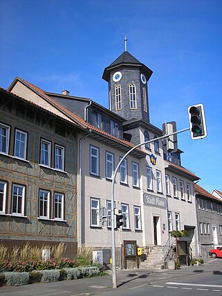
Stadtilm is a town in the Ilm-Kreis district, in Thuringia, Germany. It is situated on the river Ilm, 15 km northeast of Ilmenau, and 11 km southeast of Arnstadt. In July 2018 the former municipality of Ilmtal was merged into Stadtilm.

Alkersleben is a municipality in the Ilm-Kreis district in Thuringia, Germany. The municipality is a member of the collective municipality Riechheimer Berg.

Elleben is a municipality in the district Ilm-Kreis, in Thuringia, Germany. Elleben has two named communities, Riechheim and Gügleben.