North Gyeongsang Province is a province in eastern South Korea. The province was formed in 1896 from the northern half of the former Gyeongsang province,and remained a province of Korea until the country's division in 1945,then became part of South Korea.
North Chungcheong Province,also known as Chungbuk,is a province of South Korea. North Chungcheong has a population of 1,578,934 (2014) and has a geographic area of 7,433 km2 located in the Hoseo region in the south-center of the Korean Peninsula. North Chungcheong borders the provinces of Gyeonggi and Gangwon to the north,North Gyeongsang to the east,North Jeolla to the south and South Chungcheong,Sejong Special Autonomous City and Daejeon Metropolitan City to the west.

Gyeongsang was one of the eight provinces of Korea during the Joseon dynasty. Gyeongsang was located in the southeast of Korea.

Uiseong County (Uiseong-gun) is a county in Gyeongsangbuk-do Province,South Korea. Located near the center of the province,it is bounded by Andong on the north,Cheongsong on the east,Gunwi County on the south,and Sangju and Yecheon on the west. As in most parts of Korea,most of the land is vacant and forested;only about 19% of the county's area is farmland. The county is largely rural,with an economy dominated by agriculture;the only urbanized area is the county seat,Uiseong-eup.

A National Treasure is a tangible treasure,artifact,site,or building which is recognized by the South Korean government as having exceptional artistic,cultural and historical value to the country. The title is one of the eight State-designated heritage classifications assigned by the administrator of the Cultural Heritage Administration (CHA) in accordance with the Cultural Heritage Protection Act after deliberation by the Cultural Heritage Committee.

Eunhaesa is a head temple of the Jogye Order of Korean Buddhism. It is located in Cheongtong-myeon,Yeongcheon,in the province of Gyeongsangbuk-do,South Korea. It stands on the eastern slopes of Palgongsan,not far from another major temple,Donghwasa. The temple was founded by National Preceptor Hyecheol in 809. The name means "temple of the silver sea." The original name was "temple of the tranquil sea," Haeansa. After the original temple burned to the ground following the Seven Year War in the 1590s,it was moved to its current location and named Eunhaesa.

Gounsa is a head temple of the Jogye Order of Korean Buddhism. It stands in Danchon-myeon,Uiseong County,in the province of Gyeongsangbuk-do,South Korea. The temple was built in 681 C.E. by Uisang,a leading Buddhist monk of Silla. The name means "lonely cloud";these characters were chosen after the temple was visited by scholar Choe Chi-won. The temple had previously been known by the same name,but with the meaning of "high cloud."
This is a partial list of Korea-related topics starting with B. For Korean words starting with ㅂ,see also under P.
Jungnyeong is a mountain pass in the Sobaek Mountains of central South Korea. It reaches a height of 689 metres (2,260 ft). It stands on the flank of Sobaeksan,which reaches more than twice that height.

Songnisan is a mountain and National Park in South Korea. It lies in the Sobaek mountains along the border between Gyeongsangbuk-do and Chungcheongbuk-do. Its main attractions are the temple Beopjusa and an especially picturesque peak,Munjangdae. The mountain's highest peak is Cheonhwangbong,at 1,058.4 m (3,472 ft).

Taebaeksan,also known as Mount Taebaeksan or Mount Taebaek,is a South Korean mountain with several important peaks of the Taebaek mountain range,or the Taebaek Jeongmaek Range. It is an important mountain in the Baekdu-daegan Mountain-system Baekdudaegan,the point where it turns west after running along Korea's east coast for a long distance. Its territory stretches from the city of Taebaek in Yeongwol-gun County,Gangwon-do Province to Bonghwa-gun County,Gyeongsangbuk-do Province,and it was designated South Korea's 22nd national park on 22 August 2016. It has an elevation of 1,566.7 m (5,140 ft).
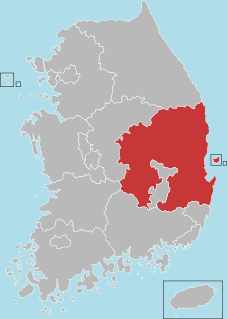
Daegu-Gyeongbuk or Taegu-Kyŏngbuk is the compound word of Daegu and Gyeongbuk,and indicates both administrative regions in South Korea. The region usually forms the similar political,economic,and cultural area. Daegu is an independent city from Gyeongsangbuk-do and has the same administrative status with its mother province. Both have their separate local governments reporting directly to the national government.

Unmun-sa (Korean: 운문사) is a Buddhist temple located on the southernmost part of the Taebaek Mountains in Gyeongsangbuk-do,South Korea. It was built in the 21st year of the reign of King Jinheung. Around the end of the Silla Kingdom,the temple was expanded and renamed as Taejakgap-sa,but its name was changed to its current Unmansa in the 20th year of the reign of King Taejo. Parts of the temple were destroyed down during the invasion of the Korean peninsula (1592–98) by the Japanese general Toyotomi Hideyoshi.

Hwanseongsa is a temple located in Gyeongsan,Gyeongsangbuk-do,South Korea.
Yeondaeam is a temple located in Yeongyang County,Gyeongsangbuk-do,South Korea.
Bogwangsa is a temple located in Gyeongsangbuk-do,South Korea.
Bohyeonsa is a temple located in Yeongcheon,Gyeongsangbuk-do,South Korea.
Beopgwangsa is a temple located in Pohang,Gyeongsangbuk-do,South Korea.
Wongaksa is a temple located in Gigye-myeon,Pohang,Gyeongsangbuk-do,South Korea.
Cheongnyeonsa is a temple located in Yeongdeok County,Gyeongsangbuk-do,South Korea.