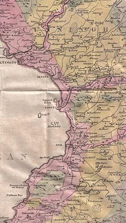
Annick Lodge and Greenville

Last updated

Annick Lodge is an estate between Perceton and Cunninghamhead in North Ayrshire, Scotland.

Contents

History

Annick Lodge (previously Annack, Annoch or Annock) and estate was built by Captain Alexander Montgomery, the brother-german of Hugh, Earl of Eglinton. The lodge stands on the site of the old mansion described by Pont as "a proper building, veill planted, the inheritance of Blaire, Laird of Adamtoune." The 11th Earl had died without male issue so the Earldom had passed to Hugh, son of Alexander Montgomerie of Coilsfield (Robertson 1908). The Right Hon. David Boyle of Kelburn married Elizabeth, eldest daughter of Alexander at Annick Lodge in 1804. Elizabeth, wife of Alexander Montgomerie Esq., died 13 February 1839; her beloved daughter Frances died 25th Sept 1858 and both were buried at Dreghorn Parish cemetery.

The second laird of Annick Lodge, who succeeded in 1802, was Lieutenant-Colonel of the Ayrshire Yeomanry Cavalry, a magistrate and deputy-lieutenant of Ayrshire. One of the sons of the family wrote a vocabulary of the American Indians of the Columbia River and Puget's Sound! (Robertson 1908). Major and Mrs Montgomerie attended the famous 1839 Eglinton Tournament in what is now Eglinton Country Park and were allotted a seat in the Grand Stand. [1] Susanna Fraser Anderson, wife of William Eglington Montgomerie of Annick Lodge, [2] died 13 October 1884 age 84 yrs and is buried in Dreghorn parish cemetery.

Annick Lodge gates and drive. Annick Lodge gates.JPG
Annick Lodge gates and drive.
Gravestone of Robert Barclay Shaw of Annick Lodge Robert Barclay Shaw of Annick Lodge, Dreghorn, Ayrshire.jpg
Gravestone of Robert Barclay Shaw of Annick Lodge

In 1800 Annick Lodge was visited by John Stoddart on his return from his tour of Scotland. Stoddart calls the new house "a complete specimen of the English ferme ornee". Hussey states that this term describes a country estate laid out partly according to aesthetic principles and partly for farming. Ferme ornee were an expression in landscape gardening of the Romantic Movement of 18th-century Europe, i.e. a working farm, domestic animals, natural landscape joined with follies and grottoes, statuary and classical texts combined with avenued walks, flowing water, lakes, areas of light and shade, special plantings and inspirational views.

The house itself is decorated with a porch supported upon Corinthian pillars, and surmounted by a facade bearing sculptured urns at its three angles. The tympanum is filled in with a heraldic shield and scroll-work in high relief (Millar 1885). Annick Lodge estate is partly on the site of a previous small estate, called Greenvale, Greenville or Greenval. Aiton records that Annack-lodge had gardens with hot-houses, greenhouse, etc. as early as 1811. The estate had a common boundary march with the Cunninghamhead estate.

The river bed here at Annick Bridge contains animal fossils and some fine specimens were removed by members of the Kilmarnock Glenfield Ramblers. It is now very rural (2006) despite the previous mining and quarrying activity and the presence of the old railway and abandoned estate coal siding nearby. A fine three arched sandstone railway viaduct on the old Glasgow and South Western Railway, later the London, Midland and Scottish, is located just upstream from the Annick Bridge. It was restored to good order in 2005 / 2006, despite being redundant. The area beside the northern bank of the Annick Water is known as Friersmill Holm. The 'Reid Friers' were the Red Friars, better known as the Knights Templar and the mill in this vicinity would have been one of many belonging to the order in Scotland, however no indication of its exact site is found on the OS or any other old maps of the district. Strawhorn relates that the 'Friersmiln' belonged to the Carmelite friars at Irvine and held the multures, a fixed proportion of the tenant's grain, paid to the miller by the suckener to grind the corn, of Armsheugh, Roddinghill and Holehouse. [3]

The Annick Lodge policies contain a number of fine specimen trees, especially some very large common oaks.

Greenville

A view of the Annick Holm in 2008. Annick Lodge holm 1.JPG
A view of the Annick Holm in 2008.
Another view with the Annick Water visible. Annick Lodge Holm 2.JPG
Another view with the Annick Water visible.

The name of a property called Greenville is found on the 1775 Armstrong map and Aiton refers to this country seat as Greenvale in 1811. It is Greenval on Ainslie's 1821 map and Dobie (1876) states that the name was Greenvale. The estate was made up of all the mains lands of Over-Pearston, sometimes called Pearston-Blair, acquired by Alexander Montgomerie, second son of Alexander Montgomerie of Skelmorlie and Coilsfield, in 1790. His mother was Lillias Montgomerie, heiress of Skelmorlie and he was born in 1744. He also purchased the old estate of Braehead and the lands of Roddinghill (previously Redenhill in 1775 and Ruddinghill in 1832), giving the name Annick Lodge to the collective whole. Part of the old 'proper building' of Pont's day (17th century) was exposed during repair work on Annick Lodge in the 1870s. lodge had gardens with hot-houses, greenhouse, etc. as early as 1811. The estate had a common boundary march with the Cunninghamhead estate.

Annick Lodge's landscape components

The Components of the designed landscape are from the 18th and 19th centuries, superseding earlier landscape phases of which little is known. [4] As regarding listed buildings, Annick Lodge is Category A, [5] the Gateway (See photograph) is Category B [6] and the Bridge near Annick Lodge (footbridge to the northwest of the Lodge) is Category C. [7]

Architectural features

William Aiton's map of 1811 showing Greenvale (sic) Map of Dunduff castle & roads.jpg
William Aiton's map of 1811 showing Greenvale (sic)

Around 100 yards east of the footbridge, between the house and the riverbank, there is a gravestone of red sandstone inscribed: "Philip of SP-Annie 1939–1947".

See also

Related Research Articles

Skelmorlie Human settlement in Scotland

Skelmorlie is a village in North Ayrshire, Scotland. Although it is the northernmost settlement in the council area of North Ayrshire it is contiguous with Wemyss Bay, which is in Inverclyde. The dividing line is the Kelly Burn, which flows into the Firth of Clyde just south of the Rothesay ferry terminal. Despite their proximity, the two villages have historically been divided, Skelmorlie in Ayrshire and Wemyss Bay in Renfrewshire.

Dreghorn

Dreghorn is a village in North Ayrshire, Scotland, 3.5 kilometres east of Irvine town centre, on the old main road from Irvine to Kilmarnock. It is sited on a ridge between two rivers. As archaeological excavations near the village centre have found a significant neolithic settlement provisionally dated to around 3500 BC, as well as medieval structures, scholars have suggested that Dreghorn could be Britain's oldest continuously inhabited village. Both Irvine and Dreghorn have grown in size and they are now separated by the Annick Valley Park, which incorporates a footpath and National Cycle Route 73 on the route of the disused Irvine to Busby railway line. It had an estimated population of 3,540 in 2016.

Ferme ornée

The term ferme ornée as used in English garden history derives from Stephen Switzer's term for 'ornamental farm'. It describes a country estate laid out partly according to aesthetic principles and partly for farming. During the eighteenth century the original ferme ornée was Woburn Farm, made by Philip Southcote, who bought the property in 1734. William Shenstone's garden at The Leasowes was also a ferme ornée. Marie Antoinette made a later example at Versailles in the form of the Hameau de la Reine, created between 1783 and 1787, but it was much more for pleasure than for food production. The Dessau-Wörlitz Garden Realm was said to be the largest ferme ornée in 18th-century Europe. The most complete surviving example is said to be Larchill near Kilcock, Ireland.

Bourtreehill House

Bourtreehill House and the enclosed land on which it was built form the original estate of Bourtreehill. The wooded hill-top, a distinctive feature of the estate, is now a landmark that sits at the centre of modern North Bourtreehill in the district of North Ayrshire on the west coast of Scotland.

Perceton is a medieval settlement and old country estate in North Ayrshire, Scotland, near the town of Irvine. The ruined church in Perceton is one of the oldest buildings in the Irvine district. The earliest legible gravestone dates from 1698, though older stone coffins will certainly still rest deep within the small hillock on which the chapel and graveyard sit.

Annick Water Tributary of the River Irvine in Scotland

The Annick Water is the largest tributary of the River Irvine. The river runs from Long Loch, just inside East Renfrewshire, in a generally south-western direction through North Ayrshire and East Ayrshire, to confluence with its parent river at Irvine, North Ayrshire on the west coast of Scotland. The name may derive from the Gaelic for 'overflowing' and Strathannick is very much prone to flooding as recorded by SEPA.

Stanecastle

Stanecastle was a medieval barony and estate in North Ayrshire, Scotland, first mentioned in 1363 and now part of the Irvine New Town project. Its nearest neighbours are Bourtreehill and Girdle Toll.

Cunninghamhead is a hamlet in North Ayrshire, Scotland. It was the centre of the lands of Cunninghamhead, Perceton and Annick Lodge in Cunninghame. This mainly rural area is noted for its milk and cheese production and the Ayrshire, Cunninghame or Dunlop breed of cattle.

Clan Montgomery Lowland Scottish clan

Clan Montgomery is a Lowland Scottish clan.

Cunninghamhead railway station

Cunninghamhead railway station (NS369414) was a railway station serving Cunninghamhead Estate, the village of Crossroads, North Ayrshire and the town of Stewarton, East Ayrshire, Scotland. The station was originally part of the Glasgow, Paisley, Kilmarnock and Ayr Railway.

Eglinton Castle

Eglinton Castle was a large Gothic castellated mansion in Kilwinning, North Ayrshire, Scotland.

Cunninghamhead Estate

The Cunninghamhead Estate is in the 21st century mainly a residential caravan park with two private residences near Irvine, Scotland. It was once a private estate, owned by a sequence of recorded families since around 1418. The Mansion House, one of Britain's lost houses, was built in 1747; it was destroyed by fire in the early 1960s, whilst renovation work was being carried out. The old mansion and castle have been lost, however the stables are still a residence, whilst the Gardner's Cottage survive as ruins. From 1964, work was carried out, first to use the estate as a chicken farm and later as holiday and residential, caravan park and camping site, making most of the rural location. Circa 2003 the site was significantly redeveloped to become a residential caravan park exclusively for the use of retired and semi-retired persons.

Cunninghamhead Human settlement in Scotland

Cunninghamhead is a hamlet on the Annick Water in the Parish of Dreghorn, North Ayrshire, Scotland. The area was part of the old Cunninghamhead estate, and once contained several watermills.

Eglinton Country Park

Eglinton Country Park is located in the grounds of the old Eglinton Castle estate, Kilwinning, North Ayrshire, Scotland. Eglinton Park is situated in the parish of Kilwinning, part of the former district of Cunninghame, and covers an area of 400 ha. The central iconic feature of the country park is the ruined Eglinton Castle, once home to the Eglinton family and later the Montgomeries, Earls of Eglinton and chiefs of the Clan Montgomery. Eglinton Country Park is managed and maintained by North Ayrshire Council and its Ranger Service.

Auchans Castle, Ayrshire

Auchans Castle, House, House of Auchans or Old Auchans, is a mock military mansion, Category A listed, T-plan building of a late 16th-century date converted to the L-plan during the early-to-mid-17th century; its ruins stand about 1 km W of Dundonald, South Ayrshire, Scotland. Parish of Dundonald. It was held at various times by the Wallace, Cochrane and Montgomerie families.

Skelmorlie Castle

Skelmorlie Castle stands on the eastern shore of the Firth of Clyde, Scotland, at the north-western corner of the county of Ayrshire. The structure dates from 1502, and was formerly the seat and stronghold of the Montgomery Clan. The modern village of Skelmorlie lies to the north of the castle.

Lands of Lainshaw The Lands Of Lainshaw Have Been In Place For Many Years And Was Used In The War.

The Lands of Lainshaw lie in Strathannick and were part of the Lordship of Stewarton, in East Ayrshire, Scotland. Lainshaw House is a category B listed mansion, lying in a prominent position above the Annick Water and its holm in the Parish of Stewarton, Scotland. Part of the much older Lainshaw Castle is contained within the several later building phases of the present day Lainshaw House. The names 'Langshaw' or 'Langschaw' were used in historic times. Law Mount near the High and Laigh Castleton farms has been suggested as the site of the original castle, granted in the 12th century to Godfrey de Ross by Hugo de Morville.

Lands of Broomlands Human settlement in Scotland

The lands of Broomlands or Broumlands formed a small country estate about a mile to the east of Irvine, North Ayrshire, Scotland situated on the east bank of the Annick Water in the Parishes of Dreghorn and Irvine.

Lawthorn Human settlement in Scotland

Lawthorn is a hamlet near Perceton in Strathannick, Irvine, North Ayrshire, Scotland. The settlement lies on the old Irvine to Stewarton toll road.

References

  1. Aikman, J & Gordon, W. (1839) An Account of the Tournament at Eglinton. Pub. Hugh Paton, Carver & Gilder. Edinburgh. M.DCCC.XXXIX. P. 8.
  2. Scotlands People pay per view , Marriages 589/00 0020 0138 Dreghorn 03.01.1824 retrieved 26 August 2014
  3. Strawhorn, John (1994). The History of Irvine. Edinburgh : John Donald. ISBN   0-85976-140-1. P.30
  4. Historic Environment Scotland. "ANNICK LODGE (GDL00014)" . Retrieved 5 March 2019.
  5. Historic Environment Scotland. "ANNICK LODGE (Category A Listed Building) (LB836)" . Retrieved 5 March 2019.
  6. Historic Environment Scotland. "GATEWAY, ANNICK LODGE (Category B Listed Building) (LB114)" . Retrieved 5 March 2019.
  7. Historic Environment Scotland. "BRIDGE, NEAR ANNICK LODGE MAINS (Category C Listed Building) (LB837)" . Retrieved 5 March 2019.

Coordinates: 55°38′32″N4°36′35″W / 55.64222°N 4.60972°W / 55.64222; -4.60972