Antarctic Bay (Greenland)

Last updated
Antarctic Bay
Antarctic Bugt
Greenland edcp relief location map.jpg
Red pog.svg
Antarctic Bay
Location in Greenland
Location Peary Land, Arctic
Coordinates 81°3′N14°20′W / 81.050°N 14.333°W / 81.050; -14.333
Ocean/sea sources Greenland Sea
Basin  countries Greenland
Max. length14 km (8.7 mi)
Max. width17 km (11 mi)
FrozenAll year round
Settlements0

Antarctic Bay (Danish : Antarctic Bugt) is a bay in the Greenland Sea coast of the Crown Prince Christian Land peninsula, King Frederick VIII Land, Northeastern Greenland. [1] Administratively the bay and its surroundings belong to the Northeast Greenland National Park.

Contents

The area of the bay is uninhabited.

History

The bay was named by the 1906-1908 Denmark expedition after Alfred Gabriel Nathorst's ship Antarctic . [2]

Geography

Antarctic Bay opens to the Fram Strait of the Greenland Sea. It lies between Amdrup Land to the west and the Flade Isblink ice cap to the north. It is a fairly wide bay, with the Nordostrundingen about 50 km (31 mi) to the northeast of its unnamed northeastern point. Sophus Müller Naes is the southwestern point of the bay. [3] Kilen lies just a few km north of the ice-covered head and northeastern shore of the bay. [4] The waters of bay are clogged by fast ice the year round.

Map of Crown Prince Christian Land's northern half. Nordostrundingen C 501 map sheet.tif
Map of Crown Prince Christian Land's northern half.
Johan Peter Koch's 1911 map of NE Greenland showing Crown Prince Christian Land. Karte Nordostgronland Koch 1911.png
Johan Peter Koch's 1911 map of NE Greenland showing Crown Prince Christian Land.

Related Research Articles

<span class="mw-page-title-main">Ludvig Mylius-Erichsen</span> Danish author, ethnologist, and explorer

Ludvig Mylius-Erichsen was a Danish author, ethnologist, and explorer, from Ringkøbing. He was most notably an explorer of Greenland.

Bessel Fjord is a fjord in northeastern Greenland. Administratively it belongs to the NE Greenland National Park area.

<i>Antarctic</i> (ship) Swedish steamship used for several polar expeditions

Antarctic was a Swedish steamship built in Drammen, Norway, in 1871. She was used on several research expeditions to the Arctic region and to Antarctica from 1898 to 1903. In 1895 the first confirmed landing on the mainland of Antarctica was made from this ship.

<span class="mw-page-title-main">Georg Carl Amdrup</span> Danish naval officer, Vice Admiral and Greenland researcher

Vice Admiral Sir Georg Carl Amdrup, RN was a Danish naval officer, Vice Admiral and Greenland researcher.

<span class="mw-page-title-main">Crown Prince Christian Land</span>

Crown Prince Christian Land is a large peninsula in northern Greenland. It is a part of King Frederick VIII Land and administratively it belongs to the Northeast Greenland National Park.

<span class="mw-page-title-main">Hovgaard Island (Greenland)</span>

Hovgaard Island is a large uninhabited island of the Greenland Sea, Greenland. The island was named after Andreas Hovgaard, a Polar explorer and officer of the Danish Navy who led an expedition to the Kara Sea on steamship Dijmphna in 1882–83.

<span class="mw-page-title-main">King Frederick VIII Land</span> Region in Greenland

King Frederick VIII Land is a major geographic division of northeastern Greenland. It extends above the Arctic Circle from 76°N to 81°N in a North-South direction along the coast of the Greenland Sea.

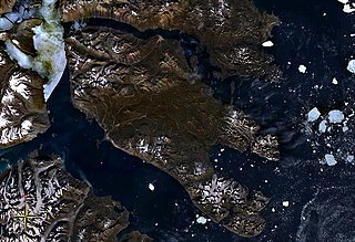
Holm Land, sometimes referred to as "Hahn Land", is a peninsula in King Frederick VIII Land, northeastern Greenland. Administratively it belongs to the NE Greenland National Park area.

Ingolf Fjord, also known as Ingolf Sound, is a fjord of Greenland's northeastern coast in northern King Frederick VIII Land.

<span class="mw-page-title-main">Denmark expedition</span>

The Denmark expedition, also known as the Denmark Expedition to Greenland's Northeast Coast, and as the Danmark Expedition after the ship, was an expedition to the northeast of Greenland in 1906–1908. Despite being overshadowed by the death in tragic circumstances of the main exploration team, including three of the expedition's leading members: Ludvig Mylius-Erichsen (1872–1907), Niels Peter Høeg Hagen (1877–1907) and Jørgen Brønlund (1877–1907), the Denmark expedition was not a failure. It achieved its main cartographic objectives and succeeded in exploring the vast region, drawing accurate charts of formerly unexplored coastlines and fjords, naming numerous geographic features, and gathering a wealth of scientific data.

<span class="mw-page-title-main">Seal Lake</span> Lake in NE Greenland

Seal Lake, also known as Sael Lake, Saelso, Saelsöen and Sælsø, is a land-locked freshwater fjord in southern King Frederick VIII Land, in Greenland's northeastern coast. The Danish weather station Danmarkshavn —the only inhabited place in the area— lies about 30 km (19 mi) to the east. The lake and its surroundings are part of the Northeast Greenland National Park zone.

<span class="mw-page-title-main">Antarctic Sound, Greenland</span>

The Antarctic Sound is a sound in King Christian X Land, Northeast Greenland. Administratively it is part of the Northeast Greenland National Park zone.

<span class="mw-page-title-main">Daly Range</span>

The Daly Range or Daly Mountains is a mountain range in Peary Land, Northern Greenland. Administratively this range is part of the Northeast Greenland National Park.

Devil Island is an uninhabited island of King Frederick VIII Land, NE Greenland.

<span class="mw-page-title-main">Antarctic Haven</span>

Antarctic Haven is a bay in King Christian X Land, Northeastern Greenland.

<span class="mw-page-title-main">Carlsberg Fjord</span>

Carlsberg Fjord is a fjord in King Christian X Land, eastern Greenland.

Fleming Fjord is a fjord in King Christian X Land, eastern Greenland.

<span class="mw-page-title-main">Davy Sound</span>

The Davy Sound is a sound in King Christian X Land, Northeast Greenland. Administratively it is part of the Northeast Greenland National Park zone.

<span class="mw-page-title-main">Flade Isblink</span>

Flade Isblink is an ice cap on the Crown Prince Christian Land peninsula, King Frederick VIII Land, NE Greenland.

<span class="mw-page-title-main">Amdrup Land</span>

Amdrup Land is a land area in the Crown Prince Christian Land peninsula, King Frederick VIII Land, northeastern Greenland. Administratively it belongs to the NE Greenland National Park area.

References

  1. "Antarctic Bay". GeoHack. Retrieved 19 June 2021.
  2. Catalogue of place names in northern East Greenland. Geological Survey of Denmark and Greenland.
  3. Prostar Sailing Directions 2005 Greenland and Iceland Enroute, p. 128.
  4. "The Kilen Expedition 1985" (PDF). 2dgf.dk. Bulletin of the Geological Society of Denmark. June 3, 1993.