
Alfred Gabriel Nathorst was a Swedish Arctic explorer, geologist, and palaeobotanist.

Erik the Red's Land was the name given by Norwegians to an area on the coast of eastern Greenland occupied by Norway in the early 1930s. It was named after Erik the Red, the founder of the first Norse or Viking settlements in Greenland in the 10th century. The Permanent Court of International Justice ruled against Norway in 1933, and the country subsequently abandoned its claims.
King Oscar Fjord is a fjord in East Greenland, marking the northern border of the Scoresby Land Peninsula.
Lyell Land is a peninsula in King Christian X Land, East Greenland. It is located in the King Oscar Fjord area. Administratively it is part of the Northeast Greenland National Park zone.

Andrée Land is a peninsula in King Christian X Land, East Greenland that is bounded by Kejser Franz Joseph Fjord, Isfjord and Geologfjord.

Myggbukta was a Norwegian whaling, meteorological and radio station located on the coast of Eastern Greenland in present-day King Christian X Land.

King Frederick VI Coast is a major geographic division of Greenland. It comprises the coastal area of Southeastern Greenland in Sermersooq and Kujalleq municipalities fronting the Irminger Sea of the North Atlantic Ocean. It is bordered by King Christian IX Land on the north and the Greenland Ice Sheet to the west.
Thorland is a peninsula in the King Frederick VI Coast, southeastern Greenland. It is a part of the Sermersooq municipality.

The Antarctic Sound is a sound in King Christian X Land, Northeast Greenland. Administratively it is part of the Northeast Greenland National Park zone.

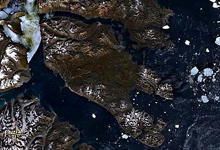
Suess Land is a peninsula in King Christian X Land, East Greenland. Administratively it is part of the Northeast Greenland National Park.

Nunatak Glacier, also known as Nunatak Glacier, is a glacier in King Christian X Land, Northeast Greenland. Administratively it lies in the Northeast Greenland National Park zone.
Segelsällskapet Fjord is a fjord in King Christian X Land, eastern Greenland.
Kempe Fjord is a fjord in King Christian X Land, eastern Greenland.

Jonsbu was a Norwegian hunting and radio station located on the coast of Eastern Greenland in present-day King Christian X Land.
The Davy Sound is a sound in King Christian X Land, Northeast Greenland. Administratively it is part of the Northeast Greenland National Park zone.

Hallvard Ophuus Devold was a Norwegian Arctic explorer, trapper and meteorologist. He was instrumental in the attempt to establish Eric the Red's Land in 1931. His brother Finn Devold (1902–1977) shared his vision and helped to establish a Norwegian station at Finnsbu, SE Greenland.

Finn Devold was a Norwegian Arctic explorer, marine biologist and meteorologist. His father was parish priest Harald Ophus Devold. Together with his brother Hallvard Devold, Finn shared an interest in the Arctic areas and in the expansion of Norwegian sovereignty across Greenland.
Dickson Fjord is a fjord in King Christian X Land, eastern Greenland.
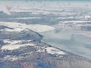
Muskox Fjord is a fjord in King Christian X Land, East Greenland. Administratively it lies in the Northeast Greenland National Park area. This fjord is part of the Kaiser Franz Joseph Fjord system.


