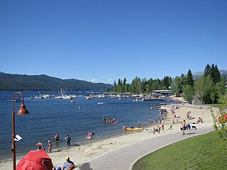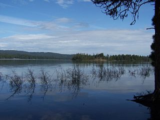
McCall is a resort town on the western edge of Valley County, Idaho, United States. Named after its founder, Tom McCall, it is situated on the southern shore of Payette Lake, near the center of the Payette National Forest. The population was 2,991 as of the 2010 census, up from 2,084 in 2000.

Mount Bachelor, formerly named Bachelor Butte, is a dormant stratovolcano atop a shield volcano in the Cascade Volcanic Arc and the Cascade Range of central Oregon. Named Mount Bachelor because it stands apart from the nearby Three Sisters, it lies in the eastern segment of the central portion of the High Cascades, the eastern segment of the Cascade Range. The volcano lies at the northern end of the 15-mile (24 km) long Mount Bachelor Volcanic Chain, which underwent four major eruptive episodes during the Pleistocene and the Holocene. The United States Geological Survey considers Mount Bachelor a moderate threat, but Bachelor poses little threat of becoming an active volcano in the near future. It remains unclear whether the volcano is extinct or just inactive.

The Wasatch Range or Wasatch Mountains is a mountain range in the western United States that runs about 160 miles (260 km) from the Utah-Idaho border south to central Utah. It is the western edge of the greater Rocky Mountains, and the eastern edge of the Great Basin region. The northern extension of the Wasatch Range, the Bear River Mountains, extends just into Idaho, constituting all of the Wasatch Range in that state.

The Wallowa Mountains are a mountain range located in the Columbia Plateau of northeastern Oregon in the United States. The range runs approximately 40 miles (64 km) northwest to southeast in southwestern Wallowa County and eastern Union County between the Blue Mountains to the west and the Snake River to the east. The range is sometimes considered to be an eastern spur of the Blue Mountains, and it is known as the "Alps of Oregon". Much of the range is designated as the Eagle Cap Wilderness, part of the Wallowa–Whitman National Forest.

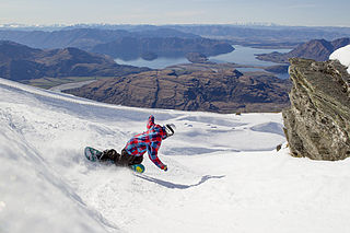
Treble Cone is the closest ski area to Wānaka, New Zealand.

Snowbird is an unincorporated community in Little Cottonwood Canyon in the Wasatch Range of the Rocky Mountains near Salt Lake City, Utah, United States. It is most famous for Snowbird Ski and Summer Resort, an alpine skiing and snowboarding area, which opened in December 1971.

Little Cottonwood Canyon lies within the Wasatch-Cache National Forest along the eastern side of the Salt Lake Valley, roughly 15 miles from Salt Lake City, Utah. The canyon is part of Granite, a CDP and "Community Council" designated by Salt Lake County. The canyon is a glacial trough, carved by an alpine glacier during the last ice age, 15,000 to 25,000 years ago. A number of rare and endemic plant species are found in the canyon's Albion Basin. Introduced Mountain goats inhabit the surrounding mountains.

Snowshoe is an unincorporated community in Pocahontas County, West Virginia, United States, centering on the Snowshoe Mountain ski resort. It is situated in the Allegheny Mountains at a bowl shaped convergence of two high mountain ridges — Cheat and Back Allegheny Mountains — at the head of the Shavers Fork of the Cheat River. Snowshoe is site of the second highest point in the state and the peak elevation for Cheat Mountain, at Thorny Flat, which reaches 4,848 feet (1,478 m) above sea level.

Snowbasin Resort is a ski resort in the western United States, located in Weber County, Utah, 33 miles (53 km) northeast of Salt Lake City, on the back (east) side of the Wasatch Range.

The Sierra Blanca is an ultra-prominent range of volcanic mountains in Lincoln and Otero counties in the south-central part of the U.S. state of New Mexico. The range is about 40 miles (64 km) from north to south and 20 miles (32 km) wide.

Banff Sunshine Village is a ski resort in western Canada, located on the Continental Divide of the Canadian Rockies within Banff National Park in Alberta and Mount Assiniboine Provincial Park in British Columbia. It is one of three major ski resorts located in the Banff National Park. Because of its location straddling the Continental Divide, Sunshine receives more snow than the neighbouring ski resorts. The Sunshine base area is located 15 km (9 mi) southwest of the town of Banff. By car, it is about a ninety-minute drive from the city of Calgary; the Sunshine exit on the Trans Canada Highway is 8 km (5 mi) west of the town of Banff.

Solitude Mountain Resort is a ski resort located in the Big Cottonwood Canyon of the Wasatch Mountains, thirty miles southeast of Salt Lake City, Utah. With 66 trails, 1,200 acres (4.9 km2) and 2,047 feet (624 m) vertical, Solitude is one of the smaller ski resorts near Salt Lake City, along with its neighbor Brighton. It is a family-oriented mountain, with a wider range of beginner and intermediate slopes than other nearby ski resorts; 50% of its slopes are graded "beginner" or "intermediate," the highest such ratio in the Salt Lake City area. Solitude was one of the first major US resorts to adopt an RFID lift ticket system, allowing lift lines to move more efficiently. It was followed by Alta Ski Area in 2007. Solitude is adjacent to Brighton Ski Resort near the top of Big Cottonwood Canyon. Solitude and Brighton offer a common "Solbright Pass" which provides access to both resorts for a nominal surcharge.

Mount Pinos is a mountain located in the Los Padres National Forest on the boundary between Ventura and Kern counties in California. The summit, at 8,847 feet (2,697 m), is the highest point in Ventura County. The mountain is the highest point of the Transverse Ranges west of Tejon Pass, as well as the southernmost point of the Salinian Block.

Sandia Crest, also known locally as Sandia Peak or simply as the Crest, is a mountain ridge that, at 10,679 feet (3,255 m), is the highpoint of the Sandia–Manzano Mountains, and is located in the Sandia Mountains of Bernalillo County, New Mexico, United States. Instead of a true summit or topographic peak, this range climbs to a long ridge line. To the east, the range slopes down from the Crest and merges into the plains below. On the west side of the Crest is a cliff; the range dramatically drops over 4,000 feet in elevation over 2 miles of horizontal distance to the Rio Grande Valley and city of Albuquerque below. It is within the Sandia Ranger District of the Cibola National Forest. The Crest features a viewing area with a shop and visitor center, telecommunications transmitters, the popular La Luz Trail, the Sandia Mountain Wilderness, and the summit of Sandia Peak Ski Area and the Sandia Peak Tramway, which is the longest aerial tramway in the Americas.
Brundage Mountain Resort is an alpine ski area in the western United States, located in west central Idaho in the Payette National Forest. Brundage first opened in November 1961 and is eight miles (13 km) northwest of McCall, a twenty-minute drive in average winter conditions.

The Stevens Pass Ski Area is a ski area in the Cascade Range of Washington in the United States. It is located at the crest of Stevens Pass at a base elevation of 4,061 feet (1,238 m) above sea level and peak elevation at 5,845 feet (1,782 m). The Mill Valley "backside" of the resort drops to a minimum elevation of 3,821 feet (1,165 m). Total skiable terrain includes 37 major runs covering 1,125 acres (4.55 km2). The ski area is accessed via U.S. Route 2, which connects to nearby Leavenworth.
Ski Bluewood, formerly known as "Bluewood Ski Area," is an alpine ski area in the northwestern United States, in southeastern Washington. Located in Columbia County, at the northern end of the Blue Mountains in the Umatilla National Forest, the elevation at the base area is 4,545 feet (1,385 m) above sea level, with a summit of 5,670 feet (1,728 m) for a vertical drop of 1,125 feet (343 m). The northward-facing slopes are about four miles (6.5 km) north of the Oregon border and fifty miles (80 km) west of Idaho, part of the headwaters of the Touchet River, the main tributary of the Walla Walla River.

June Lake is an unincorporated community and census-designated place (CDP) in Mono County, California, United States. It is located against the southern rim of the Mono Basin, 12.5 miles (20 km) south of Lee Vining, at an elevation of 7,654 feet (2,333 m).

Howard Prairie Lake is a reservoir located 4,526 feet (1,380 m) above sea level in Jackson County, Oregon, United States. It is 18 miles (29 km) east of Ashland. The lake is formed by the 100-foot (30 m) tall Howard Prairie Dam, which impounds Beaver Creek, in the Klamath River watershed.
This glossary of skiing and snowboarding terms is a list of definitions of terms and jargon used in skiing, snowboarding, and related winter sports.


