Łowicz is a village in the administrative district of Gmina Kobiele Wielkie, within Radomsko County, Łódź Voivodeship, in central Poland. It lies approximately 6 kilometres (4 mi) west of Kobiele Wielkie, 9 km (6 mi) south-east of Radomsko, and 86 km (53 mi) south of the regional capital Łódź.
Nowy Widok is a village in the administrative district of Gmina Kobiele Wielkie, within Radomsko County, Łódź Voivodeship, in central Poland. It lies approximately 5 kilometres (3 mi) east of Kobiele Wielkie, 18 km (11 mi) east of Radomsko, and 87 km (54 mi) south of the regional capital Łódź.
Przydatki Przybyszowskie is a village in the administrative district of Gmina Kobiele Wielkie, within Radomsko County, Łódź Voivodeship, in central Poland. It lies approximately 2 kilometres (1 mi) north-east of Kobiele Wielkie, 13 km (8 mi) east of Radomsko, and 82 km (51 mi) south of the regional capital Łódź.
Feliksów is a village in the administrative district of Gmina Kodrąb, within Radomsko County, Łódź Voivodeship, in central Poland. It lies approximately 4 kilometres (2 mi) south-east of Kodrąb, 15 km (9 mi) east of Radomsko, and 80 km (50 mi) south of the regional capital Łódź.
Kuźnica is a village in the administrative district of Gmina Kodrąb, within Radomsko County, Łódź Voivodeship, in central Poland. It lies approximately 9 kilometres (6 mi) north-east of Radomsko and 75 km (47 mi) south of the regional capital Łódź.
Łagiewniki is a village in the administrative district of Gmina Kodrąb, within Radomsko County, Łódź Voivodeship, in central Poland. It lies approximately 9 kilometres (6 mi) east of Radomsko and 78 km (48 mi) south of the regional capital Łódź.
Lipowczyce is a village in the administrative district of Gmina Kodrąb, within Radomsko County, Łódź Voivodeship, in central Poland. It lies approximately 6 kilometres (4 mi) north of Kodrąb, 17 km (11 mi) north-east of Radomsko, and 72 km (45 mi) south of the regional capital Łódź.
Rzejowice is a village in the administrative district of Gmina Kodrąb, within Radomsko County, Łódź Voivodeship, in central Poland. It lies approximately 18 kilometres (11 mi) east of Radomsko and 78 km (48 mi) south of the regional capital Łódź.
Smotryszów is a village in the administrative district of Gmina Kodrąb, within Radomsko County, Łódź Voivodeship, in central Poland. It lies approximately 11 kilometres (7 mi) east of Radomsko and 81 km (50 mi) south of the regional capital Łódź.
Teodorów Mały is a village in the administrative district of Gmina Kodrąb, within Radomsko County, Łódź Voivodeship, in central Poland. It lies approximately 12 kilometres (7 mi) east of Radomsko and 80 km (50 mi) south of the regional capital Łódź.
Wola Malowana is a village in the administrative district of Gmina Kodrąb, within Radomsko County, Łódź Voivodeship, in central Poland. It lies approximately 13 kilometres (8 mi) east of Radomsko and 81 km (50 mi) south of the regional capital Łódź.
Zakrzew is a village in the administrative district of Gmina Kodrąb, within Radomsko County, Łódź Voivodeship, in central Poland. It lies approximately 10 kilometres (6 mi) east of Radomsko and 78 km (48 mi) south of the regional capital Łódź.
Zalesie is a village in the administrative district of Gmina Kodrąb, within Radomsko County, Łódź Voivodeship, in central Poland. It lies approximately 18 kilometres (11 mi) north-east of Radomsko and 72 km (45 mi) south of the regional capital Łódź.
Zapolice is a village in the administrative district of Gmina Kodrąb, within Radomsko County, Łódź Voivodeship, in central Poland. It lies approximately 2 kilometres (1 mi) south of Kodrąb, 14 km (9 mi) east of Radomsko, and 79 km (49 mi) south of the regional capital Łódź.
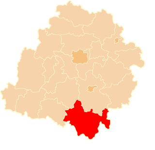
Wola Przedborska is a village in the administrative district of Gmina Przedbórz, within Radomsko County, Łódź Voivodeship, in central Poland. It lies approximately 2 kilometres (1 mi) north of Przedbórz, 31 km (19 mi) east of Radomsko, and 82 km (51 mi) south of the regional capital Łódź.
Dziepółć is a village in the administrative district of Gmina Radomsko, within Radomsko County, Łódź Voivodeship, in central Poland. It lies approximately 6 kilometres (4 mi) east of Radomsko and 81 km (50 mi) south of the regional capital Łódź.
Grzebień is a village in the administrative district of Gmina Radomsko, within Radomsko County, Łódź Voivodeship, in central Poland. It lies approximately 6 kilometres (4 mi) south-east of Radomsko and 84 km (52 mi) south of the regional capital Łódź.
Strzałków is a village in the administrative district of Gmina Radomsko, within Radomsko County, Łódź Voivodeship, in central Poland. It lies approximately 4 kilometres (2 mi) south-east of Radomsko and 82 km (51 mi) south of the regional capital Łódź.
Kawęczynek is a village in the administrative district of Gmina Warta, within Sieradz County, Łódź Voivodeship, in central Poland. It lies approximately 8 kilometres (5 mi) south-west of Warta, 16 km (10 mi) north-west of Sieradz, and 65 km (40 mi) west of the regional capital Łódź.