The Kulpenberg is a 477 metre high mountain in the Kyffhäuser mountains, Thuringia, Germany. On it is the Fernsehturm Kulpenberg, a 94-metre-high telecommunication tower. Built of reinforced concrete between 1959 and 1964, it has an observation deck and a restaurant at a height of 76 metres. The observation deck and the restaurant are closed for visitors.
Krzydłowice is a village in the administrative district of Gmina Grębocice, within Polkowice County, Lower Silesian Voivodeship, in south-western Poland. Prior to 1945 it was in Germany.
Łaszewo is a village in the administrative district of Gmina Pruszcz, within Świecie County, Kuyavian-Pomeranian Voivodeship, in north-central Poland.
Świt is a village in the administrative district of Gmina Cekcyn, within Tuchola County, Kuyavian-Pomeranian Voivodeship, in north-central Poland.
Biała Róża is a village in the administrative district of Gmina Rozprza, within Piotrków County, Łódź Voivodeship, in central Poland.
Trzebieszów Drugi is a village in the administrative district of Gmina Trzebieszów, within Łuków County, Lublin Voivodeship, in eastern Poland.
Kiczory is a village in the administrative district of Gmina Lipnica Wielka, within Nowy Targ County, Lesser Poland Voivodeship, in southern Poland, close to the border with Slovakia. The village has a population of 500.

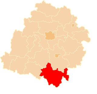
Białowieża is a village in the administrative district of Gmina Sędziszów, within Jędrzejów County, Świętokrzyskie Voivodeship, in south-central Poland. It lies approximately 8 kilometres (5 mi) south-west of Sędziszów, 25 km (16 mi) south-west of Jędrzejów, and 59 km (37 mi) south-west of the regional capital Kielce.
Zamkowa Wola is a village in the administrative district of Gmina Łagów, within Kielce County, Świętokrzyskie Voivodeship, in south-central Poland. It lies approximately 5 kilometres (3 mi) north of Łagów and 34 km (21 mi) east of the regional capital Kielce.
Grudusk-Olszak is a village in the administrative district of Gmina Grudusk, within Ciechanów County, Masovian Voivodeship, in east-central Poland.
Gardzienice-Kolonia is a village in the administrative district of Gmina Ciepielów, within Lipsko County, Masovian Voivodeship, in east-central Poland.
Łoziska is a village in the administrative district of Gmina Lesznowola, within Piaseczno County, Masovian Voivodeship, in east-central Poland.
Karolinowo is a village in the administrative district of Gmina Załuski, within Płońsk County, Masovian Voivodeship, in east-central Poland. It lies approximately 5 kilometres (3 mi) north of Załuski, 15 km (9 mi) south-east of Płońsk, and 49 km (30 mi) north-west of Warsaw.
Śnice is a village in the administrative district of Gmina Liw, within Węgrów County, Masovian Voivodeship, in east-central Poland.
Wolica Nowa is a village in west-central Poland, located in the administrative district of Gmina Nowe Miasto nad Wartą, within Środa Wielkopolska County, Greater Poland Voivodeship. It lies approximately 21 kilometres (13 mi) south-east of Środa Wielkopolska and 52 km (32 mi) south-east of the regional capital Poznań.
Ignachy is a village in the administrative district of Gmina Rudniki, within Olesno County, Opole Voivodeship, in south-western Poland.
Sopieszyno-Wybudowanie is a village in the administrative district of Gmina Wejherowo, within Wejherowo County, Pomeranian Voivodeship, in northern Poland. It lies approximately 7 kilometres (4 mi) south of Wejherowo and 33 km (21 mi) north-west of the regional capital Gdańsk.
Mõisaküla is a village in Lääneranna Parish, Pärnu County, in western Estonia.
The Belgium–France border separates France and Belgium countries and is 620 km (390 mi) long. Part of it is defined by the Leie river. The western end is at the North Sea. The eastern end is at the Belgium–France–Luxembourg tripoint. The straight distance between these points is 289 km (180 mi).
Toska is a village in Khvosh Rud Rural District, Bandpey-ye Gharbi District, Babol County, Mazandaran Province, Iran. At the 2006 census, its population was 491, in 113 families.