
Antopol is a village in the administrative district of Gmina Podedwórze, within Parczew County, Lublin Voivodeship, in eastern Poland. It lies approximately 5 kilometres (3 mi) south-east of Podedwórze, 26 km (16 mi) east of Parczew, and 65 km (40 mi) north-east of the regional capital Lublin.
Gmina Markuszów is a rural gmina in Puławy County, Lublin Voivodeship, in eastern Poland. Its seat is the village of Markuszów, which lies approximately 22 kilometres (14 mi) east of Puławy and 25 km (16 mi) north-west of the regional capital Lublin.
Chylin Mały is a village in the administrative district of Gmina Wierzbica, within Chełm County, Lublin Voivodeship, in eastern Poland. It lies approximately 2 kilometres (1 mi) north of Wierzbica, 19 km (12 mi) north-west of Chełm, and 53 km (33 mi) east of the regional capital Lublin.
Olchowiec is a village in the administrative district of Gmina Wierzbica, within Chełm County, Lublin Voivodeship, in eastern Poland. It lies approximately 4 kilometres (2 mi) south-west of Wierzbica, 18 km (11 mi) north-west of Chełm, and 50 km (31 mi) east of the regional capital Lublin.
Dębczyna is a village in the administrative district of Gmina Baranów, within Puławy County, Lublin Voivodeship, in eastern Poland. It lies approximately 6 kilometres (4 mi) east of Baranów, 25 km (16 mi) north-east of Puławy, and 44 km (27 mi) north-west of the regional capital Lublin.
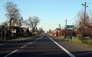
Składów is a village in the administrative district of Gmina Baranów, within Puławy County, Lublin Voivodeship, in eastern Poland. It lies approximately 6 kilometres (4 mi) north-east of Baranów, 25 km (16 mi) north-east of Puławy, and 46 km (29 mi) north-west of the regional capital Lublin.
Brzozowa Gać is a village in the administrative district of Gmina Kurów, within Puławy County, Lublin Voivodeship, in eastern Poland. It lies approximately 16 km (10 mi) east of Puławy and 32 km (20 mi) north-west of the regional capital Lublin.
Płonki is a village in the administrative district of Gmina Kurów, within Puławy County, Lublin Voivodeship, in eastern Poland. It lies approximately 3 kilometres (2 mi) south-east of Kurów, 17 km (11 mi) east of Puławy, and 30 km (19 mi) north-west of the regional capital Lublin.
Bochotnica-Kolonia is a village in the administrative district of Gmina Nałęczów, within Puławy County, Lublin Voivodeship, in eastern Poland.
Bronice is a village in the administrative district of Gmina Nałęczów, within Puławy County, Lublin Voivodeship, in eastern Poland. It lies approximately 8 kilometres (5 mi) north of Nałęczów, 20 km (12 mi) east of Puławy, and 27 km (17 mi) north-west of the regional capital Lublin.
Cynków is a village in the administrative district of Gmina Nałęczów, within Puławy County, Lublin Voivodeship, in eastern Poland. It lies approximately 3 kilometres (2 mi) north-east of Nałęczów, 24 km (15 mi) south-east of Puławy, and 24 km (15 mi) west of the regional capital Lublin.
Czesławice is a village in the administrative district of Gmina Nałęczów, within Puławy County, Lublin Voivodeship, in eastern Poland. It lies approximately 5 kilometres (3 mi) north-east of Nałęczów, 25 km (16 mi) south-east of Puławy, and 23 km (14 mi) west of the regional capital Lublin.
Drzewce is a village in the administrative district of Gmina Nałęczów, within Puławy County, Lublin Voivodeship, in eastern Poland. It lies approximately 6 kilometres (4 mi) north of Nałęczów, 19 km (12 mi) south-east of Puławy, and 28 km (17 mi) west of the regional capital Lublin.
Paulinów is a village in the administrative district of Gmina Nałęczów, within Puławy County, Lublin Voivodeship, in eastern Poland. It lies approximately 7 kilometres (4 mi) north-east of Nałęczów, 22 km (14 mi) south-east of Puławy, and 25 km (16 mi) north-west of the regional capital Lublin.
Sadurki is a village in the administrative district of Gmina Nałęczów, within Puławy County, Lublin Voivodeship, in eastern Poland. It lies approximately 5 kilometres (3 mi) east of Nałęczów, 27 km (17 mi) south-east of Puławy, and 21 km (13 mi) west of the regional capital Lublin.
Strzelce is a village in the administrative district of Gmina Nałęczów, within Puławy County, Lublin Voivodeship, in eastern Poland. It lies approximately 2 kilometres (1 mi) east of Nałęczów, 24 km (15 mi) south-east of Puławy, and 24 km (15 mi) west of the regional capital Lublin.
Bartłomiejowice is a village in the administrative district of Gmina Wąwolnica, within Puławy County, Lublin Voivodeship, in eastern Poland. It lies approximately 4 kilometres (2 mi) north-west of Wąwolnica, 16 km (10 mi) south-east of Puławy, and 33 km (21 mi) west of the regional capital Lublin.
Kotliny is a village in the administrative district of Gmina Żyrzyn, within Puławy County, Lublin Voivodeship, in eastern Poland. It lies approximately 5 kilometres (3 mi) east of Żyrzyn, 16 km (10 mi) north-east of Puławy, and 39 km (24 mi) north-west of the regional capital Lublin.


