The airstrip was constructed in 1994 by Rod Anders, known as "Ramblin' Rod" to Portland TV viewers, for his private airplane alongside his log cabin home.[1] In 2004, Mike and Jennie Applebee purchased the property and airstrip from the estate of Anders.[2] In 2005, the owner announced plans to convert the airstrip into a commercial operation and include services such as flight training.[3] Owner Jim Applebee was issued citations by the county in June 2005 for operations at the airport.[3] Neighbors formed a group to oppose the conversion and hired an attorney.[2] The application failed as incomplete and the citations were dismissed by the court.[4]
In 2006, the owners filed again with the county to expand the use of the airport, which was to include commercial use and the basing of ten aircraft with usage to total 3,016 departures each year.[4] A land-use meeting was held in September 2006,[5] with the county denying the application for commercial use at the airport.[6] In 2007, the Applebees appealed the county's decision to the Oregon Land Use Board of Appeals (LUBA), but lost the decision in June.[7] Later LUBA sent part of the case back to the county and the Applebees were allowed to have agricultural operations at the airstrip, but they dropped an appeal to the Oregon Court of Appeals in November 2007 and announced plans to sell the property.[8] In October 2008, the Applebees received initial approval to expand the airport grounds by adding a hangar, parking lot, and helipad.[9]
Details
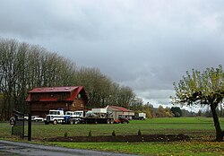
Helicopter at the airport in 2009
The 2,470 feet (750m) long grass strip runway is located in rural Washington County near the community of Buxton, adjacent to the Sunset Highway.[3][4] Owned by Applebee Aviation, the airport is east of Fisher Road on the north side of the highway in the foothills of the Northern Oregon Coast Range.[3][4] The airport is used as a base for agricultural based aviation such as spraying crops with pesticides and fertilizers.[9] An unattended private facility, it is at an elevation of 247 feet (75m) above sea level with a runway alignment of 11/29.[10]
References
↑ Colby, Richard (April 1, 2005). "Airstrip plans have residents in an uproar". The Oregonian.
1 2 Colby, Richard (July 22, 2005). "Aviator will hold public meeting on Buxton airstrip". The Oregonian. pp.West Zoner, D2.
1 2 3 4 Colby, Richard (June 15, 2005). "Washington County hits airstrip owner with citations". The Oregonian. pp.West Zoner, B2.
1 2 3 4 Gorman, Kathleen (July 27, 2006). "Washington County: Land-use officials review bid to expand airstrip". The Oregonian. pp.Metro West Neighbors, p. 4.
↑ "Local news - Washington County: Buxton: Hearing to look at plan for heavier runway use". The Oregonian. September 20, 2006. pp.Local News, p. B3.
↑ Gorman, Kathleen (December 27, 2006). "County rejects Buxton airstrip's bid to expand". The Oregonian. pp.Local News, p. C2.
↑ Gorman, Kathleen (June 21, 2007). "Washington County Duo have week to appeal decision". The Oregonian. pp.Local News, p. B3.
↑ Gorman, Kathleen (December 6, 2007). "Buxton couple ends quest for more flights". The Oregonian. pp.Metro West Neighbors.
This page is based on this Wikipedia article Text is available under the CC BY-SA 4.0 license; additional terms may apply. Images, videos and audio are available under their respective licenses.