Araguaia State Park

Last updated
Araguaia State Park
Parque Estadual do Araguaia
IUCN category II (national park)
Por do sol no Araguaia.JPG
Sunset in the park
Relief Map of Brazil.jpg
Red pog.svg
Nearest city Novo Santo Antônio, Mato Grosso
Coordinates 12°21′S50°49′W / 12.35°S 50.81°W / -12.35; -50.81 Coordinates: 12°21′S50°49′W / 12.35°S 50.81°W / -12.35; -50.81
Area223,170 hectares (551,500 acres)
Designation State park
Created28 September 2001
AdministratorFundação Estadual do Meio Ambiente MG

The Araguaia State Park (Portuguese : Parque Estadual do Araguaia) is a state park in the state of Mato Grosso, Brazil. It protects an area of annually flooded cerrado in the transition to Amazon rainforest, and is rich in biodiversity.

Portuguese language Romance language that originated in Portugal

Portuguese is a Western Romance language originating in the Iberian Peninsula. It is the sole official language of Portugal, Brazil, Cape Verde, Guinea-Bissau, Mozambique, Angola and São Tomé and Príncipe. It also has co-official language status in East Timor, Equatorial Guinea and Macau in China. As the result of expansion during colonial times, a cultural presence of Portuguese and Portuguese creole speakers are also found in Goa, Daman and Diu in India; in Batticaloa on the east coast of Sri Lanka; in the Indonesian island of Flores; in the Malacca state of Malaysia; and the ABC islands in the Caribbean where Papiamento is spoken, while Cape Verdean Creole is the most widely spoken Portuguese-based Creole. A Portuguese-speaking person or nation is referred to as "Lusophone" (Lusófono).

State park (Brazil)

A state park in Brazil is a legally defined type of protected area operated by one of the states. Their goal is to preserve important or beautiful natural ecosystems. Public access is allowed subject to regulations defined by the responsible agency.

Mato Grosso State of Brazil

Mato Grosso is one of the states of Brazil, the third largest by area, located in the western part of the country.

Contents

Location

The Araguaia State Park is in the municipality of Novo Santo Antônio, Mato Grosso. [1] It has an area of 223,169.54 hectares (551,463.9 acres). [2] It borders the municipalities of São Félix do Araguaia and Ribeirão Cascalheira, and the state of Tocantins. It is the southernmost part of the continuum of protected areas that extend along the right bank of the Araguaia River in Mato Grosso. It is in the Araguaia basin between the Araguaia and its tributary the Rio das Mortes. [3]

Novo Santo Antônio Municipality in Northeast, Brazil

Novo Santo Antônio is a Brazilian municipality of the state of Piauí. The population is 3,387 in an area of 481.71 km².

São Félix do Araguaia Municipality in Center-West, Brazil

São Félix do Araguaia is a municipality in the state of Mato Grosso in the Central-West Region of Brazil.

Ribeirão Cascalheira Municipality in Center-West, Brazil

Ribeirão Cascalheira is a municipality in the state of Mato Grosso in the Central-West Region of Brazil.

History

From the 1970s, driven by tax incentives, the state of Mato Grosso has converted huge areas of Amazon and cerrado forest into large-scale agro-pastoral systems. Most of the unoccupied land was in remote, inaccessible and protected areas. [4] The types of protected land depend on land use. Thus 83.77% of permanently flooded land is protected, while only 3.87% of open treed savanna is protected. [5]

Cerrado tropical savanna ecoregion of Brazil

The Cerrado is a vast tropical savanna ecoregion of Brazil, particularly in the states of Goiás, Mato Grosso do Sul, Mato Grosso, Tocantins and Minas Gerais. The Cerrado biome core areas are the plateaus in the center of Brazil. The main habitat types of the Cerrado include: forest savanna, wooded savanna, park savanna and gramineous-woody savanna. Savanna wetlands and gallery forests are also included. The second largest of Brazil's major habitat types, after the Amazonian rainforest, the Cerrado accounts for a full 21 percent of the country's land area.

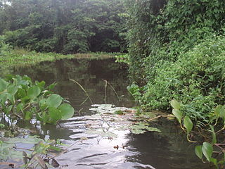
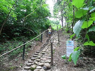
The Araguaia State Park was created by law 7.517 of 28 September 2001 with an area of about 230,000 hectares (570,000 acres). The objectives were to protect water resources, allow movement of native fauna, preserve a representative sample of ecosystems in the area and support controlled public use, education and scientific research. It was to be administered by the State Environment Foundation (FEMA). [1] The park was classed as IUCN protected area category II (national park). [6]

IUCN protected area categories used to classify protected areas in a system developed by the IUCN

IUCN protected area categories, or IUCN protected area management categories, are categories used to classify protected areas in a system developed by the International Union for the Conservation of Nature (IUCN).

At time of creation five years maximum were allowed for FEMA to prepare a management plan. [1] The park was modified by law 8.458 of 17 January 2006. [2] The management plan was published in 2007. [7] It was approved in December 2008. [8]

On 27 June 2011 the state government published a law authorizing an "exchange" with the Fundação Nacional do Índio (Funai) that would bring the Xavante people of the Maraiwatsede Indigenous Territory (TI) into the park, and regularize ownership by squatters in the TI. Funai responded that it had no interest in the exchange, which was unconstitutional since indigenous territory is inalienable. [9] [lower-alpha 1]

Fundação Nacional do Índio Brazilian agency for Indian interests and culture

Fundação Nacional do Índio or FUNAI is a Brazilian governmental protection agency for Indian interests and their culture.

Environment

The vegetation is in the transition between Amazon rainforest and the cerrado , which results in a high level of biodiversity. The park is flooded annually. Typical Amazon forest fauna include the robust capuchin monkey and howler monkey. Fauna of the cerrado include maned wolf (Chrysocyon brachyurus) and pampas deer (Ozotoceros bezoarticus). Wetland fauna include marsh deer (Blastocerus dichotomus) and capybara (Hydrochoerus hydrochaeris). The park is also home to aquatic animals such as Amazon river dolphin (Inia geoffrensis), giant otter (Pteronura brasiliensis) and turtles. [3]

Footnotes

  1. The indigenous Xavante people of the Maraiwatsede TI were evicted by the military government in the 1960s to make way for an agricultural project. The company that owned it decided to return it to the Xavantes at the time of Eco 92, but squatters occupied the land before the Indians returned. It has been devastated as it was converted to agricultural use, a process that was continuing in 2011. [9]
  1. 1 2 3 Bosaipo & Soares 2001.
  2. 1 2 Proteção Integral - SEMA.
  3. 1 2 Parque Estadual do Araguaia ... Via Rural.
  4. Campos 2007, p. 16.I.
  5. Campos 2007, p. 18.I.
  6. Unidade de Conservação ... MMA.
  7. Campos 2007, cover.
  8. Migliari 2008.
  9. 1 2 Barbosa 2011.

Sources

Related Research Articles

Central-West Region, Brazil Region in Brazil

The Central-West or Center-West Region of Brazil is composed of the states of Goiás, Mato Grosso and Mato Grosso do Sul; along with Distrito Federal, where Brazil's national capital, Brasília, is situated. This Region is right in the heart of Brazil, representing 18.86% of the national territory.

Chapada dos Guimarães National Park

The Chapada dos Guimarães National Park is a national park in the state of Mato Grosso, Brazil. It is a region of rugged terrain with dramatic cliffs and waterfalls, and contains the geographical centre of the continent.

Emas National Park

The Emas National Park is a national park and a UNESCO World Heritage Site in the states of Goiás and Mato Grosso do Sul in Brazil.

Pantanal Matogrossense National Park

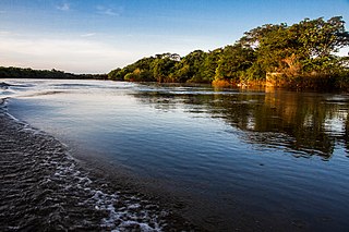
The Pantanal Matogrossense National Park is a national park in the states of Mato Grosso and Mato Grosso do Sul, Brazil.

Serra da Bodoquena National Park

Serra da Bodoquena National Park is a national park in the state of Mato Grosso do Sul, Brazil.

Carste de Lagoa Santa Environmental Protection Area

Carste de Lagoa Santa Environmental Protection Area (Portuguese: Área de Proteção Ambiental Carste de Lagoa Santa is a protected area in Minas Gerais, Brazil.

Águas do Cuiabá Ecological Station

Águas do Cuiabá Ecological Station, formerly the Águas do Cuiabá State Park, is an ecological station in the state of Mato Grosso, Brazil, a fully protected conservation unit in the cerrado biome. There was controversy about the acquisition of land to expand the unit's area when it was made an ecological station.

Rio Ronuro Ecological Station

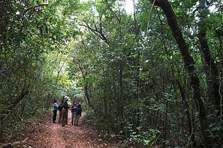
Rio Ronuro Ecological Station is an ecological station in the state of Mato Grosso, Brazil. It protects an area of contact between Amazon rainforest in the north and Cerrado semi-deciduous forest in the south. Since being created in 1998 it has been reduced in size and has suffered from significant deforestation.

Campos Amazônicos National Park

The Campos Amazônicos National Park is a National park in the states of Rondônia, Amazonas and Mato Grosso, Brazil.

Águas Quentes State Park

The Águas Quentes State Park is a state park in the state of Mato Grosso, Brazil

Serra de Santa Bárbara State Park

The Serra de Santa Bárbara State Park is a state park in the state of Mato Grosso, Brazil. It preserves a unique environment where the Amazon rainforest, pantanal and cerrado meet, and holds many endemic or endangered species.

Mirador State Park

The Mirador State Park is a state park in the state of Maranhão, Brazil. It protects the headwaters of an important source of water for communities in the state, including the state capital. The park has been starved of funds for administration and surveillance. It has suffered from illegal logging, burning, grazing and hunting.

Cristalino State Park

The Cristalino State Park is a state park in the state of Mato Grosso, Brazil.

Matas do Segredo State Park

The Matas do Segredo State Park is an urban state park in the state of Mato Grosso do Sul, Brazil. It protects an area of cerrado forest.

Serra Ricardo Franco State Park

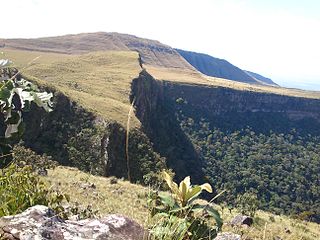
The Serra Ricardo Franco State Park is a state park in the state of Mato Grosso, Brazil. It protects the edge of a plateau on the border with Bolivia in the region of transition from cerrado to Amazon rainforest. The park has been poorly protected and is badly degraded in areas by deforestation and conversion to pasturage. It is threatened by illegal squatters, hunting and burning.

Serra Azul State Park

The Serra Azul State Park is a state park in the state of Mato Grosso, Brazil. It protects a mountainous area of cerrado forest and contains slopes that are used for paragliding. The park contains the geodetic center of Brazil.

Nascentes do Rio Taquari State Park

The Nascentes do Rio Taquari State Park is a state park in the state of Mato Grosso do Sul, Brazil. It protects the headwaters of the Taquari River in an area in the transition between the cerrado and pantanal biomes.

Dom Osório Stoffel State Park

The Dom Osório Stoffel State Park is a state park in the state of Mato Grosso, Brazil. It protects an area of the cerrado biome.

Prosa State Park

The Prosa State Park, formerly the Parque dos Poderes, is an urban state park in the state of Mato Grosso do Sul, Brazil. It protects a remnant of cerrado vegetation, and is home to a wildlife rehabilitation center.

Upaon-Açu/Miritiba/Alto Preguiças Environmental Protection Area

The Upaon-Açu/Miritiba/Alto Preguiças Environmental Protection Area is an environmental protection area in the state of Maranhão, Brazil