| Araguanã | |
|---|---|
| Municipality | |
 Araguanã Location in Brazil | |
| Coordinates: 2°57′10″S45°39′54″W / 2.95278°S 45.66500°W Coordinates: 2°57′10″S45°39′54″W / 2.95278°S 45.66500°W | |
| Country | |
| Region | Nordeste |
| State | Maranhão |
| Mesoregion | Oeste Maranhense |
| Population (2010) [1] | |
| • Total | 9,123 |
| Time zone | UTC -3 |
Araguanã is a municipality in the state of Maranhão in the Northeast region of Brazil. The population is 9,123. [1]

The Federative Republic of Brazil is a union of 27 Federative Units : 26 states and one federal district. The states are generally based on historical, conventional borders which have developed over time. The Federal District cannot be divided into municipalities, according to the Brazilian Constitution, the Federal District assumes the same constitutional and legal powers, attributions and obligations of the states and municipalities, instead, it is divided by administrative regions.

Maranhão is a northeastern state of Brazil. To the north lies the Atlantic Ocean. Maranhão is neighboured by the states of Piauí, Tocantins and Pará. The people of Maranhão have a distinctive accent inside the common Northeastern Brazilian dialect. Maranhão is described in books such as The Land of the Palm Trees by Gonçalves Dias and Casa de Pensão by Aluísio Azevedo.
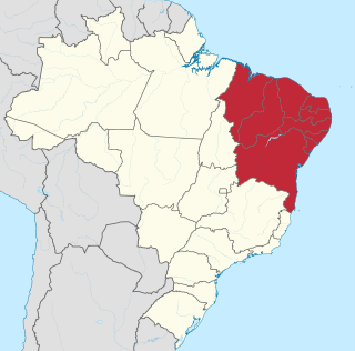
The Northeast Region of Brazil is one of the five official and political regions of the country according to the Brazilian Institute of Geography and Statistics. For the socio-geographic area see Nordeste. Of Brazil's twenty-six states, it comprises nine: Maranhão, Piauí, Ceará, Rio Grande do Norte, Paraíba, Pernambuco, Alagoas, Sergipe and Bahia, along with the Fernando de Noronha archipelago.

