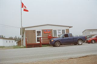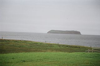
Burgeo-La Poile is a provincial electoral district for the House of Assembly of Newfoundland and Labrador, Canada. As of 2011, there are 7,527 eligible voters living within the district. The district was first created when Newfoundland joined confederation in 1949 as Burgeo and La Poile, and existed until 1975. It was recreated in 1995 following a reduction in the number of seats in the House of Assembly from 52 to 48, forming from the amalgamation of the former districts of La Poile and Burgeo-Bay D'Espoir.
Piccadilly Slant-Abraham's Cove is a local service district and designated place in the Canadian province of Newfoundland and Labrador. It is located on the island of Newfoundland, along St. George's Bay, on the Port au Port Peninsula. The DPL consists of the fishing villages of Abraham's Cove and Piccadilly.
Port Kirwan is a small incorporated fishing community located on the southern shore of the Avalon Peninsula, Newfoundland, Canada.
St. George's Bay - informally referred to as Bay St. George due to its French translation Baie St-George - is a large bay in the province of Newfoundland and Labrador, Canada. It is located on the west coast of the island of Newfoundland and comprises a sub-basin of the Gulf of St. Lawrence.

St. George's is a Canadian community in the St. George's Bay on the southwest coast of Newfoundland of the province of Newfoundland and Labrador.
Port au Port West-Aguathuna-Felix Cove is a small town located on the Port au Port Peninsula of the Island of Newfoundland, Canada. The nearest large service area is Stephenville.
Route 460 is a 87.5-kilometre-long (54.4 mi) east-west Canadian provincial highway in Newfoundland and Labrador.

Stephenville Crossing is a town in the Canadian province of Newfoundland and Labrador. It is on the island of Newfoundland at the easternmost limit of Bay St. George.
Gallants is located northeast of Stephenville, Newfoundland and Labrador, Canada. It was created as a Local Government Community on August 16, 1966.
Georgetown is a local service district and designated place in the Canadian province of Newfoundland and Labrador. It is southeast of Bay Roberts. It had a population of 166 in 1956.

Port au Port is a small Canadian rural community located in the western part of the island of Newfoundland. Port au Port is situated on the isthmus connecting the main part of the island of Newfoundland to the Port au Port Peninsula to the west. Port au Port is located on Route 460, several kilometres west of the town of Stephenville and the village of Kippens, at its intersection with Route 462. It was originally named Gravels. It had a population of 505 in 1940 and 214 by 1956. Port au Port is located with the town limits of Port au Port East.

Lourdes is a town in the Canadian province of Newfoundland and Labrador. The town had a population of 465 in the Canada 2016 Census. The current mayor of Lourdes is Henry Gaudon.
Port au Port East is a town in the Canadian province of Newfoundland and Labrador. The town had a population of 413 in the Canada 2021 Census. The town consists of the unincorporated communities of Port au Port and Romaines.
Port Rexton is a small town in the Canadian province of Newfoundland and Labrador. It is located on the East Coast of the island of Newfoundland at the north end of Robinhood Bay, about 10 minutes east of Trinity and 3 hours north of St. John's. The town had a population of 690 in 1940, 449 in 1951, 454 in 1956, 351 in the Canada 2006 Census, 338 in the Canada 2011 Census and most recently 340 in the Canada 2016 Census. The town is part of a group of communities known as the Trinity Bight. The town is home to a few small businesses, including inns and restaurants as well as the Skerwink trail which connects Port Rexton to Trinity Harbour.
Port au Port Bay located on the west coast of the Island of Newfoundland formed by a long narrow point of land of the Port au Port Peninsula and the area of Newfoundland known as the Lewis Hills, in the Canadian province of Newfoundland and Labrador.
Fox Island River-Point au Mal is a local service district and designated place in the Canadian province of Newfoundland and Labrador. It is northwest of Stephenville.

College of the North Atlantic is one of the largest post-secondary educational and skills training centres in Atlantic Canada, with a history dating back 50 years. The college has 17 campus locations throughout the province of Newfoundland and Labrador in Canada, various partner universities in China and formerly operated a technical education college for the State of Qatar in the Middle East. The enabling legislation is the College Act.

Black Duck Brook and Winterhouse is a local service district and designated place in the Canadian province of Newfoundland and Labrador. It consists of the unincorporated fishing settlements of Black Duck Brook and Winterhouse on the Port au Port Peninsula. The communities had a combined population of 57 in the Canada 2006 Census.
St. Teresa is a local service district and designated place in the Canadian province of Newfoundland and Labrador.
Bay St. George South is a local service district and designated place in the Canadian province of Newfoundland and Labrador on the south coast of Bay St. George, a large bay on the west coast of the island of Newfoundland. Bay St. George South consists nine communities, namely Heatherton, Robinsons, Cartyville, McKay's, Jeffrey's, St. David's, St. Fintan's, Lock Leven en Highlands.
This page is based on this
Wikipedia article Text is available under the
CC BY-SA 4.0 license; additional terms may apply.
Images, videos and audio are available under their respective licenses.


