Argo Dam

Last updated

Argo Dam
Argo Dam (Michigan).jpg
Argo Dam in April 2020
Relief map of USA Michigan.png
Red pog.svg
Location within the state of Michigan
Location Huron River
Ann Arbor, Michigan
Coordinates 42°17′26″N83°44′45″W / 42.29056°N 83.74583°W / 42.29056; -83.74583 Coordinates: 42°17′26″N83°44′45″W / 42.29056°N 83.74583°W / 42.29056; -83.74583
Purpose Power
StatusDecommissioned
Opening date1920;102 years ago (1920)
Owner(s) City of Ann Arbor
Dam and spillways
Type of dam Barrage
Impounds Huron River
Height18 feet (5.5 m)
Length150 feet (45.7 m)
Width (crest)162.5 feet (49.5 m)
Spillway capacity8,500 ft3/s (240.7 m3/s)
Reservoir
Total capacity92 acres (37.2 ha)

The Argo Dam is a decommissioned hydroelectric barrage dam crossing the Huron River. It is located in the city of Ann Arbor in Washtenaw County in the U.S. state of Michigan. It was built by the Detroit Edison Company in 1920 for hydroelectricity before being decommissioned in 1959 and sold to the city of Ann Arbor in 1963. [1] [2] The surrounding area is used for recreational purposes, including Argo Nature Area and Bandemer Park.

Contents

Description

The Argo Dam is located in north-central Ann Arbor about 0.75 miles (1.21 km) south of M-14 (Bus. US 23). The dam is accessible just south of the highway via exit 3 (North Main Street). The Argo Dam is approximately 50.5 miles (81.3 km) from the Huron River mouth at Lake Erie. The nearest dams are the Barton Dam 2.1 miles (3.4 km) upstream and the Geddes Dam 5.0 miles (8.0 km) downstream. [1]

When the dam was completed, the resulting flooding created an unnamed reservoir of 96 acres (39 ha). The reservoir has no official name but is sometimes referred to as the Argo Pond or Argo Impoundment. It sits at an average elevation of 773 feet (236 m) above sea level and has an average depth of 16.3 feet (5.0 m). The reservoir has no noticeable storage capacity or alteration to the surrounding area; it is considered a pondage reservoir. [1] The reservoir extends for about 2.46 miles (3.96 km) upstream from the dam to U.S. Route 23, and it has a maximum width of only 700 feet (213.4 m). The entire shoreline is considered natural with no major alterations to the original landscape. [2]

The dam consists of six automated spillways for a total crest length of 162.5 feet (49.5 m) and a dam length of 150 feet (45.7 m). The dam is 18 feet (5.5 m) tall and has a discharge capacity of 8,500 cubic feet per second (240.7 m3/s). [1]

The dam is one of four dams owned by the city of Ann Arbor. The other dams are the Barton Dam, Geddes Dam, and Superior Dam. Only the Argo Dam and Barton Dam are actually within the city of Ann Arbor. Geddes Dam is within Ann Arbor Township, and Superior Dam is in neighboring Superior Township to the east. [3] [4]

History

Historic photo of an earlier dam from a 1908 postcard Dam on the Huron River, Ann Arbor, Mich. (NBY 4092).jpg
Historic photo of an earlier dam from a 1908 postcard

This stretch of the Huron River was dammed as early as the 1830s. [5] The Argo Dam was completed in 1920 as a series of hydroelectric dams built along the Huron River by the Detroit Edison Company. The Argo Dam was decommissioned in 1959 and no longer utilized for hydroelectric purposes. The dam was soon sold to the city of Ann Arbor in 1963. The dam was rebuilt entirely in 1972 and utilized to maintain water level in the reservoir and for flood control. [1] [2]

At one time, the Detroit Edison Company operated four hydroelectric dams that served Ann Arbor: Argo Dam, Barton Dam, Geddes Dam, and Superior Dam. They were all decommissioned by the early-1960s, but Barton Dam and Superior Dam were recommissioned in the 1980s and currently provide hydroelectricity for Ann Arbor's power grid. Geddes Dam and Argo Dam were left decommissioned, because higher cost estimates and lower energy production kept them from being approved for recommissioning. [6]

In 2008, a plan was initially conceived by the city of Ann Arbor to possibly recommission the Argo Dam and Geddes Dam in order to provide additional electric power to the nearby Ann Arbor VA Medical Center. [6] [7] In 2010, the report found it would cost up to $14.7 million to construct new hydroelectric stations at both decommissioned dams. The transmission lines themselves would cost another $1.3 million, with at least $220,000 per year for maintenance. Funding was ultimately denied. [8] In order to recommission the Argo Dam for hydroelectric purposes, a new powerhouse would also have to be constructed with limited space available due to development of the area. [6] In 2013, the city approved a financial plan to improve the surrounded areas of both Argo Dam and Geddes Dam at a cost of $295,530 to a local contractor. [9] The dam received these significant improvements in 2014, but the idea of recommissioning the dam for hydroelectric purposes was abandoned. [1]

Proposed removal

Reservoir side of the Argo Dam Argo Dam (Michigan)2.jpg
Reservoir side of the Argo Dam

When the dam was deemed insufficient and too costly to reactivate for hydroelectric purposes, various proposals to completely remove the dam were discussed. The most beneficial ecological reasons for removing the Argo Dam included creating a more stable water temperature for the Huron River, as well as providing a more natural flow of the river for at least 6 miles (9.7 km) from the Barton Dam to the Geddes Dam. Removing the dam would also allow for increased fish populations, as the reservoir itself does not support a high population of fish. Due to the slow-moving water of the reservoir, undesirable zebra mussels are very abundant and would dissipate under a faster water flow. [10] The cost of removing the dam may also be funded by federal economic-stimulus dollars. Removing the dam would lower the water level and uncover an estimated 28–50 acres (11.3–20.2 ha) of usable park land along the river, as well as increasing the navigable course of the river for kayaks. [11]

Opponents of the dam's removal cite that lowering the water level would not immediately be useful, and there are no cost or time estimates on how long it would take to convert the mud basin into usable land. There are also no studies that indicate a rising fish population should the dam be removed. The city council has been unable to agree upon an adequate plan for removing the dam. The reservoir also provides a slow-moving rowing environment, which is utilized as a practice course by the University of Michigan men's rowing team and other high school teams. [12] In 2010, the Michigan Department of Natural Resources gave permission for the city to keep the dam in place and allow for additional funding to improve the surrounding landscape. The dam was considered "safe and did not need repairs" itself, but continued maintenance would be necessary. The dam's good structural integrity also played a role in the decision to keep the dam. [13] [14]

Activities

The artificial Argo Cascades allows kayakers to bypass the dam and continue along the Huron River. Argo Dam (Michigan) Cascades.jpg
The artificial Argo Cascades allows kayakers to bypass the dam and continue along the Huron River.

The area surrounding the Argo Dam reservoir is owned by the city and encompasses two city parks. The Argo Nature Area occupies 22 acres (8.9 ha) along the entire eastern shores of the reservoir, and Bandemer Park occupies 36.9 acres (14.9 ha) along a portion of the western banks. [15] [16] Barton Nature Area is another city-owned park further upstream near the Barton Dam. [17] The Border-to-Border Trail, which runs for 35 miles (56.3 km) from Dexter Township to Ypsilanti Township, passes directly across the Argo Dam and also provides public amenities. [18]

The Argo Dam reservoir serves as a popular kayaking location along the Huron River. The city of Ann Arbor owns the Argo Pond Livery for kayak and canoe rentals. [19] In 2012, the city completed a project to create the artificial Argo Cascades along the original route of the former hydroelectric plant, which forms an artificial island. The swift-moving waters descend 12 feet (3.7 m) over a length of 1,200 feet (365.8 m). The cascades allows kayakers to continue the course of the Huron River without needing to portage over the Argo Dam, although portaging is an option for those wishing to bypass the cascades. [5]

When the Argo Dam was reconstructed in 1972, the river was treated with rotenone to eliminate all fish populations along this stretch of river. After the dam project was completed, the Argo Dam reservoir was restocked with various fish species, such as smallmouth bass, walleye, hybrid sunfish, and rainbow trout. Channel catfish were intermittently stocked throughout the following decades. Common carp, suckerfish, and longnose gar were also introduced in the area. Fish stocking was discontinued after 2000 due to poor survival and low angler use. The Argo Dam continues to serve as a recreational area for shore fishing in either the reservoir or the area immediately downstream along the Huron River. Common fish caught today within this area include channel catfish, bluegill, small and largemouth bass, black crappie, northern pike, and walleye. [20]

Health concerns

The Huron River is occasionally issued a "Do Not Eat" fish advisory by the Michigan Department of Health and Human Services when the waters accumulate high levels of cyanobacteria and perfluorooctanesulfonatecan (PFOS). When this bacteria is present, prolonged contact with the water is not advised, although occasional contact with PFOS is not considered a health concern. [21] When the advisory is in place, fishermen are advised to catch and release only, and warning signs are posted at river access points. The advisory is often issued for long stretches of the Huron River that include and specifically mention the Argo Dam portion of the river. [22] [23] [24]

Related Research Articles

Barton Hills, Michigan Village in Michigan, United States

Barton Hills is a village in Washtenaw County in the U.S. state of Michigan. As of the 2010 census, the population was 294. The village is located within Ann Arbor Charter Township just northwest of the city of Ann Arbor.

Huron River (Michigan)

The Huron River is a 130-mile-long (210 km) river in southeastern Michigan, rising out of the Huron Swamp in Springfield Township in northern Oakland County and flowing into Lake Erie, as it forms the boundary between present-day Wayne and Monroe counties. Thirteen parks, game areas, and recreation areas are associated with the river, which passes through the cities of Dexter, Ann Arbor, Ypsilanti, Belleville, Flat Rock and Rockwood that were developed along its banks.

McKenzie River (Oregon) Mckenzie Blue River

The McKenzie River is a 90-mile (145 km) tributary of the Willamette River in western Oregon in the United States. It drains part of the Cascade Range east of Eugene and flows westward into the southernmost end of the Willamette Valley. It is named for Donald McKenzie, a Scottish Canadian fur trader who explored parts of the Pacific Northwest for the Pacific Fur Company in the early 19th century. As of the 21st century, six large dams have been built on the McKenzie and its tributaries.

Ross Lake (Washington) Man-made reservoir in Washington state, United States and British Columbia, Canada

Ross Lake is a large reservoir in the North Cascade mountains of northern Washington state, United States, and southwestern British Columbia, Canada. The lake runs approximately north–south, is 23 miles (37 km) long, up to 1.5 miles (2.5 km) wide, and the full reservoir elevation is 1,604 feet above sea level.

Bull Run River (Oregon) Tributary of the Sandy River in the U.S. state of Oregon

The Bull Run River is a 21.9-mile (35.2 km) tributary of the Sandy River in the U.S. state of Oregon. Beginning at the lower end of Bull Run Lake in the Cascade Range, it flows generally west through the Bull Run Watershed Management Unit (BRWMU), a restricted area meant to protect the river and its tributaries from contamination. The river, impounded by two artificial storage reservoirs as well as the lake, is the primary source of drinking water for the city of Portland, Oregon.

Isabella Dam is an embankment dam located in the Kern River Valley, about halfway down the Kern River course, between the towns of Kernville and Lake Isabella in Kern County, California.

Lake Natoma

Lake Natoma is a small lake in the western United States, along the lower American River, between Folsom and Nimbus Dams in Sacramento County, California. The lake is located within the Folsom Lake State Recreation Area which is responsible for maintaining the facilities and bike trails surrounding the lake. Lake Natoma is located 15 miles east of Sacramento, and has 500 surface acres of water. The total length of lake Natoma is 4 miles.

Belleville Lake

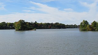
Belleville Lake is a fresh water artificial reservoir located mostly within Wayne County in the U.S. state of Michigan. A very small portion extends west into Washtenaw County. The lake was created from the construction of the French Landing Dam and Powerhouse along the Huron River in 1925.

Dam removal

Dam removal is the process of demolishing a dam, returning water flow to the river. Arguments for dam removal consider whether their negative effects outweigh their benefits. The benefits of dams include hydropower production, flood control, irrigation, and navigation. Negative effects of dams include environmental degradation, such as reduced primary productivity, loss of biodiversity, and declines in native species; some negative effects worsen as dams age, like structural weakness, reduced safety, sediment accumulation, and high maintenance expense. The rate of dam removals in the United States has increased over time, in part driven by dam age. As of 1996, 5,000 large dams around the world were more than 50 years old. In 2020, 85% percent of dams in the United States are more than 50 years old. In the United States roughly 900 dams were removed between 1990 and 2015, and by 2015, the rate was 50 to 60 per year. France and Canada have also completed significant removal projects. Japan's first removal, of the Arase Dam on the Kuma River, began in 2012 and was completed in 2017. A number of major dam removal projects have been motivated by environmental goals, particularly restoration of river habitat, native fish, and unique geomorphological features. For example, fish restoration motivated the Elwha Ecosystem Restoration and the dam removal on the river Allier, while recovery of both native fish and of travertine deposition motivated the restoration of Fossil Creek.

John C. Boyle Dam Dam in Oregon, USA

The John C. Boyle Dam is a hydroelectric dam located in southern Oregon, United States. It is on the upper Klamath River, south (downstream) of Keno, and about 12 miles north of the California border. Originally developed and known as Big Bend, the John C. Boyle dam and powerhouse complex was re-dedicated to honor the pioneer hydroelectric engineer who was responsible for the design of virtually all of the Klamath Hydroelectric Project.

Diablo Lake

Diablo Lake is a reservoir in the North Cascade mountains of northern Washington state, United States. Created by Diablo Dam, the lake is located between Ross Lake and Gorge Lake on the Skagit River at an elevation of 1,201 feet (366 m) above sea level. Diablo Lake is part of the Skagit River Hydroelectric Project and managed by Seattle City Light. Diablo Lake Trail, designated a National Recreation Trail in 1981, runs for 3.80 miles (6.12 km) along the lake's northern shore.

Iron Gate Dam is an earthfill hydroelectric dam on the Klamath River in northern California, outside Hornbrook, California, opened in 1964. The dam blocks the Klamath River to create the Iron Gate Lake Reservoir. It is the lowermost of a series of power dams on the river, the Klamath River Hydroelectric Project, operated by PacifiCorp. It also poses the first barrier to migrating salmon in the Klamath. The Iron Gate Fish Hatchery was placed just after the dam, hatching salmon and steelhead that are released back into the river. The Iron Gate Dam along with the John C. Boyle Dam are two of four on the Klamath River that would be removed under the Klamath Economic Restoration Act. As of February 2016, the states of Oregon and California, the dam owners, federal regulators and other parties reached an agreement to remove all four dams by the year 2020, pending approval by the Federal Energy Regulatory Commission. As of February 25, 2022, the FERC released their final Environmental Impact Statement (EIS) on the dam's removal. The Iron Gate Dam is expected to be removed sometime in 2023 or 2024. A movement to Un-Dam the Klamath has been ongoing for 20 years to remove the dams.

Copco Lake is an artificial lake on the Klamath River in Siskiyou County, California, near the Oregon border in the United States. The lake's waters are impounded by the Copco Number 1 Dam, which was completed in 1922. COPCO was an acronym referring to the California Oregon Power Company, which merged into Pacific Power and Light in 1961, and is now known as Pacificorp.

Ford Lake (Michigan)

Ford Lake is a fresh water artificial reservoir located in Washtenaw County in the U.S. state of Michigan. The lake was created from the construction of Ford Lake Dam along the Huron River in the early 1930s. The lake is named after business magnate Henry Ford.

Ford Lake Dam Dam in Washtenaw County, Michigan

The Ford Lake Dam is an earthen, multi-arch hydroelectric gravity dam and powerhouse crossing the Huron River in Ypsilanti Charter Township in Washtenaw County in the U.S. state of Michigan. The dam was constructed in 1931–1932 and created the Ford Lake reservoir at 975 acres (395 ha).

Flat Rock Dam (Michigan) Dam in Flat Rock, Michigan

The Flat Rock Dam is a decommissioned hydroelectric gravity dam crossing the Huron River. It is located in the city of Flat Rock in Wayne County in the U.S. state of Michigan. The dam was built by the Ford Motor Company in 1924 for hydroelectricity for the nearby Ford Motor Company Lamp Factory, which remained in operation until 1950.

Superior Dam Dam in Superior Township, Michigan

The Superior Dam is a hydroelectric barrage dam crossing the Huron River. It is located in Superior Township in Washtenaw County in the U.S. state of Michigan. It was completed in 1920 and currently provides hydroelectricity to the nearby city of Ann Arbor, which owns and maintains the dam and power station.

Geddes Dam Dam in Ann Arbor Township, Michigan

The Geddes Dam is a decommissioned hydroelectric barrage dam crossing the Huron River. It is located in Ann Arbor Township in Washtenaw County in the U.S. state of Michigan. It was built by the Detroit Edison Company in 1919 for hydroelectricity before being decommissioned in 1959. The dam is currently owned by the nearby city of Ann Arbor. The surrounding area is used for recreational purposes, including Gallup Park, which is Ann Arbor's most popular recreational area.

Barton Dam Dam in Ann Arbor, Michigan

The Barton Dam is a hydroelectric barrage dam crossing the Huron River. It is located in the city of Ann Arbor in Washtenaw County in the U.S. state of Michigan. It began operating in 1912 and currently provides hydroelectricity to city of Ann Arbor, which owns and maintains the dam and power station.

References

  1. 1 2 3 4 5 6 Huron River Watershed Council (November 2015). "Argo Dam" (PDF). Retrieved April 20, 2020.
  2. 1 2 3 Michigan Department of Natural Resources (May 2015). "Argo Pond" (PDF). Retrieved June 1, 2020.
  3. "Ann Arbor officials get Argo Dam issue soon". MLive. Booth Newspapers. April 4, 2019. Retrieved April 20, 2020.
  4. City of Ann Arbor (2020). "Dams and Hydros" . Retrieved April 20, 2020.
  5. 1 2 "The Argo Cascades: Wild Ride; A huge hit, but also a huge risk?". Ann Arbor Observer. June 2013. Retrieved May 29, 2020.
  6. 1 2 3 Huron River Watershed Council (September 27, 2010). "Argo & Geddes Dams, Ann Arbor Hyrdopower Study Final Report" (PDF). Retrieved May 24, 2020.
  7. "Hydropower at Argo Dam?". The Ann Arbor Chronicle. June 12, 2009. Retrieved May 31, 2020.
  8. "Feds considering installing hydropower stations at Argo and Geddes dams in Ann Arbor". The Ann Arbor News . Booth Newspapers. November 15, 2010. Retrieved May 23, 2020.
  9. "Deliberations on DDA Pave Way for Final Vote". The Ann Arbor Chronicle. April 10, 2013. Retrieved May 23, 2020.
  10. Huron River Watershed Council (June 24, 2009). "Science Brief: Impacts of Argo Dam and Benefits for its Removal on the Huron River, Ann Arbor, Michigan" (PDF). Retrieved June 1, 2020.
  11. "Ann Arbor officials get Argo Dam issue soon". MLive. Booth Newspapers. May 7, 2009. Retrieved May 20, 2020.
  12. "Dam In: Keeping Argo Dam is best for Ann Arbor". The Ann Arbor News . Booth Newspapers. September 13, 2009. Retrieved June 1, 2020.
  13. "After months of debate, state officials say Argo Dam can stay". The Michigan Daily . University of Michigan. April 1, 2010. Retrieved June 1, 2020.
  14. "Argo Ultimatum: Time may be running out for Argo Pond". Ann Arbor Observer. December 2008. Retrieved May 29, 2020.
  15. City of Ann Arbor (2020). "Argo Nature Area" . Retrieved May 29, 2020.
  16. City of Ann Arbor (2020). "Bandemer Park" . Retrieved May 29, 2020.
  17. City of Ann Arbor (2020). "Barton Nature Area" . Retrieved May 29, 2020.
  18. Huron River National Water Trail (Ann Arbor) (2020). "Border-to-Border Trail Access" (PDF). Retrieved May 24, 2020.
  19. City of Ann Arbor (2020). "Argo Park Livery" . Retrieved May 29, 2020.
  20. Fisheries Division (April 1995). "– Special Report: Huron River Assessment" (PDF). Michigan Department of Natural Resources. Retrieved May 22, 2020.
  21. City of Ann Arbor (August 31, 2018). "Michigan extends 'Do Not Eat' Fish Advisory for Huron River to Lake Erie" (Press release). City of Ann Arbor. Retrieved August 24, 2019.
  22. Hicks, Mark (September 1, 2018). "State: Don't eat Huron River fish in 5 counties". The Detroit News . Retrieved August 22, 2019.
  23. "Huron River 'do not eat' advisory extended". Monroe News. March 13, 2019. Retrieved April 10, 2020.
  24. City of Ann Arbor (2020). "Water Treatment: PFAS Information" . Retrieved June 1, 2020.