
Cajeme is one of the 72 municipalities of the northwestern Mexican state of Sonora. It is named after Cajemé, a Yaqui leader. The municipality has an area of 3,312.05 km2 and with a population of 436,484 inhabitants as of 2020. The municipal seat is at Ciudad Obregón.
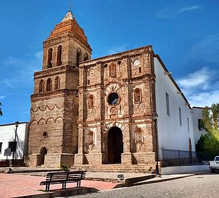
Cócorit is a town located in the municipality of Cajeme in the southern part of the Mexican state of Sonora. The name of the town is derived from the Yaqui word for a chili pepper, ko'oko'i. Cócorit and the municipality of Cajeme are within the Yaqui River Valley. The comisario municipal of Cajeme is Ing. Arturo Soto Valenzuela. Cócorit reported a 2005 census population of 7,953 inhabitants, and is the fifth-largest town in the municipality of Cajeme.
Imuris is the municipal seat of Imuris Municipality in the north of the Mexican state of Sonora.

Soledad de Graciano Sánchez, formerly Soledad Diez Gutiérrez, is the second-largest city of the state of San Luis Potosí in Mexico. It lies adjacent to the east side of the state's capital city of San Luis Potosí in the west-central part of the state. The city is the municipal seat of the municipality of the same name. The city had a 2020 Census population of 310,192, while the municipality's population was 332,072. The municipality has an area of 305.7 square kilometres (118.0 sq mi).
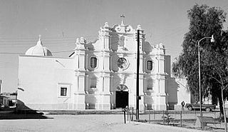
Arizpe is a small town and the municipal seat of the Arizpe Municipality in the north of the Mexican state of Sonora. It is located at 30°20'"N 110°09'"W. The area of the municipality is 2,806.78 sq.km. The population in 2005 was 2,959 of which 1,743 lived in the municipal seat as of the 2000 census.
Bacadéhuachi is a village in Bacadéhuachi Municipality in the northeast of the Mexican state of Sonora. It is 269 kilometers northeast of the state capital, Hermosillo.
Bacanora is a small town in Bacanora Municipality in the east of the Mexican state of Sonora. It is located at the geographical coordinates of 28°59′N109°24′W.

Bacoachi is a small town in Bacoachi Municipality in the north of the Mexican state of Sonora. The area of the municipality is 487 square miles (1,260.65 km2) and the population was 1,456 in 2005, with 924 inhabitants residing in the municipal seat. The elevation of the municipal seat is 4,429 feet above sea level.
Bácum is a small city and the county seat of Bácum Municipality, located in the south of the Mexican state of Sonora at 27°32′N110°05′W.
Bavispe is a small town and a municipality in the northeast part of the Mexican state of Sonora.
Huásabas is the municipal seat of Huásabas Municipality in the northeast of the Mexican state of Sonora. The municipal area is 711.17 km² (274.58 mi²) with a population of 966 registered in 2000. Most of the inhabitants live in the municipal seat.
Moctezuma is a municipio (municipality) of the Mexican state of Sonora, located in the state's central region. It is also the name of its largest settlement and cabecera municipal.
Tepache is a small town in Tepache Municipality in the east of the Mexican state of Sonora. Its location by GPS coordinates is at: Longitude (dec): -109.528889; Latitude (dec): 29.533333.
San Javier is a town in San Javier Municipality, in the Mexican state of Sonora. The elevation is 650 meters.
Suaqui Grande is a town in Suaqui Grande Municipality, in the eastern region of the Mexican state of Sonora. It was founded in 1620 by the Jesuit missionary Martín Burgencio as San Ignacio de Suaqui.

Arizpe is a municipality in the state of Sonora in north-western Mexico. The municipality of Arizpe is one of the 72 municipalities of the state of Sonora, located in the north-central region of the state in the Sierra Madre Occidental area. It has 72 localities within the municipality, its municipal seat and the most populated locality is the homonymous town of Arizpe, while other important ones are: Sinoquipe, Bacanuchi and Chinapa. It was named for the first time as a municipality in 1813 and according to the 14th Population and Housing Census carried out in 2020 by the National Institute of Statistics and Geography (INEGI) the municipality has a total population of 2,788 inhabitants. This municipality has an area of 1,186.56 square miles. Its Gross Domestic Product per capita is USD 11,012, and its Human Development Index (HDI) is 0.8292.

Navojoa is a municipality in the state of Sonora in north-western Mexico. As of 2015, the municipality had a total population of 163,650. The municipal seat is the city of Navojoa.
Nogales is a municipality in the state of Sonora in northwestern Mexico, being the most densely populated municipality in Sonora. The name "Nogales" is the Spanish word for walnut trees.

San Javier is a municipality in the state of Sonora in north-western Mexico. As of 2015, the municipality had a total population of 557.

San Luis Río Colorado is a municipality in the state of Sonora in northwestern Mexico, being the northwesternmost municipality in Sonora and covering an area of 8412.75 km2.
This page is based on this
Wikipedia article Text is available under the
CC BY-SA 4.0 license; additional terms may apply.
Images, videos and audio are available under their respective licenses.

