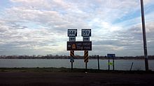
Segments of AR 159 in red | ||||
| Route information | ||||
| Maintained by AHTD | ||||
| Location | ||||
| Country | United States | |||
| State | Arkansas | |||
| Highway system | ||||
| ||||
Highway 159 (AR 159, Ark. 159, and Hwy. 159) is a designation for eight state highways in Chicot and Desha Counties. [1]
| Location | LA 17–Eudora |
|---|---|
| Length | 7.81 mi [1] (12.57 km) |
| Location | Eudora–Lake Village |
|---|---|
| Length | 5.48 mi [1] (8.82 km) |
Between Lake Village and Eudora, Arkansas, Highway 159 follows the original 1926 alignment of U.S. 65
| Location | Halley–Trippe Junction |
|---|---|
| Length | 4.92 mi [1] (7.92 km) |
| Location | US 65–McGehee |
|---|---|
| Length | 4.60 mi [1] (7.40 km) |
| Location | US 65–McGehee |
|---|---|
| Length | 1.53 mi [1] (2.46 km) |
| Location | Downtown McGehee |
|---|---|
| Length | 0.80 mi [1] (1,290 m) |
| Location | AR 138–Omega |
|---|---|
| Length | 4.41 mi [1] (7.10 km) |
| Location | Dumas–Mitchellville |
|---|---|
| Length | 1.74 mi [1] (2.80 km) |
Media related to Arkansas Highway 159 at Wikimedia Commons