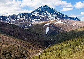
Mount Shasta is a potentially active stratovolcano at the southern end of the Cascade Range in Siskiyou County, California. At an elevation of 14,179 ft (4,322 m), it is the second-highest peak in the Cascades and the fifth-highest in the state. Mount Shasta has an estimated volume of 85 cubic miles, which makes it the most voluminous volcano in the Cascade Volcanic Arc. The mountain and surrounding area are part of the Shasta–Trinity National Forest.

The Brooks Range is a mountain range in far northern North America stretching some 700 miles (1,100 km) from west to east across northern Alaska into Canada's Yukon Territory. Reaching a peak elevation of 8,976 feet (2,736 m) on Mount Isto, the range is believed to be approximately 126 million years old.

Gates of the Arctic National Park and Preserve is a national park of the United States that protects portions of the Brooks Range in northern Alaska. The park is the northernmost national park in the United States, situated entirely north of the Arctic Circle. The area of the park and preserve is the second largest in the U.S. at 8,472,506 acres ; the National Park portion is the second largest in the U.S., after the National Park portion of Wrangell–St. Elias National Park and Preserve.

The Koyukuk River is a 425-mile (684 km) tributary of the Yukon River, in the U.S. state of Alaska. It is the last major tributary entering the Yukon before the larger river empties into the Bering Sea.

The Colville River is a major river of the Arctic Ocean coast of Alaska in the United States, approximately 350 miles (560 km) long. One of the northernmost major rivers in North America, it drains a remote area of tundra on the north side of the Brooks Range entirely above the Arctic Circle in the southwestern corner of the National Petroleum Reserve-Alaska. The river is frozen for more than half the year and floods each spring.The Colville River and its adjacent hills are home to a variety of Arctic wildlife, including Lake Teshekpuk and Central Arctic caribou herds, and hawks.

The Alatna River is a federally designated wild and scenic river partially contained within the boundaries of Gates of the Arctic National Park, Alaska.

The John River (Iñupiaq: Atchiiniq) is a 125-mile (201 km) tributary of the Koyukuk River in the northern part of the U.S. state of Alaska. It was named after John Bremner, a prospector and explorer who was one of the first non-native persons to go there. It flows south from Anaktuvuk Pass in Alaska's Brooks Range, into the larger river at a point near Bettles, slightly north of the Arctic Circle.

Israel Cook Russell, LL.D. was an American geologist and geographer who explored Alaska in the late 19th century.

The Anaktuvuk River is a river in Alaska's North Slope. One hundred and thirty-five miles (217 km) long, it flows west from glaciers in the Endicott Mountains changing direction just north of Anaktuvuk Pass to flow north to the Arctic Coastal Plain where it joins the Colville River. Its headwaters are formed by runoff from various glaciers in the Gates of the Arctic Wilderness on the slopes of Fan Mountain, Alapah Mountain and Limestack Mountain, the last of which lies on the watershed divide between the Arctic Coastal Plain and the Koyukuk River, and feeds the Anaktuvuk River via Graylime Creek. Its first major tributary is the John River which joins it at 68°12′14″N151°36′50″W. The Nanushuk River joins it at 69°18′11″N150°59′58″W.
George Marshall was an American economist, political activist, and conservationist. He was an early leader of The Wilderness Society, a HUAC abolitionist, and later a leader of the Sierra Club.

Robert Marshall was an American forester, writer and wilderness activist who is best remembered as the person who spearheaded the 1935 founding of the Wilderness Society in the United States. Marshall developed a love for the outdoors as a young child. He was an avid hiker and climber who visited the Adirondack Mountains frequently during his youth, ultimately becoming one of the first Adirondack Forty-Sixers. He also traveled to the Brooks Range of the far northern Alaskan wilderness. He wrote numerous articles and books about his travels, including the bestselling 1933 book Arctic Village.

Ernest de Koven Leffingwell was an arctic explorer, geologist and Spanish–American War veteran.

The North Fork of the Koyukuk River is one of the principal forks of the Koyukuk River, approximately 105 mi (160 km) long, in northern Alaska in the United States. It has a watershed area of 1,850 square miles (4,800 km2). It rises on the south slopes of the Continental Divide in the Brooks Range.
Marvin Dale Mangus (1924–2009) was an American geologist and landscape painter. He was giving the honor of driving a purely symbolic wood stake prior to start of drilling the actual oil well by the Atlantic Richfield Corporation, his employer. The focus of his later art career was glorified role of geologist and other exploration of Alaska. He painted animals and birds and was recognized with awards from The National Park Service

The Endicott Mountains are a range of mountains, part of the Brooks Range in northern Alaska. They are located in the middle of the Brooks range and run some 151 miles (243 km) east–west. To the east are the Philip Smith Mountains and to the west are the Schwatka Mountains. The Endicott Mountains are separated from the Philip Smith Mountains by the Middle Fork of the Koyukuk River, the Dalton Highway, and Atigun Pass. The Endicott Mountains are separated from the Schwatka Mountains by Walker Lake, the upper reaches of the West Fork of the Kobuk River, Akabluak Pass, and the Noatak River. The Endicott Mountains are separated from the mountains north of the Schwatka by Lucky Six Creek, Gull Pass, Gull Creek, a portion of the Alatna River and the Killik River.

Limestack Mountain is a 6,250-foot (1,905 m) mountain in the U.S. state of Alaska, located within Gates of the Arctic National Park in the central Brooks Range mountains. The continental divide between the Arctic Ocean and the Pacific Ocean runs along the mountain's northern edge.

Poss Mountain is a prominent 6,180-foot mountain summit located in the Philip Smith Mountains of the Brooks Range, in the U.S. state of Alaska. The peak is situated 80 miles north of the Arctic Circle, five miles east of Dalton Highway, 11.3 mi (18 km) south of Sukakpak Mountain, and 190 mi (306 km) north-northwest of Fairbanks. The peak was named about 1930 by wilderness activist Robert Marshall after "Poss" Postlethwaite, an early and old gold prospector in this area around Wiseman. Robert Marshall described the then 78-year-old Postlethwaite as "the oldest man in the Koyukuk," having spent 32 winters in the area. The name was officially adopted in 1932 by the U.S. Board on Geographic Names. The Poss Mountain Research Natural Area was designated in 1991 to protect natural mineral licks and lambing habitat for Dall sheep. Precipitation runoff from the mountain drains into tributaries of the Middle and South Forks of Koyukuk River.

The Wild River is a river, about 63 miles (101 km) long, in the U.S. state of Alaska whose headwaters are found in Wild Lake at the foot of Tobin Mountain with a mouth emptying into the Koyukuk River near Bettles, Alaska. The river flows through the southern edge of the Brooks Range and out into the plains of the Yukon River System of north central Alaska and the Kanuti Flats.

Snowden Mountain is a 6,420-foot-elevation (1,960-meter) mountain summit located in the Brooks Range, in the U.S. state of Alaska.

Mount Doonerak is a 7,457-foot-elevation (2,273-meter) mountain summit in Alaska, United States.


