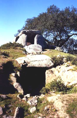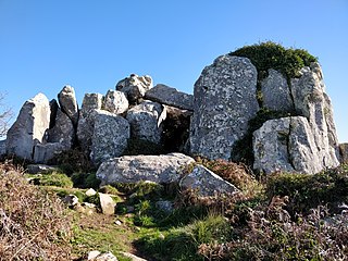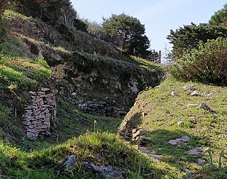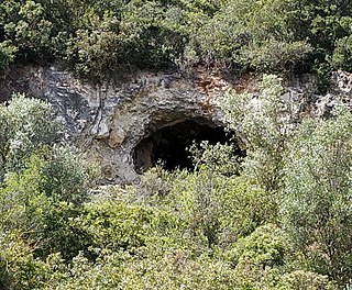
A tumulus is a mound of earth and stones raised over a grave or graves. Tumuli are also known as barrows, burial mounds or kurgans, and may be found throughout much of the world. A cairn, which is a mound of stones built for various purposes, may also originally have been a tumulus.

The Tumulus of Bougon or Necropolis of Bougon is a group of five Neolithic barrows located in Bougon, near La-Mothe-Saint-Héray, between Exoudun and Pamproux in Nouvelle-Aquitaine, France.

The Dolmen of Cunha Baixa is a dolmen in the civil parish of Cunha Baixa, in the municipality of Mangualde. It is located in a valley area of the Rio Castelo, between the villages of Cunha Baixa and Espinho.

The Roman ruins of Casais Velhos are the remains of a Roman town, in the municipality of Cascais, Lisbon District, Portugal that included baths, two cemeteries, remains of a wall and ceramic artifacts.

The Great Dolmen of Comenda da Igreja is a megalithic funerary site in the civil parish of Nossa Senhora do Bispo, in the municipality of Montemor-o-Novo, in the central Alentejo region of continental Portugal.

The Megalithic Monuments of Alcalar are a group of burial tombs that comprise a Calcolithic necropolis, located in the civil parish of Mexilhoeira Grande, municipality of Portimão, Portugal.

The Roman villa of Freiria is a Roman villa in the civil parish of São Domingos de Rana, in the Portuguese municipality of Cascais.

The Anta de Adrenunes, located on top of a hill at 426 metres above sea level, in the municipality of Sintra, within Sintra-Cascais Natural Park, Lisbon District, Portugal, is believed to be a Stone Age burial chamber or megalithic monument. It is a structure consisting of a cluster of granite stones, between which there is a gallery about 5 metres high that is surmounted by monoliths that rest horizontally on vertical stones. The passage is thought to have served as a collective necropolis or dolmen during the megalithic period although no artifacts or burial chambers have been found to prove this. The site contains a geodesic landmark that has been inserted into one of the upper stones.

The Anta de Agualva, also known as the Anta do Carrascal, is a megalithic dolmen situated in an urban area of Agualva-Cacém in the municipality of Sintra, in the Lisbon District of Portugal. First identified by Carlos Ribeiro in 1875, the dolmen has recently been restored and can be easily visited.

The Praia das Maçãs Prehistoric Monument, also known as the Tholos of Outeiro das Mós, consists of an artificial Neolithic cave and a Chalcolithic domed or beehive tomb. It is situated close to the Praia das Maçãs beach, near the town of Colares in Sintra municipality, in the Lisbon District of Portugal. The area was discovered in 1927. As an important prehistoric sepulchral site, it was classified as a national monument in 1974. Surrounded by housing, the location has been designated as a special zone of protection, and construction is forbidden. Plans by Sintra and the Directorate-General for Cultural Heritage to turn the complex into a museum area, first discussed in 2001, have not yet been implemented. For purposes of protection the site has been covered by sand and there is little presently visible.

The Cave of Pedra Furada is a small cave located in the municipality of Vila Franca de Xira, about 20 km north of Lisbon in Portugal. Archaeological studies conducted within the cave suggest it was occupied intermittently by humans during at least three periods between the end of the fourth millennium BC and the second millennium BC. The cave results from karstification of the limestone Upper Jurassic Massif.

The Anta do Alto da Toupeira, also called the Anta da Toupeira or the Anta de Salemas, is a Neolithic dolmen, or megalithic tomb, situated in the parish of Lousa in the municipality of Loures, in the Lisbon District of Portugal. It dates back to the Chalcolithic.

The Cave of Salemas is located close to the village of Lousa in the municipality of Loures in the Lisbon District of Portugal. Discovered by archaeologists during the 1950s, the cave appears to have been occupied by humans as a temporary refuge during the Upper Paleolithic and used as a tomb during the Neolithic.

The four Artificial caves of Casal do Pardo, also known as the Caves of Quinta do Anjo, were neolithic tombs. They are situated in Palmela municipality in the Setúbal District, of Portugal, about 25 km (16 mi) south of the capital of Lisbon. These caves were classified as a National Monument of Portugal in 1934.

The Necropolis of Carenque is an archaeological site consisting of three well-preserved late Neolithic collective sepulchres or tombs, dating back to about 3000 BCE, which are dug into smooth limestone outcrops. It is situated in the municipality of Amadora in the Lisbon District of Portugal.

The Antas do Olival da Pêga are located near the village of Telheiro, in the municipality of Reguengos de Monsaraz, in the Évora district of the Alentejo region of Portugal. Anta is the Portuguese name for a dolmen, a single-chamber megalithic tomb. These two neolithic dolmens were used over a long period, from the late neolithic to the chalcolithic. The tombs were originally identified by the German archaeologists, Georg and Vera Leisner, who excavated Anta 1, with Anta 2 being subsequently excavated from the 1990s by Victor Gonçalves and Ana Catarina Sousa of the Centre of Archaeology of the University of Lisbon (UNIARQ). In addition to the visible stones at the two sites, which are about 300 meters apart, many items have been found as a result of excavations. Over one hundred people were buried in each tomb. The proximity of the two tombs gives rise to the conclusion that both were part of the same megalithic complex.

The Anta da Vidigueira is a megalithic dolmen or burial chamber located southwest of the village of Freixo, in Redondo municipality in the Évora district of the Alentejo region of Portugal. The dolmen was probably constructed between the Neolithic and the Chalcolithic. It has been classified as a National Monument since 1910.
Romajë is a village in the Prizren municipality of Kosovo. It has 2,747 inhabitants as of 2011. The area of Romajë is the site of a multi-layered settlement of the pre-Roman Iron Age, the Roman era, and the medieval era. Excavations at the necropolis of Romajë have revealed extensive burial mounds (tumuli) of classical antiquity.

Jeannette Nolen was a Dutch archaeologist who carried out extensive research in Portugal.

The Caves of Poço Velho are located in the centre of Cascais in the Lisbon district of Portugal. Their use, primarily as a necropolis, is believed to date back to the paleolithic era.


