Aruppukkottai block is a revenue block in the Virudhunagar district of Tamil Nadu, India. It has a total of 32 panchayat villages.
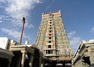
Virudhunagar District is an administrative district of Tamil Nadu state in southern India. Virudhunagar is the district headquarters and the largest city in Virudhunagar district is Rajapalayam. Virudhunagar district was formed by the separation of Old Ramanathapuram District in 1987 into Ramanathapuram District, Sivagangai District and the west part as Virudhunagar District. Virudhunagar District was formerly called Karmavirer Kamarajar District. As of 2011, Virudhunagar district had a population of 2,105,930 with a sex-ratio of 1,007 females for every 1,000 males.
Tamil Nadu, formerly Madras State, is one of the 29 states of India. Its capital and largest city is Chennai. Tamil Nadu lies in the southernmost part of the Indian subcontinent and is bordered by the union territory of Puducherry and the South Indian states of Kerala, Karnataka, and Andhra Pradesh. It is bounded by the Eastern Ghats on the north, by the Nilgiri Mountains, the Meghamalai Hills, and Kerala on the west, by the Bay of Bengal in the east, by the Gulf of Mannar and the Palk Strait on the southeast, and by the Indian Ocean on the south. The state shares a maritime border with the nation of Sri Lanka.
India is a country in South Asia. It is the seventh-largest country by area, the second-most populous country, and the most populous democracy in the world. Bounded by the Indian Ocean on the south, the Arabian Sea on the southwest, and the Bay of Bengal on the southeast, it shares land borders with Pakistan to the west; China, Nepal, and Bhutan to the north; and Bangladesh and Myanmar to the east. In the Indian Ocean, India is in the vicinity of Sri Lanka and the Maldives; its Andaman and Nicobar Islands share a maritime border with Thailand and Indonesia.
Aruppukottai is the legislative assembly in Virudhunagar district, which includes the city, Aruppukkottai. Until 2006 election, Aruppukottai assembly constituency was part of Ramanathapuram. After 2006 election, it is part of Virudhunagar. This is the constituency, held by popular actor-turned politician, M.G. Ramachandran, when he first became Chief Minister in 1977 assembly elections.
Thanjavur is a taluk of Thanjavur district of the Indian state of Tamil Nadu.
Aruppukkottai taluk is a taluk of Virudhunagar district of the Indian state of Tamil Nadu. The headquarters of the taluk is the town of Aruppukkottai.
The Chinnasalem block is a revenue block in the Viluppuram district of Tamil Nadu, India. It has a total of 50 panchayat villages.
Rasipuram block is a revenue block in the Namakkal district of Tamil Nadu, India. It has a total of 20 panchayat villages.
Narikudi block is a revenue block in the Virudhunagar district of Tamil Nadu, India. It has a total of 44 panchayat villages. It is situated about 32 km from Aruppukkottai. The residential Areas are located in 3 places,viz., Hospital Area, Union Office Area and the Bus Stand Area. There is no remarkable business establishments here and for every thing the people will have to move to Aruppukkottai or Thiruppuvanam. The block has 3 revenue Firkas namely Narikudi, A.Mukkulam and Veeracholan. It comes under Thiruchuli Taluk. Narikudi has one Nationalized Indian Overseas Bank and one Co-operative Bank. Though there is a Railway Station, trains are running in this area between virudhunagar to karaikudi passenger train. The major cultivated crops are Paddy and Groundnut and these crops are mostly cultivated in Dry lands with the help of North East Monsoon.
Sattur block is a revenue block in the Virudhunagar district of Tamil Nadu, India. It has a total of 46 panchayat villages.
Srivilliputtur block is a revenue block in the Virudhunagar district of Tamil Nadu, India. It has a total of 29 panchayat villages.
Vembakkottai block is a revenue block in the Virudhunagar district of Tamil Nadu, India. It has a total of 48 panchayat villages.
Watrap block is a revenue block in the Virudhunagar district of Tamil Nadu, India. It has a total of 27 panchayat villages.
Kariapatti block is a revenue block in the Virudhunagar district of Tamil Nadu, India. It has a total of 36 panchayat villages.
Rajapalayam block is a revenue block in the Virudhunagar district of Tamil Nadu, India. It has a total of 36 panchayat villages.
Sivakasi block is a revenue block in the Virudhunagar district of Tamil Nadu, India. It has a total of 54 panchayat villages.
Tiruchuli block is a revenue block in the Virudhunagar district of Tamil Nadu, India. It has a total of 40 panchayat villages.
Virudhunagar block is a revenue block in the Virudhunagar district of Tamil Nadu, India. It has a total of 58 panchayat villages.
Vilathikulam block is a revenue block in the Thoothukudi district of Tamil Nadu, India. It has a total of 51 panchayat villages.
Yercaud block is a revenue block of Salem district of the Indian state of Tamil Nadu. This revenue block consists 9 panchayat villages.They are Manjakuttai, Maramangalam, Nagalur, Semmanatham, Thalaisolai, Vazhavanthi, Vellakkadai, Velur and Yercaud.
The Kallakkurichi block is a revenue block in the Viluppuram district of Tamil Nadu, India. It has a total of 46 panchayat villages.
Gundar is a river flowing in the Virudhunagar and Ramanathapuram districts of the Indian state of Tamil Nadu.
Rajapalayam may refer to:
Coordinates: 9°31′N78°06′E / 9.51°N 78.1°E
A geographic coordinate system is a coordinate system that enables every location on Earth to be specified by a set of numbers, letters or symbols. The coordinates are often chosen such that one of the numbers represents a vertical position and two or three of the numbers represent a horizontal position; alternatively, a geographic position may be expressed in a combined three-dimensional Cartesian vector. A common choice of coordinates is latitude, longitude and elevation. To specify a location on a plane requires a map projection.
This article related to a location in Virudhunagar district, Tamil Nadu, India is a stub. You can help Wikipedia by expanding it. |