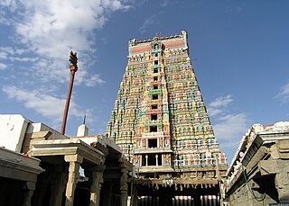
Kotagiri or Kothagiri is a taluk and a Panchayat town in The Nilgiris District in the Indian state of Tamil Nadu. It is the third largest hill station in the Nilgiri hills.

Madurai district is one of the 38 districts of the state of Tamil Nadu in southeastern India. The city of Madurai serves as the district headquarters. It houses the famous Sri Meenakshi Sundareshwarar temple and is situated on the banks of the river Vaigai. Thiruparankundram is one of the major tourist place in the district. As of 2011, the district had a population of 3,038,252 with a sex-ratio of 990 females for every 1,000 males. Aside from the city of Madurai, the larger towns are Melur, Vadipatti, Peraiyur, and Usilampatti. It is an important hub for various film shootings. Alanganallur is a popular spot in the district for Jallikattu, as are Palamedu and Avaniyapuram.

Virudhunagar District is a district of Tamil Nadu state in south India. Virudhunagar is the district headquarters of Virudhunagar district. Virudhunagar district was formed by the separation of Old Ramanathapuram District in 1987 into Ramanathapuram District, Sivagangai District and the west part as Virudhunagar District. Virudhunagar District was formerly called Karmavirer Kamarajar District. As of 2011, Virudhunagar district had a population of 1,942,288 with a sex-ratio of 1,007 females for every 1,000 males.

Arimalam is a Town Panchayath in the district of Pudukkottai, in the state of Tamil Nadu, India.

Jalakandapuram is a panchayat town in the Salem district of the Indian state of Tamil Nadu and has an average elevation of 269 metres (883 ft).

Kilpennathur is a Panchayat Town in Tiruvanamalai district in the Indian state of Tamil Nadu. Kilpennathur is one of the taluks of Tiruvannamalai district and an assembly constituency of Tamil Nadu. The MLA of Kilpennathur assembly constituency is DMK party Mr. K. Pichandi. Vettavalam is the most populous town panchayat in this taluk. Kilpennathur is located a 12.25 degrees latitude and 79.224 degrees longitude. Nearest towns are Avalurpet, Vettavalam, Gingee and Tiruvannamalai, and Chennai is about 177 km away.

Kilvelur is a panchayat town in kilvelur taluk in the district of Nagapattinam district in the Indian state of Tamil Nadu.

Kolathur is a medium-sized town in Salem district in the Indian state of Tamil Nadu. It is located near Mettur and surrounded by Cavery river.

Lalganj is an important town and river port situated in Vaishali district, Bihar.

Nallur (Nalloor) is a panchayat town in Kanniyakumari district in the Indian state of Tamil Nadu.

Peranamallur is a panchayat town in Tiruvanamalai district in the Indian state of Tamil Nadu.

Sendarapatti, also known as Senthalai, is a panchayat town in Salem district in the Indian state of Tamil Nadu.

Thenthiruperai is a panchayat town in Thoothukudi district in the Indian state of Tamil Nadu. It is one of the nine temple shrines that constitutes Nava Tirupathi temples. Thenthiruperai also hosts one of the Navakailasams, Sri Kailasanathar Temple, Then Thirupperai, the seventh in the series.

Thevur is a Town Panchayat city in Salem district, Tamil Nadu.
Thondi or Tondi is a Panchayat town in Ramanathapuram district in the Indian state of Tamil Nadu.It is located 48Km North from district headquarters Ramanathapuram. It is believed to be an ancient port site of Pandiyan kingdom. The famous Sri Sarvatheertheswarar Temple at Marungur, Theerthandathanam is located little northerly to Thondi.

Unnamalaikadai is a panchayat town in Kanya Kumari district in the Indian state of Tamil Nadu.

Vennanthur or Vennandur is a town panchayat in Vennandur block in Rasipuram taluk of Namakkal district in the state of Tamil Nadu, India. Their major economic activity is powerlooms and cloth production especially towels and dhotis.

Vettavalam is a first grade panchayat town in Tiruvanamalai district in the Indian state of Tamil Nadu.

Ayyampettai is a panchayat town in Thanjavur district in the state of Tamil Nadu, India. It is located 15 km from Thanjavur and 24 km from Kumbakonam.

Mullipallam is a panchayat village in Vadipatti Taluka of Madurai district, Tamil Nadu, India, with a total of 2173 families residing.


