
The Kipsigis or Kipsigiis are a Nilotic tribe in Kenya. They are contingent of the Kalenjin ethnic group and speak Kipsigis language, a tonal language which is closely related to a group of languages collectively known as Kalenjin language. It is observed that the Kipsigis and an aboriginal race native to Kenya known as Ogiek have a merged identity. The Kipsigis are the most numerous of the Kalenjin. The latest Census population in Kenya put the kipsigis at 1.972 Million speakers accounting for 45% of all kalenjin speaking people. They occupy the highlands of Kericho stretching from Timboroa to Mara River in the south, the west of Mau Escarpment in the east to Kebeneti in the west. They also occupy, parts of Laikipia, Kitale, Nakuru, Narok, Trans Mara District, Eldoret and Nandi Hills.

Rift Valley Province of Kenya, bordering Uganda, was one of Kenya's eight provinces, before the Kenyan general election, 2013. Rift Valley Province was the largest and one of the most economically important provinces in Kenya. It was dominated by the Kenya Rift Valley which passes through it and gives the province its name. According to the 2009 Census, the former province covered an area of 182,505.1 square kilometres and would have had a population of 10,006,805, making it the largest and most populous province in the country. The bulk of the provincial population inhabited a strip between former Nairobi and Nyanza Province. The capital was the town of Nakuru.
The Kalenjin are a group of tribes designated as Highland Nilotes and are descended from Maliri people (thus related to Daasanach of Ethiopia.) The Kalenjin are cousins with Datooga people of Tanzania and Malawi. In contrast, their designation groups them with other Nilotes including Maasai, Luo, Turkana and Nuer, Dinka among others. They are indigenous to East Africa, residing mainly in what was formerly the Rift Valley Province in Kenya and Eastern slopes of Mount Elgon in Uganda. Upon their arrival in the forest region of Mau, the Kalenjin assimilated the aboriginal hunter-gatherer people known as Okiek. They number 6,358,113 individuals as per the Kenyan 2019 census and an estimated 300,000 in Uganda mainly in Kapchorwa, Kween and Bukwo districts. They have been divided into 11 culturally and linguistically related tribes: Kipsigis, Nandi (937,000), Sebei Keiyo, Marakwet, Sabaot (296,000), Pokots, Tugen, Terik, Sengwer, and Ogiek. The Kalenjin speak the Nadi-Marakweta languages but can also be inclusive of Akie language in Tanzania and Pokot language spoken in Kenya; all being classified collectively as Kalenjin Language; while in combination with Datooga languages of Tanzania, this cluster is called Southern Nilotic languages.
The Tugen are a sub tribe of the Kalenjin people alongside the Nandi, Kipsigis, Keiyo, Pokot, Marakwet, Sabaot, Ogiek, Lembus and Sengwer sub-tribes. They occupy Baringo County and some parts of Nakuru County and Elgeyo Marakwet County in the former Rift Valley Province, Kenya. Daniel arap Moi, the second president of Kenya (1978–2002), came from the Tugen sub-tribe. The Tugen people speak the Tugen language. The Tugen population was 197,556 in 2019.
Dorobo is a derogatory umbrella term for several unrelated hunter-gatherer groups of Kenya and Tanzania. They comprised client groups to the Maasai and did not practice cattle pastoralism.

Nakuru is a city in the Rift Valley region of Kenya. It is the capital of Nakuru County, and was formerly the capital of Rift Valley Province. As of 2019, Nakuru had an urban and rural population of 570,674 inhabitants, making it the largest urban center in the Rift Valley, with Eldoret in Uasin Gishu County following closely behind. The city lies along the Nairobi Nakuru Highway, a distance of 160 kilometers from Nairobi, the capital of Kenya. It is the fourth largest city in Kenya, behind Nairobi, Mombasa and Kisumu respectively. It lies about 1,850 m above sea level.

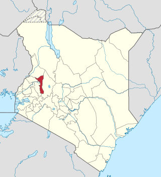
Kericho is the biggest town in Kericho County located in the highlands west of the Kenyan Rift Valley. Standing on the edge of the Mau Forest, Kericho has a warm and temperate climate making it an ideal location for agriculture and in particular, the large scale cultivation of tea.

Nandi County is a county in Kenya in the North Rift, occupying an area of 2,884.4 square kilometres. Its capital, Kapsabet, is the largest town in the county while other towns include Mosoriot, Tinderet, Kobujoi, Kaiboi, Kabiyet and Nandi Hills. According to a 2019 census, the county had a population of 885,711, made up of a number of Kenyan communities, the majority of whom belong to the native tribe called Nandi.
Ainamoi is a settlement in Kenya's Kericho County formerly part of the Rift Valley Province.
Bartimaro is a settlement in Kenya's Rift Valley Province.
Barwesa is a settlement in Kenya's Baringo County.
Biretwo is a settlement in Kenya's Rift Valley Province.
Chebara is a settlement in Kenya's Rift Valley Province.
Kabaldamet is a settlement in Kenya's Rift Valley Province.
Nairagie Ngare is a small town in Kenya's Narok County.
Nakinglas is a settlement in Kenya's Rift Valley Province.
Kuresoi Constituency was one of the five constituencies in Nakuru County, in the Rift valley province. Kenya. In 2012, Kuresoi district was split into two constituencies; Kuresoi North and Kuresoi South. A large part of kuresoi is the East Mau forest, part of the largest water catchment in Kenya, Mau forest. Two major rivers, Mara River and Sondu Miriu have their sources in Kuresoi, Molo River which drains into Lake Baringo has one of its tributaries Ribeti starting in Kuresoi.
Elgeyo-Marakwet County is one of Kenya's 47 counties. Elgeyo Marakwet County is located in the former Rift Valley Province. Its capital and largest town is Iten. It borders the counties of West Pokot to the north, Baringo County to the east, southeast and south, Uasin Gishu to the southwest and west, and Trans Nzoia to the northwest.
The Kalenjin people are an ethnolinguistic group indigenous to East Africa, with a presence, as dated by archaeology and linguistics, that goes back many centuries. Their history is therefore deeply interwoven with those of their neighboring communities as well as with the histories of Kenya, Uganda, Tanzania, South Sudan, and Ethiopia.
The Nakuru County Peace Accord refers to the peace agreement signed on 19 August 2012 between elders of the Agikuyu and Kalenjin communities as well as other ethnic groups of Kenya.
