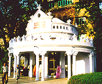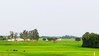
Ludhiana(Punjabi pronunciation: [lʊdiˈɑːnə] ) is the most populous and the largest city in the Indian state of Punjab. The city has an estimated population of 1,618,879 as of the 2011 census and distributed over 310 km2 (120 sq mi), making Ludhiana the most densely populated urban centre in the state. It is a major industrial center of Northern India, referred to as "India's Manchester" by the BBC. It is also known as the Commercial capital of Punjab.
Vidarbha is a geographical region in the east of the Indian state of Maharashtra and a proposed state of western India, comprising the state's Amravati and Nagpur divisions. Amravati Division's former name is Berar. It occupies 31.6% of the total area and holds 21.3% of the total population of Maharashtra. It borders the state of Madhya Pradesh to the north, Chhattisgarh to the east, Telangana to the south and Marathwada and Uttar Maharashtra regions of Maharashtra to the west. Situated in central India. The largest city in Vidarbha is Nagpur followed by Amravati, Akola, Chandrapur and Gondia. A majority of Vidarbha residents speak Varhadi and Zadi dialects of Marathi.

Howrah is a city in the Indian state of West Bengal. Howrah is located on the western bank of the Hooghly River opposite its twin city of Kolkata. Administratively it lies within Howrah district, and is the headquarters of the Howrah Sadar subdivision. It is a part of the area covered by the Kolkata Metropolitan Development Authority. Howrah is an important transportation hub and gateway to Kolkata and West Bengal.
Pataudi is a town and one of the 4 sub-divisions of Gurugram district, in the Indian state of Haryana, within the boundaries of the National Capital Region of India. Ahirs/Yadav dominate the area. It is located 28 km (17.4 mi) from Gurugram, at the foot hills of the Aravali hills.

Chatra district is district one of the twenty-four districts of Jharkhand state, India. The district was formed after separation from Hazaribagh district in 1991. Chatra is the administrative headquarters of this district. The district covers an area of 3718 km2.

Ranaghat is a city and a municipality in Nadia district in the state of West Bengal, India. It is the headquarters of the Ranaghat subdivision. It is compact but one of the densely populated cities of West Bengal. It is known for its handloom industry, various types of flowers and floriculture and a flower market.

Mohali district, officially known as Sahibzada Ajit Singh Nagar district or SAS Nagar district, is one of the twenty three districts of Punjab, a state in north-west India. It was formed in April 2006 and is 18th district of Punjab, created next to Pathankot district. This district was carved out of areas falling in Ropar and Patiala District. It is situated next to the union territory of Chandigarh and Panchkula district of Haryana.
Afzalgarh is a city and a municipal board in Bijnor district in the Indian state of Uttar Pradesh. It is located at the border with the state of Uttarakhand.
Bankapura is a panchayat town in Haveri district in the state of Karnataka, India. It is in Shiggaon taluk, is just 2.5 km from the Pune-Bangalore national highway NH-4, 22 km from Haveri town. Bankapura is about 45 km from Hubli-Dharwad. An historical site, Bankapura is famous for the Nagareshwara temple, Bankapura fort, The Bankapura Peacock Sanctuary. Baada, the birthplace of Kanakadasa is near to Bankapura.

Ballabgarh, officially Balramgarh, is a large town, nearby Faridabad city and a tehsil (subdistrict) in Faridabad district of Haryana, India, and is part of the National Capital Region. The town was founded by Raja Balram Singh, in 1739, who also built the Nahar Singh Mahal palace in the same year. Raja Nahar Singh (1823–1858) was the last king of the princely state. He was executed for taking part in the 1857 war of independence in 1858. The town of Ballabhgarh is only 17 miles (27 km) from Delhi, and today lies on the National Highway 19, a major portion of historical Grand Trunk Road. It is connected to Faridabad and south-east Delhi by the Delhi Metro. Ballabhgarh is the fourth city in Haryana to get metro connectivity after Gurgaon, Faridabad and Bahadurgarh.

Malihabad is a town and nagar panchayat in the Lucknow district of Uttar Pradesh, India. It is also the seat of a tehsil and a community development block of the same name. As of 2011, its population was 17,818, in 3,032 households. Malihabad is the largest of Uttar Pradesh's 14 designated mango belts and accounted for 12.5% of all mango production in the state in 2013. Hundreds of mango varieties are grown here, including the Chausa, Langda, Safeda, and most famously the Dasheri, the "king of mangoes", of which it is one of India's main producers and exporters. Mango grower and Padma Shri recipient Kaleem Ullah Khan has contributed to the popularization of Malihabad's mango industry.

Vikarabad is a town and mandal in Vikarabad district of the Indian state of Telangana. It is located in Vikarabad mandal of Vikarabad revenue division.

Zira is a town and a municipal council in Ferozepur district in the Indian state of Punjab.
Bahadurganj is a Municipality located of Zahurabad pargama of the Kasimabad Tehsil in Ghazipur district of Uttar Pradesh, India. Bahadurganj is located one the banks of Tamsa and Bhainsahi rivers.

Maner also spelled Maner Sharif, is a Block and satellite town in Patna Metropolitan Region. It is part of the Patna district in the Indian state of Bihar. Maner Sharif lies 24 km west of Patna, the capital of Bihar on NH-922. The town has tombs of Sufi saints Makhdoom Yahya Maneri and Makhdoom Shah Daulat, known as Bari Dargah and Chhoti Dargah.
Kabbur is a town in the southern state of Karnataka, India. It is located in the Chikodi taluk of Belgaum district in Karnataka.

Usia is a village in Kamsaar, Uttar Pradesh, India. It lies southeast of Ghazipur and east of Dildarnagar, close to the Bihar State border.USIA is a historical village of ghazipur as well as uttar pradesh, it was founded by 1. Barbal khan 2. Dada jahangir khan. Barbal khane stablished half of village is called north side of village. Jahangir Khan established half of village is known as south side and he also established another village is called Khajuri most of the population of village is Muslim as well as hindu and other community who lives together and happily. Deupty syed Ahmed Khan founder of Skbm, famous Bollywood actor and indian freedom fighter Nazir Hussain and from bazar muhalla railway grd. Dawood Hussain Khan who was also a one of founding fathers of skbm are famous personalities from village.
Fufuao or Rampur Phuphuaon is a village in Dildarnagar Kamsar in the Indian state of Uttar Pradesh.
Khan Sahib is a town sub-district and a notified area committee in Budgam district in the central Kashmir, union territory of Jammu and Kashmir, India. v

Dewaitha is a village in Dildarnagar Kamsar, Ghazipur, India, on the banks of the Karmanasa River. The village had a population of 7,706 as of the 2011 Census of India and a land area of 1,043 acres. Most of the people living in the village are Kamsar Pathan.


