Related Research Articles

Burlington County is a county in the South Jersey region of the U.S. state of New Jersey. The county is the largest by land area in New Jersey and ranks second behind neighboring Ocean County in total area. Its county seat is Mount Holly. As of the 2020 census, the county was the state's 11th-most-populous county, with a population of 461,860, its highest decennial count ever and an increase of 13,126 (+2.9%) from the 448,734 recorded at the 2010 census, which in turn had reflected an increase of 25,340 (6.0%) from the 423,394 enumerated at the 2000 census. The most populous place in the county was Evesham Township with 46,826 residents as of the 2020 census. Washington Township covered 102.71 square miles (266.0 km2), the largest area of any municipality in the county.

U.S. Route 130 is a U.S. Highway that is a spur route of U.S. Route 30, located completely within the state of New Jersey. It is signed with north and south cardinal directions, following a general northeast–southwest diagonal path, with north corresponding to the general eastward direction and vice versa. The route runs 83.4 mi (134.22 km) from I-295 and US 40 at Deepwater in Pennsville Township, Salem County, where the road continues south as Route 49, north to US 1 in North Brunswick, Middlesex County, where Route 171 continues north into New Brunswick. The route briefly runs concurrent with U.S. Route 30 near Camden, about one-third of the way to New Brunswick. The road runs within a close distance of I-295 south of Bordentown and a few miles from the New Jersey Turnpike for its entire length, serving as a major four- to six-lane divided local road for most of its length. US 130 passes through many towns including Penns Grove, Bridgeport, Westville, Camden, Pennsauken, Burlington, Bordentown, Hightstown, and North Brunswick.

U.S. Route 206 is a 130.2-mile-long (209.5 km) north–south U.S. highway in New Jersey and Pennsylvania, United States. Only about a 1⁄2 mile (0.80 km) of its length is in Pennsylvania; the Milford–Montague Toll Bridge carries it over the Delaware River into New Jersey, where it connects to the remainder of the route. Its southern terminus is at an intersection of White Horse Pike and Bellevue Avenue in Hammonton. The highway's northern terminus is at an intersection of US 209 near Milford, Pennsylvania; some sources and signs show an overlap with US 209 to end at its parent route US 6. For much of its length, US 206 is a rural two-lane undivided road that passes through the Pine Barrens, agricultural areas, and the Appalachian Mountains of Northwestern New Jersey, with some urban and suburban areas. The route connects several cities and towns, including Bordentown, Trenton, Princeton, Somerville, Roxbury, Netcong, and Newton.

The Raritan River is the longest and largest river of the U.S. state of New Jersey. Its watershed drains much of the mountainous areas of the central and northern regions of the state, emptying into the Raritan Bay near Staten Island on the Atlantic Ocean.
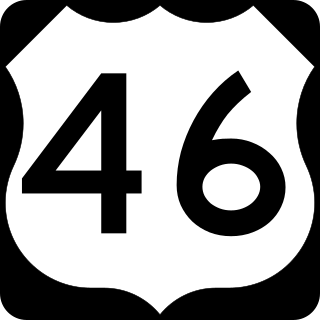
U.S. Route 46 (US 46) is an east–west U.S. Highway completely within the state of New Jersey, running for 75.34 mi (121.25 km), making it the shortest signed, non-spur U.S. Highway. The west end is at an interchange with Interstate 80 (I-80) and Route 94 in Columbia, Warren County, on the Delaware River. The east end is in the middle of the George Washington Bridge over the Hudson River in Fort Lee, Bergen County, while the route is concurrent with I-95 and US 1-9. Throughout much of its length, US 46 is closely paralleled by I-80. US 46 is a major local and suburban route, with some sections built to or near freeway standards and many other sections arterials with jughandles. The route runs through several communities in the northern part of New Jersey, including Hackettstown, Netcong, Dover, Parsippany-Troy Hills, Wayne, Clifton, Ridgefield Park, Palisades Park, and Fort Lee. It crosses over the Upper Passaic River at several points. The road has been ceremonially named the United Spanish–American War Veterans Memorial Highway.

The Hackensack River is a river, approximately 45 miles (72 km) long, in the U.S. states of New York and New Jersey, emptying into Newark Bay, a back chamber of New York Harbor. The watershed of the river includes part of the suburban area outside New York City just west of the lower Hudson River, which it roughly parallels, separated from it by the New Jersey Palisades. It also flows through and drains the New Jersey Meadowlands. The lower river, which is navigable as far as the city of Hackensack, is heavily industrialized and forms a commercial extension of Newark Bay.

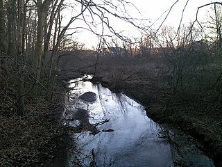
Rancocas Creek is a tributary of the Delaware River in southwestern New Jersey in the United States. The creek's main stem is 8.3 miles (13.4 km) long, with a North Branch of 28.3 miles (45.5 km) and a South Branch flowing 21.7 miles (34.9 km). The creek system drains a rural agricultural and forested area on the western edge of the Pinelands north and northeast of Camden and the New Jersey suburbs of Philadelphia.

Interstate 295 (I-295) in Delaware, New Jersey, and Pennsylvania is an auxiliary Interstate Highway, designated as a bypass around Philadelphia, and a partial beltway of Trenton.

The South Branch Raritan River is a 50-mile-long (80 km) tributary of the Raritan River in New Jersey.
Manalapan Brook is a tributary of the South River in Monmouth and Middlesex counties, New Jersey in the United States.

Stony Brook, also known as Stoney Brook, is a tributary of the Millstone River in Hunterdon and Mercer counties, New Jersey, in the United States.

The Millstone River is a 38.6-mile-long (62.1 km) tributary of the Raritan River in central New Jersey in the United States.

Papakating Creek is a 20.1-mile-long (32.3 km) tributary of the Wallkill River located in Frankford and Wantage townships in Sussex County, New Jersey in the United States. The creek rises in a small swamp located beneath the eastern face of Kittatinny Mountain in Frankford and its waters join the Wallkill to the east of Sussex borough.
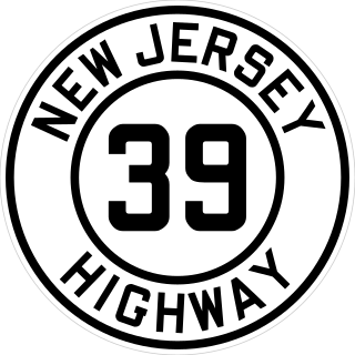
Route 39 was a major state highway in the southwestern portions of the U.S. state of New Jersey. It was fully concurrent with U.S. Route 206 from its southern terminus at U.S. Route 30/State Highway Route 43/State Highway Route 54 in Hammonton to the current-day intersection with County Route 524 in Hamilton Township. Route 39 originally continued westward, crossing the Yardley–Wilburtha Bridge in the community of Wilburtha, New Jersey near State Highway Route 29.
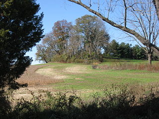
Mount Pleasant is a historic community located within the southeastern range of Mansfield Township and the northeastern range of Springfield Township, Burlington County, New Jersey. Mount Pleasant encompasses the intersection of Mount Pleasant Road and Gaunt's Bridge Road, 40°3′56″N74°40′4″W. The intersection is located about three miles (5 km) east of Columbus and one mile (1.7 km) south of Georgetown.

The members of the New Jersey Legislature are chosen from 40 electoral districts. Each district elects one senator and two assemblymen.
The Assunpink Trail was a Native American trail in what later became Middlesex, Somerset, and Mercer counties in the central and western part of New Jersey. Like Assunpink Creek, the trail takes its name from the Lenape language Ahsën'pink, meaning "stony, watery place".
Jegou's Island or Chygoe's Island is a former island located at the junction of Assiscunk Creek and the Delaware River, on which the central portion of the city of Burlington, in Burlington County, New Jersey, is located. The Moat, a now partially filled distributary of Assiscunk Creek, formerly separated the island from the mainland.
References
- ↑ Gertler, Edward. Garden State Canoeing, Seneca Press, 2002. ISBN 0-9605908-8-9
- ↑ Ricky, Donald B. (1999). Indians of Maryland. St. Clair Shoes, MI: Somerset. p. 72. ISBN 9780403098774.
- ↑ "Assiscunk Creek Watershed Restoration Protection Plan April 2013" (PDF). rutgers.edu. Retrieved 14 September 2023.