
Mount Shattuck is a peak, 1,430 m, located at the south end of Independence Hills, about 3 miles (4.8 km) northwest of Redpath Peaks, in the Heritage Range. It was named by the Advisory Committee on Antarctic Names (US-ACAN) for aviation machinist Wayne M. Shattuck of the U.S. Navy, who was an air crewman on LC-47 aircraft, who perished in a crash on the Ross Ice Shelf on February 2, 1966.
Decazes Island is an island 0.8 km (0.5 mi) long, lying 2.4 km (1.5 mi) southwest of Belding Island at the southwestern extremity of the Biscoe Islands. The island is one of the largest of many small islets and rocks that fringe the northern side of Matha Strait. The vicinity was charted by the French Antarctic Expedition, 1908–10, under Jean-Baptiste Charcot, who applied the name "Pointe Decazes" to the south end of an island in this approximate position. The original application has been altered in recent years, and the name Decazes is now established in usage for the entire island described.

The Astro Cliffs are rock cliffs 60 metres (200 ft), situated at the southeast extremity of Churchill Peninsula, 6 miles (10 km) northeast of Cape Alexander on the east coast of Graham Land. Surveyed by the Falkland Islands Dependencies Survey in 1955, they mark the most southerly point of the survey. The UK Antarctic Place-Names Committee name arose from the astronomical fix obtained near the summit which was essential for the control of the survey traverse.
Baldred Rock is a rock in Fitchie Bay at Laurie Island in the South Orkney Islands. It lies close off the south side of Ferrier Peninsula, 0.75 nautical miles (1.4 km) east-southeast of Graptolite Island. This rock was mapped by the Scottish National Antarctic Expedition under William Speirs Bruce, 1902–04, and was later named "Bass Rock" owing to its likeness to the Bass Rock in Scotland. The name Bass Rock has also appeared on charts as an alternative name for an island in the Joinville Island group. To avoid confusion of these names, in 1954 the UK Antarctic Place-Names Committee recommended an entirely new name for the rock at Fitchie Bay. Baldred Rock is named after Saint Baldred, the first hermit known to have lived on the Scottish Bass Rock.
Bedford Island is an island about 1 nautical mile (2 km) long, lying at the south end of the Barcroft Islands in the Biscoe Islands. It was mapped from air photos taken by the Falkland Islands and Dependencies Aerial Survey Expedition (1956–57), and named by the UK Antarctic Place-Names Committee for Thomas Bedford, an English physicist who specialized in the measurement of the physical environment of man.
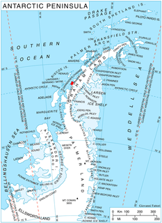
The Bernal Islands are a group of four mainly snow-covered islands and a number of rocks lying in Crystal Sound, about 10 nautical miles (20 km) east of the south end of Lavoisier Island, Biscoe Islands. They were mapped from surveys by the Falkland Islands Dependencies Survey (1958–59) and from air photos obtained by the Ronne Antarctic Research Expedition (1947–48), and named by the UK Antarctic Place-Names Committee for John D. Bernal, a British physicist, joint author with Sir Ralph Fowler of a classic 1933 paper on the structure of ice which suggested the location of the hydrogen atoms, known as the ice rules.
Conway Island lies in Crates Bay to the west of Lens Peak and facing Bregare Point, off the northeast coast of Stresher Peninsula, Graham Land. It was photographed by Hunting Aerosurveys Ltd in 1956–57, and mapped from these photos by the Falkland Islands Dependencies Survey. It was named by the UK Antarctic Place-Names Committee in 1959 for Martin Conway, 1st Baron Conway of Allington, an English mountaineer and a pioneer of polar skiing during his crossing of Vestspitsbergen in 1896.

Napier Rock is a rock lying 1.75 nautical miles (3.2 km) east-southeast of Point Thomas in Admiralty Bay, King George Island, in the South Shetland Islands. Charted by the French Antarctic Expedition under Charcot, 1908-10. Named by the United Kingdom Antarctic Place-Names Committee (UK-APC) in 1960 for Ronald G. Napier (1925–1956) of Falkland Islands Dependencies Survey (FIDS), general assistant and handyman at the Signy Island station in 1955, and then leader at Admiralty Bay until he was drowned on March 24, 1956.
Davidson Island is a small, dome-shaped ice-covered island between Wollan Island and Shull Rocks in Crystal Sound. It was mapped from air photos obtained by the Ronne Antarctic Research Expedition (1947–48) and the Falkland Islands and Dependencies Aerial Survey Expedition (1958–59) and from surveys by the Falkland Islands Dependencies Survey (1958–59). It was named by the UK Antarctic Place-Names Committee for William L. Davidson, an American physicist who used neutron diffraction to determine the position of the hydrogen atoms in ice.
The Fowler Islands are a group of small islands lying between the Bernal Islands and the Bragg Islands in Crystal Sound, off the coast of Antarctica. They were mapped from air photos obtained by the Ronne Antarctic Research Expedition (1947–48) and the Falkland Islands and Dependencies Aerial Survey Expedition (1956–57), and from surveys by the Falkland Islands Dependencies Survey (1958–59). They were named by the UK Antarctic Place-Names Committee for Sir Ralph H. Fowler (1889–1944), an English physicist, joint author with J.D. Bernal of a classic paper in 1933 on the structure of ice which suggested the location of the hydrogen atoms now known as the ice rules.
Gibbs Glacier is a glacier, 15 nautical miles (28 km) long, flowing southeast into the northern part of Mercator Ice Piedmont on the east side of the Antarctic Peninsula. This feature together with Neny Glacier, which flows northwest, occupy a transverse depression between Mercator Ice Piedmont and Neny Fjord on the west side of the Antarctic Peninsula. Gibbs Glacier was photographed from the air and first mapped by the United States Antarctic Service, 1939–41, and the Ronne Antarctic Research Expedition, 1947–48. It was named by the UK Antarctic Place-Names Committee for Peter M. Gibbs of the Falkland Islands Dependencies Survey, a surveyor at Horseshoe Island, 1957, and leader at Stonington Island, 1958, who was responsible for the first ground survey of the glacier.
Mount Hanson is a mountain rising to 800 metres (2,600 ft), standing 1 nautical mile (2 km) southeast of Supporting Party Mountain in the Harold Byrd Mountains of Antarctica. It was discovered in December 1929 by the Byrd Antarctic Expedition geological party under Laurence Gould, and named by Rear Admiral Richard E. Byrd for Malcolm P. Hanson, chief radio engineer of the expedition, and a pioneer in the development of radio communication apparatus for polar regions.
Heim Glacier is a glacier 8 nautical miles (15 km) long in the southeast part of Arrowsmith Peninsula, which flows south to merge with the ice in Jones Channel on the west coast of Graham Land, Antarctica. With Antevs Glacier to the north, it forms a transverse depression extending to the southwest part of Lallemand Fjord. Heim Glacier was first sighted from the air in 1936 by the British Graham Land Expedition under John Rymill. Its lower reaches were surveyed in 1949 by the Falkland Islands Dependencies Survey, and the glacier named by them for Albert Heim, a Swiss glaciologist and the author in 1885 of Handbuch der Gletscherkunde.
Helios Ridge is a broad rock ridge, 4.5 nautical miles (8 km) long, that extends in an east-northeast direction from Mount Helios in the Olympus Range, to the vicinity of Lake Brownworth in Wright Valley, Victoria Land, Antarctica. The ridge rises between the east snout of Clark Glacier and Wright Valley, causing meltwater streams to flow east around it to reach Onyx River. It was named by the Advisory Committee on Antarctic Names in 1997 in association with Mount Helios and other features in this area that are named from Greek mythology.
Tenorio Rock is a rock 0.4 nautical miles (0.7 km) offshore in western Discovery Bay, Greenwich Island, South Shetland Islands. The name derives from the forms "Islote Tenorio" and "Islote Aviador Tenorio" used on Chilean hydrographic charts of the 1950s. Humbert Tenorio Island was second pilot of the Sikorsky helicopter employed by the Chilean Antarctic Expedition of 1947.
Rambler Harbour is a small harbour in the north side of Rambler Island, Bragg Islands, in Crystal Sound. First mapped and named by Commander W.M. Carey, Royal Navy, of the Discovery II (1930–31). The location of the harbour was in doubt for several years, but in 1958 was reidentified and surveyed by Falkland Islands Dependencies Survey (FIDS).
Lagrange Peak is a conspicuous peak, 450 metres (1,500 ft) high, standing 5.5 nautical miles (10 km) northeast of Strath Point on the southeast coast of Brabant Island, in the Palmer Archipelago, Antarctica. A point on the coast just south of this peak was first charted and the name Lagrange applied by the Belgian Antarctic Expedition under Gerlache, 1897–99. On one of the photos published by the expedition, the name is applied to the southern tip of the island. To avoid confusion, the generic term has been altered and the name applied to this peak.

