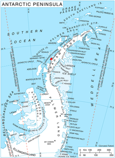
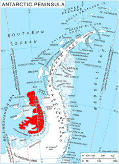
Decazes Island is an island 0.8 km (0.5 mi) long, lying 2.4 km (1.5 mi) southwest of Belding Island at the southwestern extremity of the Biscoe Islands. The island is one of the largest of many small islets and rocks that fringe the northern side of Matha Strait. The vicinity was charted by the French Antarctic Expedition, 1908–10, under Jean-Baptiste Charcot, who applied the name "Pointe Decazes" to the south end of an island in this approximate position. The original application has been altered in recent years, and the name Decazes is now established in usage for the entire island described.
Atom Rock is an insular rock 0.5 miles (0.8 km) northeast of Rambler Island in the Bragg Islands, lying in Crystal Sound off the west coast of Graham Land. It was mapped from surveys by the Falkland Islands Dependencies Survey (1958–59), and named by the UK Antarctic Place-Names Committee in association with Bragg Islands.
Bedford Island is an island about 1 nautical mile (2 km) long, lying at the south end of the Barcroft Islands in the Biscoe Islands. It was mapped from air photos taken by the Falkland Islands and Dependencies Aerial Survey Expedition (1956–57), and named by the UK Antarctic Place-Names Committee for Thomas Bedford, an English physicist who specialized in the measurement of the physical environment of man.
The Bernal Islands are a group of four mainly snow-covered islands and a number of rocks lying in Crystal Sound, about 10 nautical miles (20 km) east of the south end of Lavoisier Island, Biscoe Islands. They were mapped from surveys by the Falkland Islands Dependencies Survey (1958–59) and from air photos obtained by the Ronne Antarctic Research Expedition (1947–48), and named by the UK Antarctic Place-Names Committee for John D. Bernal, a British physicist, joint author with Sir Ralph Fowler of a classic 1933 paper on the structure of ice which suggested the location of the hydrogen atoms, known as the ice rules.

The Boker Rocks are a rocky exposure located 5 nautical miles (9 km) northeast of Von der Wall Point on the south coast of Thurston Island. The feature was mapped by the United States Geological Survey from surveys and from U.S. Navy air photos, 1960–66, and named by the Advisory Committee on Antarctic Names for Helmut C. Boker, a meteorologist at Byrd Station, 1964–65.
Carnell Peak is a peak, 1,730 metres (5,680 ft) high, in the Watlack Hills, situated 2.5 nautical miles (5 km) from the southeast end of the group, in the Heritage Range, Ellsworth Mountains. It was mapped by the United States Geological Survey from surveys and from U.S. Navy air photos, 1961–66, and named by the Advisory Committee on Antarctic Names for Lieutenant D.L. Carnell, Civil Engineer Corps, U.S. Navy, maintenance officer at Williams Field, McMurdo Sound, in the 1965–66 season, who was responsible for the first piercing of the Ross Ice Shelf at 50 meters.

Conway Island lies in Crates Bay to the west of Lens Peak and facing Bregare Point, off the northeast coast of Stresher Peninsula, Graham Land. It was photographed by Hunting Aerosurveys Ltd in 1956–57, and mapped from these photos by the Falkland Islands Dependencies Survey. It was named by the UK Antarctic Place-Names Committee in 1959 for Martin Conway, 1st Baron Conway of Allington, an English mountaineer and a pioneer of polar skiing during his crossing of Vestspitsbergen in 1896.
Ekho Mountain is a mountain, 1,690 metres (5,540 ft) high, standing 3 nautical miles (6 km) southwest of Vorposten Peak in the Lomonosov Mountains, Queen Maud Land. It was discovered and roughly plotted from air photos by the Third German Antarctic Expedition, 1938–39. It was mapped from air photos and surveys by the Sixth Norwegian Antarctic Expedition, 1958–59, was remapped by the Soviet Antarctic Expedition, 1960–61, and named "Gora Ekho".
The Fowler Islands are a group of small islands lying between the Bernal Islands and the Bragg Islands in Crystal Sound, off the coast of Antarctica. They were mapped from air photos obtained by the Ronne Antarctic Research Expedition (1947–48) and the Falkland Islands and Dependencies Aerial Survey Expedition (1956–57), and from surveys by the Falkland Islands Dependencies Survey (1958–59). They were named by the UK Antarctic Place-Names Committee for Sir Ralph H. Fowler (1889–1944), an English physicist, joint author with J.D. Bernal of a classic paper in 1933 on the structure of ice which suggested the location of the hydrogen atoms now known as the ice rules.
Gibbs Glacier is a glacier, 15 nautical miles (28 km) long, flowing southeast into the northern part of Mercator Ice Piedmont on the east side of the Antarctic Peninsula. This feature together with Neny Glacier, which flows northwest, occupy a transverse depression between Mercator Ice Piedmont and Neny Fjord on the west side of the Antarctic Peninsula. Gibbs Glacier was photographed from the air and first mapped by the United States Antarctic Service, 1939–41, and the Ronne Antarctic Research Expedition, 1947–48. It was named by the UK Antarctic Place-Names Committee for Peter M. Gibbs of the Falkland Islands Dependencies Survey, a surveyor at Horseshoe Island, 1957, and leader at Stonington Island, 1958, who was responsible for the first ground survey of the glacier.

Goff Glacier is a broad glacier flowing from Parker Peak into the head of Koether Inlet on the north side of Thurston Island, Antarctica. It was named by the Advisory Committee on Antarctic Names after Lieutenant Robert G. Goff, co-pilot of PBM Mariner aircraft in the Eastern Group of U.S. Navy Operation Highjump, which obtained aerial photographs of Thurston Island and adjacent coastal areas, 1946–47.
Mount Hanson is a mountain rising to 800 metres (2,600 ft), standing 1 nautical mile (2 km) southeast of Supporting Party Mountain in the Harold Byrd Mountains of Antarctica. It was discovered in December 1929 by the Byrd Antarctic Expedition geological party under Laurence Gould, and named by Rear Admiral Richard E. Byrd for Malcolm P. Hanson, chief radio engineer of the expedition, and a pioneer in the development of radio communication apparatus for polar regions.

McManus Glacier is a glacier flowing north into Palestrina Glacier, in northwestern Alexander Island, Antarctica. It separates Lassus Mountains on the west from Sofia University Mountains on the east. The glacier was surveyed by the British Antarctic Survey (BAS), 1975–76, and was named by the UK Antarctic Place-Names Committee in 1980 after Alan James McManus, a BAS cook at Grytviken and Faraday Research Station, 1971–73, and at Adelaide Island and Rothera Research Station, 1975–78.

Marret Glacier is a channel glacier about 4 nautical miles (7 km) wide and 4 nautical miles long, flowing northeast from the continental ice of Antarctica to the coast close east of Cape Robert. It was delineated from aerial photos taken by U.S. Navy Operation Highjump, 1946–47, and was named by the Advisory Committee on Antarctic Names for Mario Marret, the leader of the French Antarctic Expedition, 1952–53, whose party extended reconnaissance of the coastal features to the west side of Victor Bay.
Mackerel Island is an island immediately west of Flounder Island in the Fish Islands, off the west coast of Graham Land, Antarctica. It was charted by the British Graham Land Expedition under John Rymill, 1934–37, and was so named by the UK Antarctic Place-Names Committee in 1959 after the mackerel as it is one of the Fish Islands.

Mahaffey Glacier is a glacier flowing into the head of Morgan Inlet at the east end of Thurston Island, Antarctica. It was named by the Advisory Committee on Antarctic Names after J.S. Mahaffey, a Photographer's Mate in the Eastern Group of U.S. Navy Operation Highjump, which obtained aerial photographs of Thurston Island and adjacent coastal areas in 1946–47.

Savage Glacier is a glacier at the east end of Thurston Island, lying south of Tierney Peninsula and flowing east to Seraph Bay. The glacier was discovered on helicopter flights from the USS Glacier and Burton Island by personnel of the U.S. Navy Bellingshausen Sea Expedition in February 1960. The Advisory Committee on Antarctic Names named the glacier for Lieutenant John Savage, U.S. Navy, dental officer aboard the Glacier, who assisted in establishing geodetic control points in the area.
Salmon Island is the westernmost of the Fish Islands, lying off the west coast of Graham Land. Charted by the British Graham Land Expedition (BGLE) under Rymill, 1934-37. So named by the United Kingdom Antarctic Place-Names Committee (UK-APC) in 1959 because it is one of the Fish Islands.
Rambler Island is the largest of the Bragg Islands, lying in Crystal Sound about 7.5 nautical miles (14 km) north of Cape Rey, Graham Land. Mapped from surveys by Falkland Islands Dependencies Survey (FIDS) (1958–59). The name derives from association with Rambler Harbor which lies on the north side of the island.
Lagrange Peak is a conspicuous peak, 450 metres (1,500 ft) high, standing 5.5 nautical miles (10 km) northeast of Strath Point on the southeast coast of Brabant Island, in the Palmer Archipelago, Antarctica. A point on the coast just south of this peak was first charted and the name Lagrange applied by the Belgian Antarctic Expedition under Gerlache, 1897–99. On one of the photos published by the expedition, the name is applied to the southern tip of the island. To avoid confusion, the generic term has been altered and the name applied to this peak.


