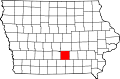
History
The community is one of the oldest in the county, and was platted by the county surveyor Stanford Doud on May 16, 1847, for James Barker and Nathaniel and Rhoda Cockelreas. The plat was filed under the name Barkersville, in honor of one of the founders, James Barker. The first home and business were owned by Barker, and he also served as the first postmaster. [2]
On December 28, 1852, he name was changed from Barkersville to Attica after a petition was circulated to change the name of the community. The Iowa Legislature passed a bill entitled "An act to change the name of Barkersville in Marion County to Attica." At that time, there was also a school and a hotel. [2]
In 1914, there was a post office, three general stores, and the hotel; the population was 125. [2] The population was 130 in 1940. [3]
This page is based on this
Wikipedia article Text is available under the
CC BY-SA 4.0 license; additional terms may apply.
Images, videos and audio are available under their respective licenses.