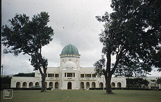
Kaduna is the capital city of Kaduna State, and the former political capital of Northern Nigeria. It is located in north-western Nigeria, on the Kaduna River. It is a trade center and a major transportation hub as the gateway to northern states of Nigeria, with its rail and important road network.

Kaduna State is a state in the northwest geopolitical zone of Nigeria. The state capital is its namesake, the city of Kaduna, which was the 8th largest city in the country as of 2006. Created in 1967 as North-Central State, which also encompassed the modern Katsina State, Kaduna State achieved its current borders in 1987. Kaduna State is the fourth largest and third most populous state in the country, Kaduna State is nicknamed the Centre of Learning, owing to the presence of numerous educational institutions of importance within the state such as Ahmadu Bello University.
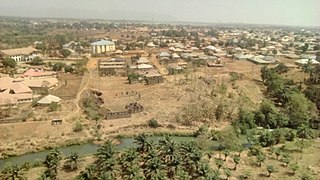
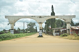
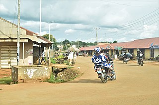
Kafanchan is a town located in the southern part of Kaduna State, Nigeria. The town owes much of its development to the railway development in the area. The railway is situated at a particular junction of the Nigerian Railway Corporation (NRC) station built in 1927. It sits on the railtrack connecting Port Harcourt, Enugu, Kafanchan, Kuru, Bauchi and finally Maiduguri. As of 2007, Kafanchan had an estimated population of 83,092.
Chikun is a Local Government Area in central Kaduna State, Nigeria. It has an area of about 4,466 km2, and had a population of 372,272 as at the 2006 census. Its headquarters is located in the town of Kujama. The postal code of the area is 2438000.
Sanga is a Local Government Area in southern Kaduna State, Nigeria. Its headquarters is in the town of Gbantu. The Local Government Council is chaired by Bisallah Malam. It has an area of 1,821 km2 and had a population of 151,485 as at the 2006 census. The postal code of the area is 801.
Jema'a is a Local Government Area in southern Kaduna State, Nigeria with headquarters at Kafanchan. The Local Government Council is chaired by Yunana Barde. It has an area of 1,384 km2 and a population of 278,202 at the 2006 census. The postal code of the area is 801.
Kaura is a town and a Local Government Area in southern Kaduna State, Nigeria. Its headquarters are in the town of Kaura in Asholyio (Moroa) Chiefdom. The Local Government Council is chaired by Matthias Siman. Other towns include: Manchok and Kagoro. It has an area of 461 km2 and a population of 174,626 at the 2006 census. The postal code of the area is 801.
Jaba is a Local Government Area in southern Kaduna State, Nigeria. It covers an area of 531 km2. It is located close to the Jos Plateau region and Abuja in the central part of Nigeria in West Africa. The local government capital is in the town of Kwoi. The postal code of the area is 801. The Chairman of the local government oversee both economic and developmental activities in the area.
Zangon Kataf is a Local Government Area in southern Kaduna State, Nigeria. Its headquarters is in the town of Zonkwa. It is also a name of a town in the chiefdom of the Atyap. Other towns include: Batadon (Madakiya), Chenkwon, Kamantan, Anchuna and Kamuru. It has an area of 2,579 km2 and a population of 318,991 at the 2006 census. The postal code of the area is 802.

The Kafanchan Peace Declaration is a peace accord signed by five local government areas in southern Kaduna State, Nigeria. The local government areas involved in the process were the Sanga, Kachia, Kaura, Zangon Kataf and Jema'a. The five areas include 29 ethnic communities headed by 32 chairs. The declaration has been signed on 23 March 2016 in Kafanchan, Kaduna State, Nigeria. The peace accord has been facilitated by the Swiss-based organization Centre for Humanitarian Dialogue (HD).
Herder–farmer conflicts in Nigeria are a series of disputes over arable land resources across Nigeria between the mostly-Muslim Fulani herders and the mostly-Christian non-Fulani farmers. The conflicts have been especially prominent in the Middle Belt since the return of democracy in 1999. More recently, they have deteriorated into attacks on farmers by Fulani herdsmen.

Kagoma is a district of Jema'a Local Government Area, southern Kaduna state in the Middle Belt region of Nigeria. The postal code for the village is 801104.

Lists of villages in Nigeria organised by state:
Gwong people are a people found in the southern part of Kaduna State, Nigeria. Their language, Gyong language belongs to the central plateau language group. Their headquarters is at Fadan Kagoma, Jema'a Local Government Area of the state.
Tagwai Sambo was the monarch of Asholyio (Moroa) Chiefdom with headquarters at Manchok, a Nigerian traditional state in southern Kaduna State, Nigeria. He is also known by the title "Chief of Moro'a (Asholyio)".
Takau is a district in Fantswam (Kafanchan) Chiefdom of Jema'a Local Government Area in southern Kaduna state in the Middle Belt region of Nigeria. It is a suburban area of the town of Kafanchan. The postal code of the area is 801139.

Gidan Waya is a small town and Headquarters of Godogodo chiefdom about 18 km from Kafanchan in Jema'a Local Government Area of southern Kaduna state in the Middle Belt region of Nigeria. The town has a post office.
Mariri is a town in Garu Mariri, Lere Local Government Area, southern Kaduna state, Middle Belt, Nigeria. It is located 131 km from the state capital, Kaduna. The postal code of the area is 811.
The immediate origins of killings in Southern Kaduna especially in the 2010s and early 2020s can be traced to the events that brought in Goodluck Jonathan into power in 2010 as the President of Nigeria, and escalated after the presidential election in 2011, which he won.
Antang is a village and district in Jema'a Local Government Area, southern Kaduna State, Middle Belt, Nigeria. It is located 163.93 km from the state capital, Kaduna. The postal code of the area is 801. The village is 1,850 ft above sea level.
