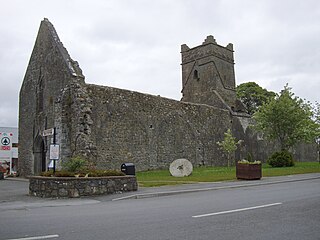
Aughrim is a small village in County Galway, Ireland. It is located between the towns of Loughrea and Ballinasloe, along the old N6 national primary road, now listed as R446 regional road that used to be the main road between Galway and Dublin. According to the Irish census of 2011, the division had a population of 595.

Cashelmore, also called Clogher Stone Fort, is a stone ringfort (cashel) and National Monument located in County Sligo, Ireland.

Cashelore, also called Cashel Bir or Bawnboy, is a stone ringfort (cashel) and National Monument located in County Sligo, Ireland.

Drummin fort is a ringfort and National Monument located in County Roscommon, Ireland.

Rathsoony is a ringfort and National Monument located in County Galway, Ireland.

Brian Boru's Fort, also called Béal Ború, is a ringfort and National Monument located in County Clare, Ireland.

Cashlaungar, also Cashlaungarr, Cashlaun Gar or Cashlán Gar, is a stone ringfort (cashel) and National Monument located in The Burren, a region in County Clare, Ireland.

Lissacresig is a ringfort (rath) and National Monument (#571) located in County Cork, Ireland.

Cahervagliar is a ringfort (rath) and National Monument (#233) located in County Cork, Ireland.

Loher Cashel is a stone ringfort (cashel) and National Monument located on the Iveragh Peninsula, Ireland.

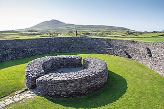
Leacanabuaile is a stone ringfort (cashel) and National Monument in County Kerry, Ireland. Leacanabuaile is immediately northwest of Cahergal, 3 km (1.9 mi) northwest of Cahirciveen.

Cahergall is a stone ringfort (cashel) and National Monument located in County Kerry, Ireland.

Caheravoley Fort is a ringfort (rath) and bawn forming a National Monument located in County Galway, Ireland.

Portumna Abbey is a medieval Cistercian friary and National Monument located in Portumna, Ireland.

Drumacoo is a medieval ecclesiastical site and National Monument located in County Galway, Ireland.

Dunmore Abbey is a medieval Augustinian friary and National Monument located in County Galway, Ireland.

Ballynavenooragh is a stone fort and National Monument located in County Kerry, Ireland.

Creggankeel Fort is a stone fort and National Monument located on the island of Inisheer, Ireland. It also contains a later Christian site, the Grave of the Seven Daughters.

Dún Conor is a stone ringfort (cashel) and National Monument located on Inishmaan, Ireland.

Dún Fearbhaí[d̪ˠuːnˠ ˈfʲaɾˠ.vˠiː] is a stone ringfort (cashel) and National Monument located on Inishmaan, Ireland.


