Myanmar is the northwestern-most country of mainland Southeast Asia. It lies along the Indian and Eurasian Plates, to the southeast of the Himalayas. To its west is the Bay of Bengal and to its south is the Andaman Sea. It is strategically located near major Indian Ocean shipping lanes.The neighboring countries are China, India, Bangladesh, Thailand and Laos.
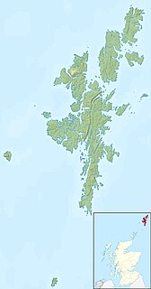
The Out Skerries are an archipelago in Shetland, Scotland, lying to the east of the main Shetland Island group. Locally, they are usually called Da Skerries or just Skerries.

The Treshnish Isles is an archipelago of small islands and skerries, lying west of Mull, in Scotland. They are part of the Inner Hebrides. Trips to the Treshnish Isles operate from Tobermory and Ardnamurchan in the summer months.

The Tuscan Archipelago is a chain of islands between the Ligurian Sea and Tyrrhenian Sea, west of Tuscany, Italy.
Astrolabe Glacier is a glacier 7 kilometres (4 nmi) wide and 19 kilometres (10 nmi) long, flowing north-northeast from the continental ice and terminating at the coast in a prominent tongue at the east side of Geologie Archipelago. It was first sighted in 1840 by the French expedition under Captain Jules Dumont d'Urville, although no glaciers were noted on d'Urville's chart of this coast but a formidable icy dike with perpendicular flanks of 37.7 m high according to the joined plate, corresponding to the glacier tongue. The glacier was photographed from the air by U.S. Navy Operation Highjump in January 1947. It was charted by the French Antarctic Expedition, 1949–51, and named after d'Urville's flagship, the Astrolabe.

The Ibar Rocks are two rocks located 0.4 kilometres (0.2 nmi) east of Bonert Rock and 1 kilometre (0.6 nmi) southeast of Canto Point, Greenwich Island, in the South Shetland Islands. The names "Islote Ibar" and "Islote Teniente Ibar" appearing on Chilean hydrographic charts in the 1950s refer to the larger and western rock. The recommended name "Ibar Rocks" includes a submerged outlier to the northeast of the larger rock. Teniente (lieutenant) Mario Ibar P. signed the official act of inauguration of the Chilean Captain Arturo Prat Base on Greenwich Island in 1947.

Delta Island is an island 1 kilometre (0.5 nmi) long, lying close southeast of Lambda Island and east of Alpha Island in the Melchior Islands, Palmer Archipelago. The name, derived from the fourth letter of the Greek alphabet, was probably given by Discovery Investigations personnel who roughly surveyed the island in 1927. The island was surveyed by Argentine expeditions in 1942, 1943 and 1948.

The Beaumont Skerries are two small islands and several rocks 2 kilometres (1 nmi) east of the Joubin Islands, off the southwest coast of Anvers Island. They were named by the Advisory Committee on Antarctic Names for Malcolm J. Beaumont, an Electronics Technician in RV Hero on her first Antarctic voyage, reaching nearby Palmer Station on Christmas Eve, 1968.
The Canopus Rocks are two small, low rocks lying 2 kilometres (1 nmi) northwest of Canopus Island, 2 kilometres (1 nmi) east of Nella Rock and the Sawert Rocks, and 1.9 kilometres (1 nmi) southeast of Hansen Rocks in the eastern part of Holme Bay, Mac. Robertson Land. They were plotted from photos taken from Australian National Antarctic Research Expeditions aircraft in 1958, and named by the Antarctic Names Committee of Australia after Canopus Island.
Carroll Inlet is an inlet, 74 kilometres (40 nmi) long and 11 kilometres (6 nmi) wide, trending southeast along the coast of Antarctica between the Rydberg Peninsula and Smyley Island. The head of the inlet is divided into two arms by the presence of Case Island and is bounded to the east by Stange Ice Shelf. It was discovered on an airplane flight, December 22, 1940, by members of the United States Antarctic Service (USAS) (1939–1941), and named after Arthur J. Carroll, chief aerial photographer on USAS flights from the East Base.
The Child Rocks are a group of rocks at the west end of the Robinson Group off the coast of Mac. Robertson Land, 3.7 kilometres (2 nmi) west of Andersen Island. They were mapped by Norwegian cartographers from air photos taken by the Lars Christensen Expedition, 1936–37, and named "Vestskjera". They were renamed by the Antarctic Names Committee of Australia for J.B. Child, Third Officer of the RSS Discovery during the British Australian New Zealand Antarctic Research Expedition, 1929–31.
Pollholmen is an island 0.56 kilometres (0.3 nmi) long, situated 0.19 kilometres (0.1 nmi) off the southeast side of East Ongul Island, in the east side of the entrance of Lutzow-Holm Bay. Mapped by Norwegian cartographers from air photos taken by the Lars Christensen Expedition, 1936–37, and named Pollholmen, presumably because of its location opposite the narrow inlet or bay separating Ongul and East Ongul Islands.
Ponce Island is an island 0.2 kilometres (0.1 nmi) east of Ortiz Island and 0.6 kilometres (0.3 nmi) southeast of Largo Island in the Duroch Islands. The island 2 kilometres (1 nmi) northeast of the Chilean scientific station, General Bernardo O'Higgins. Named by Martin Halpern, leader of the University of Wisconsin field party during geological mapping of this area, 1961-62. Named for Lautaro Ponce, Chief of Antarctic Operations, University of Chile, in appreciation for Chilean logistical support provided to the Wisconsin field party.
Pascal Island in the Antarctic is a small rocky island 0.37 kilometres (0.2 nmi) east-southeast of Descartes Island and 1.9 kilometres (1 nmi) northeast of Cape Mousse. Charted in 1951 by the French Antarctic Expedition and named by them for Blaise Pascal (1623–1662), French physician and philosopher.
Paterson Islands is a group of small islands lying 7.4 kilometres (4 nmi) northeast of Klung Islands, 3.7 kilometres (2 nmi) southeast of Wiltshire Rocks and Kitney Island, and 5.6 kilometres (3 nmi) southeast of Smith Rocks, close along the coast of Mac. Robertson Land. Mapped by Norwegian cartographers from air photos taken by the Lars Christensen Expedition, 1936-37. Named by Antarctic Names Committee of Australia (ANCA) for A.J.F. Paterson, supervisory technician (radio) at Mawson Station, 1963.
Foreland Island is an island 2 kilometres (1 nmi) east-southeast of Taylor Point, off the east side of King George Island, in the South Shetland Islands. This island was known to sealers as early as 1821 and takes its name from North Foreland, the prominent cape 6 kilometres (3.5 nmi) to the northwest.
The Marshall Archipelago is an extensive group of large ice-covered islands within the Sulzberger Ice Shelf off Antarctica. Several of the islands were discovered and plotted by the Byrd Antarctic Expeditions and by the United States Antarctic Service (1939–41), all led by Admiral Richard E. Byrd. The full extent of the archipelago was mapped by the United States Geological Survey from surveys and U.S. Navy air photos (1959–65). The name was proposed by Admiral Byrd for General of the Army George C. Marshall, who made financial contributions as a private individual and also, on the same basis, provided advisory assistance to the Byrd expedition of 1933–35.
Kellick Island is an island 1 kilometre (0.5 nmi) long, lying 2 kilometres (1 nmi) north-east of Round Point, off the north coast of King George Island in the South Shetland Islands of Antarctica. It was named by the UK Antarctic Place-Names Committee in 1960 for Captain Kellick, Master of the British sealer Henry, who visited the South Shetland Islands in 1821–22.