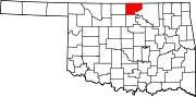
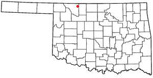
Grant County is a county located on the northern border of the U.S. state of Oklahoma. As of the 2020 census, the population was 4,169. Its county seat is Medford. Originally designated as part of the Cherokee Outlet, it was named County L in Oklahoma Territory at the time of its opening to non-Indian settlement. A county election renamed it for U.S. President Ulysses S. Grant.

Gibbs is a village in Wilson Township, Adair County, Missouri, United States. The population was 107 at the 2010 census.

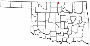
Fairmont is a town in Garfield County, Oklahoma, United States. The population was 134 at the 2010 census, a decrease from 147 at the 2000 census.
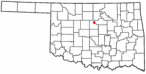
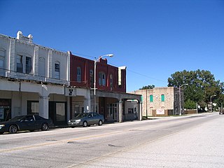
Medford is a city in and the county seat of Grant County, Oklahoma, United States. As of the 2010 census, the city population was 996.

Blackwell is a city in Kay County, Oklahoma, United States, located at the intersection of U.S. Highway 177 and State Highway 11 along Interstate 35. The population was 7,092 at the 2010 census and 6,085 in the 2020 Census. Blackwell was established following the September 16, 1893 Cherokee Outlet land run by A. J. Blackwell. Blackwell has an agricultural and fossil fuel based economy.
Braman is a town in Kay County, Oklahoma, United States. The population was 217 at the 2010 census, a decline of 11.1 percent from the figure of 244 in 2000.

Newkirk is a city and county seat of Kay County, Oklahoma, United States. The population was 2,172 at the 2020 census.

Coyle is a town in Logan County, Oklahoma, United States. The population was 325 at the 2010 census, compared to the figure of 337 in 2000. It is part of the Oklahoma City metropolitan area. The town was named for William Coyle, an influential Guthrie business man.

Marshall is a rural town in Logan County, Oklahoma, United States, and is an outer suburb/exurb on the northern edge of the Oklahoma City Metropolitan Statistical Area. The population was 278 at the 2010 census, a 5.7 percent increase from the figure of 258 in 2000. Sperling Bestplaces lists the Marshall population at 580.
Mulhall is a town in Logan (mostly) and Payne counties in Oklahoma, United States. The population was 225 at the 2010 census, down 5.9 percent from the figure of 239 in 2000. It is part of the Oklahoma City Metropolitan Statistical Area.

Marland is a town in Noble County, Oklahoma, United States. The population was 225 at the 2010 census. It was named for Ernest W. Marland, an oilman from nearby Ponca City who later became a governor of Oklahoma. Marland is on SH-156, south-southwest of Ponca City.
Afton is a town in northeast Oklahoma in Ottawa County, Oklahoma, United States. The population was 1,049 as of the 2010 census, with population growth stemming from the near abandonment of nearby towns of Cardin and Picher because of ground contamination sites by local mining quarries. The town may have been named for the Scottish River Afton.

Avard was a town in Woods County, Oklahoma, United States. The town is southwest of Alva, and northeast of Waynoka. The population was 26 at the 2000 census. After initial growth Avard began declining in the 1930s. Avard had a post office from June 1, 1895, until November 22, 1963. As of the 2010 census, Avard was listed as disincorporated.
Capron is a town in Woods County, Oklahoma, United States. The population was 23 at the 2010 census, declining by almost half from 2000 when it had 42 persons.

Blanchard is a city in McClain and Grady counties in the U.S. state of Oklahoma. The population was 8,879 at the 2020 census, up from 7,670 at the 2010 census. Blanchard is part of a rapidly growing area of northern McClain and Grady counties known as the "Tri-City Area" with Newcastle and Tuttle.

Ponca City is a city in Kay County in the U.S. state of Oklahoma. The city was named after the Ponca tribe. Ponca City had a population of 25,387 at the time of the 2010 census- and a population of 24,424 in the 2020 census.
Dooley is a ghost town in northeastern Sheridan County, Montana, United States. The town was established as a station stop and one of the first four depots along the Soo Line Railroad branch line to Whitehall.
Numa was a farming community that was established early on in what was then "L" County in the Oklahoma Territory. This area was part of the Cherokee Strip Outlet which was opened for settlement on September 16, 1893. It is located in modern-day Grant County, between Medford and Deer Creek. It was located seven miles east and one-half mile south of Medford. It was located along the Gulf Railroad that connected the towns of Manchester, Wakita, Medford, and Deer Creek. The Numa Post Office was established on April 20, 1898. Numa had amenities such as a community hall, granary, weigh station, and a rail spur. Many members of the settler community made the run from Caldwell, Kansas and continued their relationships with contacts from that entry point.
The Hutchinson and Southern Railway was incorporated under the general laws of the State of Kansas on December 21, 1897. On January 21, 1898 it acquired at foreclosure the assets of the Hutchinson and Southern Railroad Company, which had built 90.7 miles of trackage from Hutchinson, Kansas south through Kingman, Kansas and Anthony, Kansas to terminate at Wakita, Oklahoma. In the 1898-1899 timeframe, it also acquired all the assets of the Gulf Railroad Company, which had built 36.7 miles of track from Wakita to Blackwell, Oklahoma.
Dilworth was one of the many oil boomtowns created in Kay County, Oklahoma during the early part of the 20th Century. It was located about 10.5 miles northwest of Newkirk, the county seat, or about 14 miles by present-day roads. While it is now designated a Populated Place, it is considered a ghost town.