Santo Tirso is a city and municipality located in the north of Porto Metropolitan Area, 25 km from central Porto, Portugal. In the region, the Ave Valley, there is a large center of textile industry. The population in 2021 was 67,709, in an area of 136.60 square kilometres (52.74 sq mi).

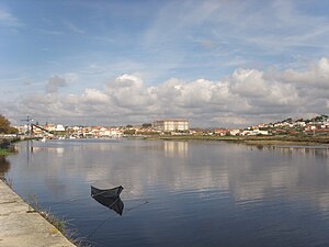
Vila do Conde is a municipality in the Norte Region of Portugal. The population in 2011 was 79,533, in an area of 149.03 km2. The urbanized area of Vila do Conde, which includes the parishes of Vila do Conde, Azurara and Árvore, represent 36,137 inhabitants. Vila do Conde is interlinked to the north with Póvoa de Varzim, forming a single urban agglomeration which is a part of the Porto Metropolitan Area. The town is on the Portuguese Way of the Camino de Santiago.
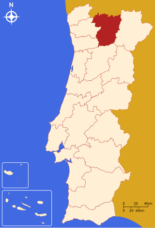
The District of Vila Real is a district of northern Portugal. With an area of 4,239 km2 (1,637 sq mi), the district is located east of the port city of Porto and north of the Douro River. Vila Real has always belonged to the historical province of Trás-os-Montes. Approximate population in the 2001 census was 230,000. The population has shown negative rates in recent years due to emigration and aging. Many of the villages have lost population and have become deserted while the district capital has gained in population. It is bordered by Spain (Galicia) in the north and east, Braga District and Porto District in the west, Viseu District in the south and Bragança District in the east.
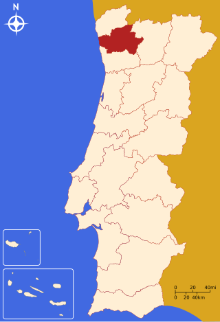
The district of Braga is a district in the northwest of Portugal. The district capital is the city of Braga, and it is bordered by the district of Viana do Castelo in the north, Vila Real in the east, Galicia in the northeast and Porto in the south. Its area is 2,673 km2 (1,032 sq mi) and it has a population of 831,368. It takes it name from the Bracarii, a Celtic tribe.

The North Region or Northern Portugal is the most populous region in Portugal, ahead of Lisbon, and the third most extensive by area. The region has 3,576,205 inhabitants according to the 2017 census, and its area is 21,278 kilometres (13,222 mi) with a density of 173 inhabitants per square kilometre. It is one of five regions of Mainland Portugal. Its main population center is the urban area of Porto, with about one million inhabitants; it includes a larger political metropolitan region with 1.8 million, and an urban-metropolitan agglomeration with 2.99 million inhabitants, including Porto and neighboring cities, such as Braga, Guimarães and Póvoa de Varzim. The Commission of Regional Coordination of the North (CCDR-N) is the agency that coordinates environmental policies, land-use planning, cities and the overall development of this region, supporting local governments and associations.

Entre Douro e Minho is one of the historical provinces of Portugal which encompassed the country's northern Atlantic seaboard between the Douro and Minho rivers. Contemporaries often referred to the province as simply "Minho". It was one of six provinces Portugal was commonly divided into from the early modern period until 1936, although these provinces were not recognized as official units of government.
Estádio do Rio Ave FC, also known as Estadio dos Arcos, is a multi-use stadium in Vila do Conde, Portugal. It is used mostly for football matches of Primeira Liga club Rio Ave. The stadium is able to hold 12,815 people and was built in 1985.
Grande Porto or Greater Porto is a former Portuguese NUTS3 subregion, integrating the NUTS2 region of Norte, in Portugal. It was abolished at the January 2015 NUTS 3 revision.

Póvoa de Varzim, with an area of 82.06 square kilometres, lies between the Cávado and Ave Rivers, or, from a wider perspective, halfway between the Minho and Douro Rivers on the northern coast of Portugal. Although in administrative reforms of 1936, the city was integrated in Douro Litoral, the case for such an administrative integration is arguable, because Póvoa de Varzim is found in a transition region. It has characteristic Minho traditions, historical and demographic bounds with several towns and villages in the region, religiously it is part of Braga archdiocese, and due to that it is perhaps preferable to recognize Póvoa as part of the old region, favouring more Entre-Douro-e-Minho, given its central geographic position in this region.

Beiriz is a suburban area in Póvoa de Varzim, Portugal. It is an ancient ecclesiastical parish and former civil parish. In the census of 2001, it had a population of 3,229 inhabitants and a total area of 4.31 km2. A 2012 law merged the parish with neighbouring Póvoa de Varzim (parish) and Argivai, becoming the southern parish of the city of Póvoa de Varzim, known as União das Freguesias da Póvoa de Varzim, Beiriz e Argivai.

Bairro Sul, literally the South Neighborhood, also known as Lapa, is the fishery district of the city of Póvoa de Varzim in Portugal. It is one of the six traditional neighborhoods of Póvoa de Varzim and one of the eleven parts in which the city is subdivided. The quarter is situated south of Póvoa de Varzim City Center. It has green and white as neighborhood colors and Lancha Poveira as symbol, also the icon of the city.

Amorim is a suburban area in Póvoa de Varzim, Portugal. It is an ancient ecclesiastical parish and former civil parish. It is bordered by Aver-o-Mar to the west and by Terroso to the east. In the census of 2001, it had a population of 2,856 inhabitants and a total area of 5.65 km2. In 2013, it was amalgamated in the civil parish known as União das Freguesias de Aver-o-Mar, Amorim e Terroso.

The Cávado River is a river located in northern Portugal.

The Ceira River is a river in central Portugal arising out of the Serra do Açor. It is a lefthand tributary of the Mondego River, which it enters from the south, just upstream of the city of Coimbra.

Guimarães is a city and municipality located in northern Portugal, in the district of Braga. Its historic town centre has been listed as a UNESCO World Heritage Site since 2001, in recognition for being an "exceptionally well-preserved and authentic example of the evolution of a medieval settlement into a modern town" in Europe. The Nicolinas are the city's main festivities.

Vizela River is a river in Portugal. It flows into Ave River and it is named after the city of Vizela.

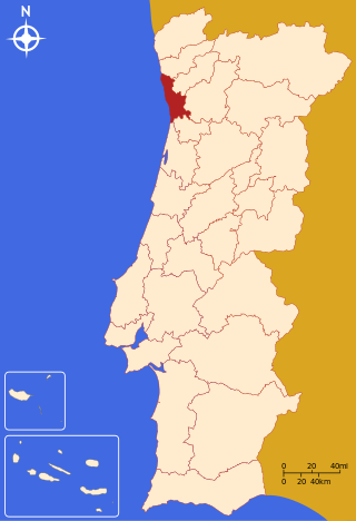
The District of Porto is located on the north-west coast of Portugal. The district capital is the city of Porto, the second largest city in the country. It is bordered by the Aveiro and Viseu districts to the south, Braga district to the north and Vila Real district to the east.

Arcos is a former civil parish in the municipality of Vila do Conde, Portugal. In 2013, the parish merged into Rio Mau e Arcos, a newer parish. In 2011 the population was 819 in an area of 5.81 km2. It is situated on the Ave River near the north-eastern frontier with the municipality of Barcelos, and resides in the shadow of its larger municipal neighbor.
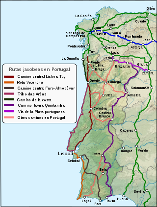
The Portuguese Way is the name of the Camino de Santiago pilgrimage routes starting in Portugal. It begins at Porto or Lisbon. From Porto, along the Douro River, pilgrims travel north crossing the five main rivers—the Ave, Cávado, Neiva, Lima and Minho—before entering Spain and passing through Pontevedra on the way to Santiago de Compostela.
The 2022–23 season is the 84th in the history of Rio Ave F.C. and their second consecutive season in the top flight. The club will participate in the Primeira Liga, the Taça de Portugal, and the Taça da Liga.