
Lake Marble Falls is a reservoir on the Colorado River in the Texas Hill Country in the United States. The reservoir was formed in 1951 by the construction of Max Starcke Dam by the Lower Colorado River Authority. Originally named Marble Falls Dam, the dam was renamed in 1962 for Max Starcke, the second general director of the LCRA. Located near the town of Marble Falls, the lake is used as a venue for aquatic recreation and for the purpose of generating hydroelectric power. It is the newest and smallest of the Texas Highland Lakes.
Lake Fork Reservoir is a reservoir located in Wood, Rains, and Hopkins counties in the state of Texas, between the towns of Quitman, Alba, Emory, and Yantis, Texas.

Amistad Reservoir is a reservoir on the Rio Grande at its confluence with the Devils River 12 miles (19 km) northwest of Del Rio, Texas. The lake is bounded by Val Verde County on the United States side of the international border and by the state of Coahuila on the Mexican side of the border; the American shoreline forms the Amistad National Recreation Area. The reservoir was formed in 1969 by the construction of Amistad Dam. The dam and lake are managed jointly by the governments of the United States and Mexico through the International Boundary and Water Commission. The name of the dam and lake is the Spanish word for "friendship". The reservoir is also known as Lake Amistad.

Inks Lake State Park is a state park located in Burnet County, Texas, United States, next to Inks Lake on the Colorado River. The landscape of the park is hilly, with many cedar, live oak, prickly pear cacti, and yuccas. The ground is rocky, mainly consisting of gneiss rock.

Lake Ouachita is a reservoir created by the damming of the Ouachita River by Blakely Mountain Dam.

The DeGray Dam project, encompassing flood-control, power, and water-supply features is located in northern Clark County, Arkansas on the Caddo River approximately eight miles above its confluence with the Ouchita River. The project plan for DeGray Lake included the construction of the DeGray Dam with a height of 240 feet above the Caddo River, a dike that splits the Caddo River and Bayou de Roche, an outlet works, an uncontrolled spillway, and a powerhouse.

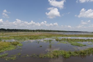
Choke Canyon Reservoir is a reservoir in South Texas, United States. The lake and the dam that creates it are owned by the United States Bureau of Reclamation and managed by the City of Corpus Christi.

Big Hill Lake is a body of water in Labette County, Kansas, United States. It is located 3.5 miles (5.6 km) east of Cherryvale and 9.5 miles (15.3 km) southwest of Parsons. The reservoir holds 1,240 acres (5.0 km²) of water, with 367 acres (1.49 km2) available for public use. Fishing, picnicking, boating, and a sandy beach swimming area are popular activities. The lake is operated by the U.S. Army Corps of Engineers.

Lake Bastrop is a reservoir on Spicer Creek in the Colorado River basin 3 miles (5 km) northeast of the town of Bastrop in central Bastrop County, Texas, United States. The reservoir was formed in 1964 by the construction of a dam by the Lower Colorado River Authority. The lake serves primarily as a power plant cooling pond for the Sim Gideon Power Plant operated by the LCRA and the Lost Pines Power Project 1, owned by GenTex Power Corporation, a wholly owned affiliate of the LCRA. Lake Bastrop also serves as a venue for outdoor recreation, including fishing, boating, swimming, camping and picnicking, and is maintained at a constant level year round.

Lake Gonzales is a reservoir on the Guadalupe River 4 miles (6 km) southeast of the town of Belmont in Gonzales County, Texas. The reservoir was formed in 1931 by the construction of a dam to provide hydroelectric power to the area. Management of the dam and lake was assume by the Guadalupe-Blanco River Authority on May 1, 1963. Lake Gonzales also serves as a venue for outdoor recreation, including fishing, boating, swimming, camping and picnicking, and is maintained at a constant level year round.
Lake Placid is a reservoir on the Guadalupe River one-half mile (0.80 km) southwest of the town of Seguin in Guadalupe County, Texas. The reservoir was formed in 1928 by the construction of a dam on the river. Management of the dam and lake was assumed by the Guadalupe-Blanco River Authority on May 1, 1963. Lake Placid is a venue for outdoor recreation, including fishing, boating, and swimming.
Lake Wood was a reservoir on the Guadalupe River 4 miles (6 km) west of the town of Gonzales in Gonzales County, Texas. The reservoir was formed in 1931 by the construction of a dam to provide hydroelectric power to the area. Management of the dam and lake was assumed by the Guadalupe-Blanco River Authority on May 1, 1963. Lake Wood served as a venue for outdoor recreation, including fishing and boating.
Coleto Creek Reservoir is a reservoir on Coleto Creek and Perdido Creek located in Fannin, Texas, 15 miles (24 km) southwest of Victoria, Texas. The surface of the lake extends into Victoria and Goliad counties. The reservoir was formed in 1980 by the construction of a dam by the Guadalupe-Blanco River Authority to provide a power station cooling pond for electric power generation. Coleto Creek Reservoir is a venue for outdoor recreation, including fishing and boating.
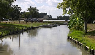
Lake Corpus Christi is a reservoir in coastal southern Texas. The lake was created by impoundment of the Nueces River by the Wesley E. Seale Dam opened in 1958. The lake and the dam that creates it are managed by the City of Corpus Christi. Lake Corpus Christi was originally known as Lake Lovenskiold. It is often referred to as Lake Mathis because of its location.

Lavon Lake is a freshwater reservoir located in southeast Collin County, Texas, on the East Fork of the Trinity River near Wylie, off State Highway 78. It is commonly called Lake Lavon for commercial and recreational purposes, but Lavon Lake is its official name according to the U.S. Army Corps of Engineers. It was originally called Lavon Reservoir.

Spruce Run Recreation Area is a 1,290-acre (5.2 km2) New Jersey state recreation area located in Union Township and Clinton Township in Hunterdon County, New Jersey, United States. It encompasses the Spruce Run Reservoir that is used as a backup reservoir to protect the state from prolonged droughts. The reservoir is the third largest in the state, after Round Valley and Wanaque Reservoir. The reservoir is used for recreation purposes, including hunting, fishing, boating and swimming.

Aquilla Lake is an artificial lake (reservoir) in Hill County, Texas, USA. The dam was constructed by the U.S. Army Corps of Engineers. The dam is part of the overall flood control project in the Brazos River basin. The lake is located approximately 23 miles (37 km) north of Waco, Texas.

Sherman Dam is an earthen dam near Loup City, in the central part of the state of Nebraska in the Midwestern United States. It was constructed in 1961 by the United States Bureau of Reclamation. It has a height of 134 feet (41 m) and a length of 1,912 feet (583 m) at its crest. It impounds Oak Creek. The dam was originally constructed for flood control and irrigation, but is now owned and operated by the local Farwell Irrigation District and the Loup Basin Reclamation District.

Jim Chapman Dam is a dam in Delta County and Hopkins County, Texas, United States.

Lake Alan Henry is a reservoir situated in the upper Brazos River Basin in the United States. Created by the construction of the John T. Montford Dam in 1993, it is operated and used as a future tertiary water supply by the city of Lubbock, Texas and serves as a recreational spot for the region of West Texas. The surface area of the lake is 2,880 acres (1,170 ha) with a mean depth of 40 ft (12 m). Lake Alan Henry is located 4 mi (6.4 km) east of Justiceburg, Texas, and 45 mi (72 km) south of Lubbock.

