Apeldoorn is a municipality and city in the province of Gelderland in the centre of the Netherlands. The municipality of Apeldoorn, including the of villages of Beekbergen, Loenen, Ugchelen and Hoenderloo, had a population of 165,525 on 1 December 2021. The western half of the municipality lies on the Veluwe ridge, with the eastern half in the IJssel valley.

Hilvarenbeek is a municipality and a town in the south of the Netherlands, along the border with Belgium.

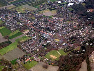
Buitenpost is a village in north-east Friesland in the Netherlands.

De Adriaan is a windmill in the Netherlands that burnt down in 1932 and was rebuilt in 2002. The original windmill dates from 1779 and the mill has been a distinctive part of the skyline of Haarlem for centuries.
Vessem is a village in the southern Netherlands. It is located in the municipality of Eersel, North Brabant. Cultural attractions include the Jacobusmolen windmill and several galleries.

Almkerk is a village in the municipality of Altena, in the Netherlands. It is located about 7 km south of Gorinchem.

Diessen is a village in the Dutch province of North Brabant. It is located in the municipality of Hilvarenbeek.

Moergestel is a village in the Dutch province of North Brabant. It is located in the municipality of Oisterwijk, about 7 km East of Tilburg.
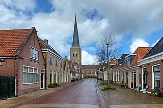
Tzum is a village in Waadhoeke municipality in the province of Friesland, the Netherlands. It had a population of around 1,164 in January 2014. Tzum is known for its 72 metre tall church tower.
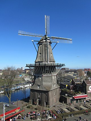
De Gooyer is a windmill in Amsterdam located between Funenkade and Zeeburgerstraat. It is the tallest wooden mill in the Netherlands at 26.6 meters high. It is registered as a National Monument.
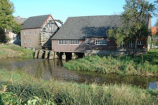
The Watermill at Opwetten is a watermill along the river Kleine Dommel, located on the Opwettenseweg 203 in Opwetten, Nuenen, Gerwen en Nederwetten, in the province of North Brabant, Netherlands. First mentioned in the 11th century, the watermill burned down and was rebuilt in 1764.

The Kinderdijk windmills are a group of 19 monumental windmills in the Alblasserwaard polder, in the province of South Holland, Netherlands. Most of the mills are part of the village of Kinderdijk in the municipality of Molenlanden, and one mill, De Blokker, is part of the municipality of Alblasserdam. Built in 1738 and 1740, to keep water out of the polder, it is the largest concentration of old windmills in the Netherlands and one of the best-known Dutch tourist sites. The mills are listed as national monuments and the entire area is a protected village view since 1993. They have been a UNESCO World Heritage Site since 1997, and as such are officially named as the Mill Network at Kinderdijk-Elshout.

De Olde Molen, also known as Old Dutch Windmill, The Mill, or Alte Mühle is a non-operational octagonal smock mill with a stage reconstructed in 1961 in Bubali, Aruba. Since then, it has been serving as a restaurant and a windmill museum.

Winschoterzijl is a former hamlet in the municipality of Oldambt in the northeast of the Netherlands. It was also a sconce, and is still a lock. The village was settled by Lutheran refugees from East Frisia during the Thirty Years' War (1618–1648). In 1992, Winschoterzijl was demolished during the widening of the Pekel A.

Windesheim is a village in the municipality of Zwolle in the province of Overijssel, Netherlands. The Congregation of Windesheim was located in Windesheim from 1387 until 1577.
Hoonhorst is a village in the municipality of Dalfsen in the province of Overijssel, Netherlands. It is a Catholic enclave in a Protestant area. It located about 9 kilometres (5.6 mi) east of Zwolle.
Niebert is a village in the municipality of Westerkwartier in the province of Groningen in the Netherlands. As of 2021, it had a population of 745.
Nuis is a village in the municipality of Westerkwartier in the province of Groningen in the Netherlands. As of 2021, it had a population of 670.

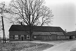
Baarschot is a hamlet in the municipality of Deurne in the province of North Brabant in the Netherlands.

Dyksterhuzen is a hamlet in the Dutch municipality of Waadhoeke in the province of Friesland. It is located northwest of Ingelum and east of Bitgummole, of which it is a part administratively. The settlement of the hamlet is located on the eponymous road, Dyksterhuzen. The residences are both houses and farms. The N398, a trunk road, forms the division between the hamlet and the village of Bitgummole.