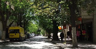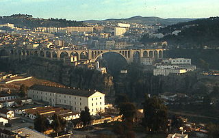
Constantine, also spelled Qacentina or Kasantina, is the capital of Constantine Province in northeastern Algeria. During Roman times it was called Cirta and was renamed "Constantina" in honour of Emperor Constantine the Great. Located somewhat inland, Constantine is about 80 kilometres from the Mediterranean coast, on the banks of the Rhumel River.

Blida is a city in Algeria. It is the capital of Blida Province, and it is located about 45 km south-west of Algiers, the national capital. The name Blida, i.e. bulaydah, is a diminutive of the Arabic word belda, city.

Biskra is a province (wilaya) of Algeria. Its capital is Biskra. It is located on the northern edge of the Algerian Sahara, south of the Atlas Mountains.

El Kantara is a town and commune in Biskra Province, Algeria. The 1911 Baedeker travel guide described it as "one of the most important caravan-stations in E. Algeria." The town is well known for the eponymous gorge nearby, described by locals as the "Mouth of the Desert".

Aïn Beïda is a city and municipality (baladiyah) located in Oum El Bouaghi Province, Algeria, south east of Constantine and north of Khenchla, inhabited by Chaouis and Arabs. In 1998 its population was 88,300.

Djamaa el Kebir, also known as the Great Mosque of Algiers, is a historic mosque in Algiers, Algeria. It is located within the Casbah, near the city's harbor. Dating to 1097, it is one of the few remaining examples of Almoravid architecture, although it has undergone other additions and reconstructions since its foundation. It is the oldest mosque in Algiers and is said to be one of the oldest mosques in Algeria after Sidi Okba Mosque and Sidi Ghanem Mosque.

The Medina of Tunis is the medina quarter of Tunis, the capital of Tunisia. It has been a UNESCO World Heritage Site since 1979.

The Elster Viaduct is a railway bridge in the German state of Saxony. It carries the Leipzig–Hof line near Jocketa over the valley of the White Elster. After the Göltzsch Viaduct (Göltzschtalbrücke) it is the second largest brick bridge in the world. The Elster Valley Railway passes under the 68 metre-high bridge.

The Kingdom of the Ait Abbas or Sultanate of the Beni Abbas was a Kabyle, Berber state of North Africa, then a fief and a principality, controlling Lesser Kabylie and its surroundings from the sixteenth century to the nineteenth century. It is referred to in the Spanish historiography as "reino de Labes"; sometimes more commonly referred to by its ruling family, the Mokrani, in Berber At Muqran. Its capital was the Kalâa of Ait Abbas, an impregnable citadel in the Biban mountain range.

Sidi M'Cid Bridge is a 164-metre-long (538 ft) suspension bridge across the Rhumel River in Constantine, Algeria. It was opened to traffic in April 1912 and until 1929 was the highest bridge in the world at 175 m (574 ft). The bridge was designed by French engineer Ferdinand Arnodin and links the Casbah to Sidi M'Cid hill. The bridge underwent restoration in 2000 when 12 of its cables were replaced by the Algerian company SAPTA.

The Salah Bey Mosque is a mosque in Annaba, Algeria. It was built between 1791 and 1792.

The Salah Bey Viaduct, is a cable-stayed bridge that spans the gorge valley of the Rhumel River in Constantine, North East Algeria is named after Salah Bey whose rule of the city (1771-1797) was marked by major urban works, This viaduct is already considered the "eighth wonder" of the city with seven bridges. With a length of 1119m, the viaduct has a futuristic design, which modernized the urban configuration of the city.

Salah Bey ben Mostefa, was the bey of the Beylik of Constantine in the Deylik of Algiers from 1771 to 1792, and one of the most famous in the province. Salah Bey's governance is marked by a victorious participation against the Invasion of Algiers (1775) during the Spanish-Algerian war (1775-1785) and his works of urban planning in Constantine. An example of remaining construction from his era is Bab El Kantra Bridge.

The Sidi Rached Viaduct, The Sidi Rached bridge is a road viaduct that crosses the Rhummel gorges and connects the Coudiat district to Constantine Train station. It was built in Constantine in French Algeria, between 1908 and 1912, by the engineer Aubin Eyraud, with the help of Paul Séjourné who designed the hangers and finished the construction. It was the tallest Concrete bridge in the world when it was built until.

The architecture of Algeria encompasses a diverse history influenced by a number of internal and external forces, including the Roman Empire, Muslim conquest of the Maghreb, French colonization, and movements for Algerian independence.

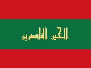
The Beylik of Constantine, Beylik of the Sunrise or Beylik of the East as was its official designation, was one of the three Beyliks of the Regency of Algiers . The region liberated itself from the Hafsid Emirate of Béjaïa in the early 16th century, and constituted itself around Constantine in the mid to late 16th century. The Beylik collapsed in the 1837 siege of Constantine during the French conquest of Algeria. The Constantine department was formed upon the bases of the Beylik in 1848.

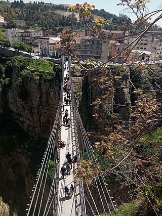
Mellah Slimane Bridge is a 125 m long suspension Footbridge across the Rhumel River in Constantine, Algeria. It was opened in April 1925 and until it was the 3rd highest bridge in the world at 110 m. The bridge was designed by Ferdinand Arnodin and links Larbi Ben M'hidi Larbi Street to Romania Road which means it connects the train station neighbourhood to the centre of the old town, this connection is via a staircase, or the Merdersa lift. It is located halfway between Sidi Rached bridge and Bab El Kantra Bridge. The bridge underwent restoration in 2000 when its cables were replaced by the Algerian company SAPTA.
The Great Mosque of Constantine, or Djamâa El Kebir is a mosque located in Constantine, Algeria.


