
The 1947 Atlantic hurricane season was the first Atlantic hurricane season to have tropical storms labeled by the United States Air Force. The season officially began on June 16, 1947, and ended on November 1, 1947. These dates conventionally delimit the period of each year when most tropical cyclones form in the Atlantic basin. However, the first tropical cyclone developed on June 13, while the final system was absorbed by a cold front on December 1. There were 10 tropical storms; 5 of them attained hurricane status, while two became major hurricanes, which are Category 3 or higher on the modern day Saffir–Simpson scale. Operationally, the third tropical storm was considered two separate tropical cyclones, resulting in the storm receiving two names. The eighth tropical storm went undetected and was not listed in HURDAT until 2014.
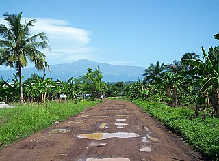
Tiko, originally called ‘Keka’ by the Bakweris, is a town and important port in the southwest region of Cameroon. The settlement grew as a market town for Duala fishermen, Bakweri farmers and hunters from Molyko, Bwenga, Bulu and Bokova. The core quarters in Tiko include Streets 1 to 7, Motombolombo, Down Beach, New Quarter, P&T quarters, New Layout, Long Street, Likomba, Golf Club, Mutengene, Ombe. As of 2010, the town is estimated to have a population of 55,914.

The 1903 Atlantic hurricane season featured seven hurricanes, the most in a season since 1893. The first tropical cyclone was initially observed in the western Atlantic Ocean near Puerto Rico on July 21. The tenth and final system transitioned into an extratropical cyclone well northwest of the Azores on November 25. These dates fall within the period with the most tropical cyclone activity in the Atlantic. Six of the ten tropical cyclones existed simultaneously.
Alexander Wallace Dreyfoos Jr. is an American entrepreneur and philanthropist based in West Palm Beach, Florida, and Saranac Lake, New York. He is the only son of cellist Martha Bullard Whittemore Dreyfoos (1898–1977) and photographer-inventor Alexander W. Dreyfoos Sr. (1876–1951) of Apeda Studios.

The Serra do Divisor National Park is a 8,463 km2 (3,268 sq mi) national park on the westernmost point of Brazil, in the state of Acre, near the Peruvian border. It also has the highest point in that state, reaching 609 meters above sea level. It has been nominated by the Brazilian government as a Tentative World Heritage Site since 1998.

Guaporé Biological Reserve (Portuguese: Reserva Biológica do Guaporé is a biological reserve in the state of Rondônia, Brazil, on the border with Bolivia.
The 1903 Florida hurricane was an Atlantic hurricane that caused extensive wind and flood damage on the Florida peninsula and over the adjourning Southeastern United States in early to mid September 1903. The third tropical cyclone and third hurricane of the season, this storm was first observed near Mayaguana island in the Bahamas early on September 9. Moving northwestward, it became a hurricane the next day and passed near Nassau. The cyclone then turned to the west-northwest on September 11 and passed just north of the Bimini Islands. As it crossed the Bahamas, the cyclone produced hurricane-force winds that caused damage to crops and buildings, but no deaths were reported over the island chain.
After an isolated presence in the late 1920s, the Baháʼí Faith in Nigeria begins with pioneering Baháʼís coming to Sub-Saharan West Africa in the 1950s especially following the efforts of Enoch Olinga who directly and indirectly affected the growth of the religion in Nigeria. Following growth across West Africa a regional National Spiritual Assembly was elected in 1956. As the community multiplied across cities and became diverse in its engagements, it elected its own National Spiritual Assembly by 1979. Estimates of membership vary widely - a 2001 estimate by Operation World showed 1000 Baháʼís in 2001 while the Association of Religion Data Archives estimated some 38,000 Baháʼís in 2005.

The effects of Hurricane Georges in Florida lasted for more than a week in late September and early October in 1998. After developing from a tropical wave to the south of Cape Verde on September 15, Georges moved steadily west-northwestward and peaked as a strong Category 4 hurricane on the Saffir–Simpson scale on September 20. After weakening slightly to a Category 3, the cyclone proceeded to strike Antigua, Saint Kitts and Nevis, Puerto Rico, Dominican Republic, and Cuba. Georges emerged into the Straits of Florida as a Category 1, but re-strengthened slightly to a Category 2 before making landfall in Key West, Florida, on September 25. The hurricane continued northwestward into the Gulf of Mexico and struck near Biloxi, Mississippi, on September 28. After moving inland, Georges turned eastward and crossing into the Florida Panhandle on the next day. By October 1, the system dissipated near the northeast Florida–southeast Georgia coast.
Ndu is a town and commune in Donga-Mantung, a department of the Northwest Region of Cameroon. It lies at the northeast edge of the Bamenda Grassfields, on the eastern arc of the Ring Road. It is the highest elevation town in Cameroon.

Typhoon Ruby, known in the Philippines as Typhoon Unsang, was the strongest typhoon to strike the Philippines in 18 years. The tenth typhoon of the 1988 Pacific typhoon season, Ruby formed from an area of low pressure situated east of the Philippines on October 20. The storm steadily intensified as it moved west, and then west-northwest. After developing an eye, Ruby attained typhoon intensity on October 23 and began to strengthen at a brisker clip. Ruby reached maximum intensity later that day, before moving ashore along the central portion of Luzon early on October 24. The storm steadily weakened over land and this trend only continued after Ruby entered the South China Sea. On October 27, Ruby made a second landfall as a tropical storm on Hainan Island before dissipating the next day.

Hurricane Eugene was the only tropical cyclone to make landfall in Mexico during the 1987 Pacific hurricane season. The eighth tropical cyclone, fifth named storm, and first hurricane of the season, Eugene developed on July 22 from a tropical disturbance centered well offshore of Mexico. Later that day, the system intensified into a tropical storm while moving northwestward. Eugene reached hurricane status on July 24; it briefly peaked as a Category 2 hurricane the next day. Hurricane Eugene weakened back to a Category 1 hurricane; subsequently, the hurricane made landfall near Manzanillo. Shortly after landfall, Eugene rapidly weakened inland, and was only a tropical storm when it re-emerged into open water, where it quickly dissipated. Throughout southwestern Mexico, the storm produced high winds, especially in the southwestern portion of the country. The hurricane deluged the southwest Mexican coastline, resulting in the highest rainfall totals from a tropical cyclone in five Mexican states. Over 5,000 people were left homeless, including 60 in Manzanillo. The city's airport control tower was also damaged, requiring closure. Elsewhere, 200 to 300 houses were destroyed in Colima. In all, Eugene injured 18 people, and caused three fatalities and $142.12 million (1987 USD) in damage.

The Effects of Hurricane Isaac in Florida were severe local flooding in South Florida and tornadoes in the central and northern portions of the state in August 2012. Hurricane Isaac formed from a tropical wave while located east of the Lesser Antilles on August 21, 2012. The storm moved westward, crossed through the Leeward Islands, and entered the Caribbean Sea on August 22. Isaac initially struggled to intensify and defied predictions of it strengthening into a hurricane. The storm made its first landfall in Haiti as a midgrade tropical storm prior to making a second one in Cuba later that day. It remained somewhat disorganized while moving through the Straits of Florida and passed near the Florida Keys on August 27. The storm threatened to strike the Tampa Bay Area during the 2012 Republican National Convention and move ashore in the Florida Panhandle as a major hurricane. However, it continued northwestward and avoided landfall in the state. The storm finally became a hurricane late on August 28. Isaac made two landfalls in Louisiana on August 29, the first near the mouth of the Mississippi River and the other near Port Fourchon. The storm steadily weakened and eventually dissipated over Missouri on September 1.

The effects of the 1928 Okeechobee hurricane in Florida included at least 2,500 fatalities in the state of Florida, making this the second deadliest tropical cyclone in the history of the contiguous United States, behind only the 1900 Galveston hurricane. The hurricane originated from a tropical depression that formed near Dakar, Senegal, on September 6. Traversing the Atlantic Ocean, the cyclone struck the Lesser Antilles, Puerto Rico, and the Bahamas as a powerful hurricane. Early on September 17, the storm made landfall near West Palm Beach, Florida, as a Category 4 hurricane on the modern day Saffir–Simpson hurricane wind scale. Thereafter, it moved further inland across the Southeastern United States and became extratropical over North Carolina on September 20, before the remnants lost their identity over Ontario on September 21.

Bambalang is a village located in the NorthWest Region of Cameroon. The village of Bambalang is one of the four villages that make up Ndop Central Sub Division and one of the thirteen villages that make up Ngoketunjia Division. Bambalang village saw most of its fertile land flooded upon the completion of the Bamendjin Dam in 1974 giving rise to some Islands like Mbissa, Nkeshie, Mbefekhu, Mishie and Mpayah. The Bamendjin Dam was constructed mainly to serve as a reservoir to feed the hydroelectric plant at Edéa. It was constructed across the Noun River, a tributary of the Sanaga River that operates the hydroelectric plant at Edea. The construction of this dam has served as a source of mixed feelings for Bambalang people because while those whose fertile land were flooded look at it as a mishap, it is beneficial to a cross section of the population given that it is contributing enormously to the economy of the village with thousands of fishermen whose lives and that of their families depend on fish gotten from the water. The vegetation is Guinea Savanna as farming has destroyed most forests with the exception of the "Pa’ah Ngwong" Forest at the heart of the village. Bambalang village is mainly a hillock stretching in a North West, South-East direction. It is narrow at the North-West and broadens towards the South East, appearing as a semi-Island or a promontory. Bambalang has a length of about 21 km and a width of about 8 km giving an area of about 168 km2 supporting a population of 20.863 people.

Babungo is one of the four villages of Babessi Sub Division, Ngoketunjia Division of the North West Region Cameroon. It is situated on the Ring Road from Bamenda about ten kilometers from Bamunka on the high plain of Ndop which is fertile and rich in water, intensely cultivated and surrounded by a ring of hills covered with pastures, making it an ideal grazing land.
Bamali village is one of the four villages that make up Ndop Central sub division and one of the thirteen villages of Ngoketunjia division of the North West region of Cameroon. Bamali village is located partly along the ring road from Bamenda some 40 km away from Bamenda town on the Bamenda-Nkambe stretch of the ring road just before reaching Bamunka.
Baba I village (Papiakum) is one of the four villages that make up Babessi subdivision and one of the thirteen villages of Ngoketunjia division of the North West region of Cameroon. Baba I village is located along the ring road from Bamenda some 50 km away from Bamenda town on the Bamenda-Nkambe stretch of the ring road just before one reaches Bamunka.

Hurricane Irma was the most expensive storm in the history of the U.S. state of Florida. Irma developed from a tropical wave near the Cape Verde Islands on August 30, 2017. The storm quickly became a hurricane on August 31 and then a major hurricane shortly thereafter, but would oscillate in intensity over the next few days. By September 4, Irma resumed strengthening, and became a powerful Category 5 hurricane on the following day. The cyclone then struck Saint Maarten and the British Virgin Islands on September 6 and later crossed Little Inagua in the Bahamas on September 8. Irma briefly weakened to a Category 4 hurricane, but re-intensified into a Category 5 hurricane before making landfall in the Sabana-Camagüey Archipelago of Cuba. After falling to Category 3 status due to land interaction, the storm re-strengthened into a Category 4 hurricane in the Straits of Florida. Irma struck Florida twice on September 10 – the first as a Category 4 at Cudjoe Key and the second on Marco Island as a Category 3. The hurricane weakened significantly over Florida, and was reduced to a tropical storm, before exiting the state into Georgia on September 11.

Costa Rica, officially the Republic of Costa Rica, is a country in Central America, bordered by Nicaragua to the north, the Caribbean to the northeast, Panama to the southeast, the Pacific Ocean to the southwest, and Ecuador to the south of Cocos Island. It has a population of around 5 million in a land area of 51,060 square kilometers. Hurricanes are uncommon in the country, as only eighteen have been recorded in history.
