
The Karakoram Highway, also known as the KKH, National Highway 35, N-35, and the China–Pakistan Friendship Highway, is a 1,300 km (810 mi) national highway which extends from Hasan Abdal in the Punjab province of Pakistan to the Khunjerab Pass in Gilgit-Baltistan, where it crosses into China and becomes China National Highway 314. The highway connects the Pakistani provinces of Punjab and Khyber Pakhtunkhwa plus Gilgit-Baltistan with China's Xinjiang Uyghur Autonomous Region. The highway is a popular tourist attraction and is one of the highest paved roads in the world, passing through the Karakoram mountain range, at 36°51′00″N75°25′40″E at maximum elevation of 4,714 m (15,466 ft) near Khunjerab Pass. Due to its high elevation and the difficult conditions under which it was constructed, it is often referred to as the Eighth Wonder of the World. The highway is also a part of the Asian Highway AH4.

Skardu is a city located in Pakistan-administered Gilgit-Baltistan in the disputed Kashmir region. Skardu serves as the capital of Skardu District and the Baltistan Division. It is situated at an average elevation of nearly 2,500 metres above sea level in the Skardu Valley, at the confluence of the Indus and Shigar rivers. It is an important gateway to the eight-thousanders of the nearby Karakoram mountain range. The Indus River running through the region separates the Karakoram from the Ladakh Range.

Northern Pakistan is a tourism region in northern and north-western parts of Pakistan, comprising the administrative units of Gilgit-Baltistan, Azad Kashmir, Khyber Pakhtunkhwa, Islamabad Capital Territory and the Rawalpindi Division in Punjab. The first two territories are a part of the wider Kashmir region. It is a mountainous region straddling the Himalayas, Karakoram and the Hindu Kush mountain ranges, containing many of the highest peaks in the world and some of the longest glaciers outside polar regions. Northern Pakistan accounts for a high level of Pakistan's tourism industry.

Saiful Muluk is a mountainous lake in northern Pakistan, located at the northern end of the Kaghan Valley, near the town of Naran in the Saiful Muluk National Park. At an elevation of 3,224 m above sea level, the lake is located above the tree line, and is one of the highest lakes in Pakistan.

Shandur Pass(Urdu: شندور) is a pass located on the boundary of district Chitral, Khyber Pakhtunkhwa, Pakistan and Gilgit-Baltistan, a disputed territory within the larger region of Kashmir. Historically part of Gilgit-Baltistan; however, recent Khyber Pakhtunkhwa governments have made claims for the Shandur. It is often referred to as 'The Roof of the World.

The Kaghan Valley is an alpine valley in Balakot Tehsil, Mansehra District of Khyber Pakhtunkhwa, Pakistan. The valley stretches 155 kilometres (96 mi) across northern Pakistan, rising from its lowest elevation of 650 m (2,134 ft) to its highest point at the Babusar Pass around 4,170 m (13,690 ft). Landslides triggered by the devastating 2005 Kashmir earthquake destroyed many passes leading into the valley, though roads have since been rebuilt. Kaghan is a popular tourist attraction in Pakistan.

Chilas is a city in Pakistani-administered Gilgit–Baltistan in the disputed Kashmir region. It is the divisional capital of Diamer Division and is located on the Indus River. It is part of the Silk Road, connected by the Karakoram Highway and N-90 National Highway to Islamabad and Peshawar in the southwest, via Hazara and Malakand divisions of Khyber Pakhtunkhwa. To the north, Chilas connects to the cities of Tashkurgan and Kashgar in Xinjiang, China, via Gilgit, Aliabad, Sust, and the Khunjerab Pass.
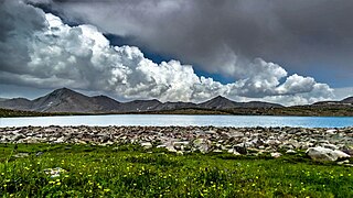
Diamer District, also spelled Diamir District,) is a district in the Gilgit-Baltistan region administered by Pakistan. The headquarters of the district is the town of Chilas. The district is bounded on the north by the Tangir and the Gilgit districts, on the east by the Astore District, on the south by the Mansehra district of Pakistan's Khyber Pakhtunkhwa Province and the Neelum District of Pakistan controlled Kashmir, and on the west by the Upper Kohistan District of Khyber Pakhtunkhwa Province. The Karakoram Highway passes through Diamer District.

Gilgit-Baltistan is an administrative territory of Pakistan in the northern part of the country. It was given self-governing status on August 29, 2009. Gilgit-Baltistan comprises 14 districts within three divisions. The four districts of Skardu Kharmang Shigar and Ghanche are in the Baltistan Division, four districts of Gilgit Ghizer Hunza and Nagar districts which were carved out of Gilgit District are in the Gilgit Division and the third division is Diamir, comprising Chilas and Astore. The main political centres are the towns of Gilgit and Skardu.
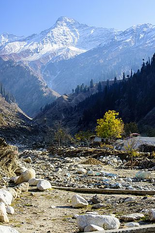
Malika Parbat is the highest peak in Kaghan Valley, Khyber Pakhtunkhwa, Pakistan. It is about 6 kilometres (3.7 mi) south of Lake Saiful Muluk, near Ansoo Lake.
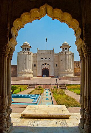
Tourism in Pakistan is a growing industry. In 2010, Lonely Planet termed Pakistan "tourism's 'next big thing'". The country is geographically and ethnically diverse, and has a number of historical and cultural heritage sites. Condé Nast Traveller ranked Pakistan The Best Holiday Destination for 2020 and also declared it the third-highest potential adventure destination in the world for 2020. As security in the country improves, tourism increases; in two years, it has increased by more than 300%.
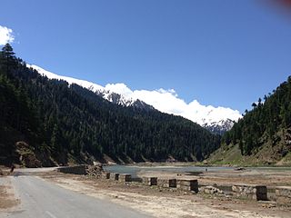
Naran is a town and popular tourist destination in the upper Kaghan Valley in the Mansehra District of the Khyber Pakhtunkhwa province of Pakistan. It is located 119 kilometers (74 mi) from Mansehra city at an altitude of 2,409 meters (7,904 ft). It is located about 65 kilometers (40 mi) away from Babusar Top. It is one of the most popular tourist attractions locally as well as internationally. Naran Valley is also Pakistan's most visited Valley, around 1.5 million people visit Naran Valley every year.

Gilgit-Baltistan, formerly known as the Northern Areas, is a region administered by Pakistan as an administrative territory and consists of the northern portion of the larger Kashmir region, which has been the subject of a dispute between India and Pakistan since 1947 and between India and China since 1959. It borders Azad Kashmir to the south, the province of Khyber Pakhtunkhwa to the west, the Wakhan Corridor of Afghanistan to the north, the Xinjiang region of China to the east and northeast, and the Indian-administered union territories of Jammu and Kashmir and Ladakh to the southeast.
The N–15 or National Highway 15 is a 240-kilometre-long national highway in Pakistan. It connects the city of Mansehra in Pakistan's Khyber Pakhtunkhwa province to the city of Chilas in the administrative territory of Gilgit–Baltistan. It is often used as a bypass for the Karakoram Highway (N–35) and is popular amongst tourists who visit Naran and its surrounding region.
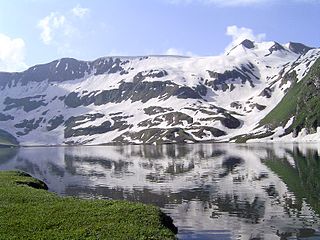
Lulusar-Dodipat National Park is located in the Kaghan Valley in Mansehra District of Khyber-Pakhtunkhwa, Pakistan. The park was created in 2003. The scenic Dudipatsar Lake and Lulusar Lake and peaks are in the park.

Safar Hai Shart is a travelogue television show on-air on Express News. The show was hosted by Waqar Ahmed Malik and Mukkaram Kaleem. Safar Hai Shart was an exclusive travelogue produced by Waqar Ahmed Malik, completed on nothing but motorbikes. Two guys on bikes explored the wonders of the Karakoram Highway in Pakistan. The Karakoram Highway (KKH) is the highest paved international road in the world and often known as 9th wonder of the world. The travels started from Rawalpindi and end on Khunjerab Pass, the highest paved international border crossing in the world and the highest point on the Karakoram Highway. The show comprises the adventure, thrill and depiction of native culture of Kohistan, Gilgit and Hunza. Safar Hai Shart also showed Nanga Parbat and the related expedition stories specially of Hermann Buhl, Reinhold Messner in 6th and 7th episodes. This program was produced with the cooperation of Frontier Works Organisation and World Wide Fund for Nature.

Tourism in Gilgit-Baltistan, an administered territory of Pakistan, focuses on its access to various mountain ranges and alpine terrain. Various tourist destinations attract millions of travelers from within Pakistan. On the other hand, tourists from other countries also routinely visit GB. An estimated 1.72 million tourists visited the region in 2017 according to the Pakistan Tourism Development Corporation (PTDC). Travelers had contributed Rs.300 million to the local economy in 2017. The authorities were expecting 2.5 million tourists in 2018 which would have meant an additional Rs.450 million to the economy.
Dharamsar Lake is an alpine lake in the Kaghan Valley in the Khyber-Pakhtunkhwa province of Pakistan. It is located approximately 3,690 metres (12,110 ft) above sea level to the left of Babusar Top going eastwards from Chilas on the Karakoram Highway, next to the larger Sambaksar and Ganai Gali. Dharamsar lake is located close to the border of Khyber Pakhtunkhwa and Azad Jammu and Kashmir just south of the meeting point of all three of Khyber Pakhtunkhwa, Azad Kashmir and Gilgit-Baltistan.
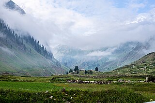
Batakundi also spelt Battakundi is a tourist town located 15 km east of Naran in Mansehra District, Khyber Pakhtunkhwa, Pakistan. It is located within the Kaghan Valley.


