Chamarajanagar or Chamarajanagara is the southernmost district in the state of Karnataka, India. It was carved out of the original larger Mysore District in 1998. Chamarajanagar town is the headquarters of this district.
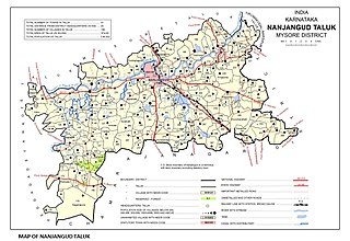
Nanjangud, officially known as Nanjanagudu, is a town in the Mysuru district of Indian state of Karnataka. Nanjangud lies on the banks of the river Kapila, 23 km from the city of Mysore. Nanjangud is famous for the Srikanteshwara Temple located here. Nanjangud is also called Dakshina Kashi. This town is also famous for a type of banana grown in the region called the Nanjanagoodu rasabale. Nanjangud's local administrative unit was designated as a Municipal Committee in 2015 by including Devirammanahalli and Kallahalli village.

Chamarajanagar or Chamarajanagara is a town in the southern part of Karnataka, India. Named after Chamaraja Wodeyar IX, the erstwhile king of Mysore, previously known as 'Arikottara'. Chamarajanagara is the headquarters of Chamarajanagar district. It is located on the interstate highway linking the neighboring states of Tamil Nadu and Kerala.

Karnataka is one of the highest economic growth states in India with an expected GSDP growth of 9.5% in the 2021–22 fiscal year. The total expected GSDP of Karnataka in 2022–2023 is about $240 billion. Karnataka recorded the highest growth rates in terms of GDP and per capita GDP in the last decade compared to other states. In 2008–09, the tertiary sector contributed the most to GSDP, followed by the secondary sector, and the primary sector.

Varavoor, a lush green residential village in Thrissur district is in the state of Kerala, India. It is widely believed that this village was situated on the banks of Bharathapuzha during prehistoric times. Shrinking of the river over several millennia of human settlements has moved the village more distant from its banks. It is surrounded by small green hills and is 30 mins drive away from the cultural capital of Kerala. Varavoor was declared "litigation-free" village on 7 May 2000. Climatic conditions in and around Varavoor varies around the year. The well-known Palakkal Pooram is usually held in the month of February welcoming tourists from different parts of the country. During the month of February, paddy fields surrounding the Palakkal temple is usually fallow after harvest, making it ideal location for gathering for the pooram festivities and for fireworks at night.
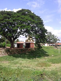
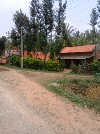
Kadakola is a Town and a suburb of Mysuru metropolitan area in the southern state of Karnataka, India. It is located in the Mysore taluk of Mysore district. In November 2020, Kadakola was upgraded from a Gram Panchayat to a Town Panchayat and a gazetted notification was passed on November 26, 2020.2. The combined population of the newly formed town is 19,969.
Islamnagar is a Block and Nagar Panchayat in Badaun district in the Indian state of Uttar Pradesh. Its block code is 0174.

Tetagunta is one of the villages in Tuni Mandal in Kakinada district in Andhra Pradesh State and is located 14.1 km from its Mandal main town Tuni. It is 44.3 km from its district main city Kakinada. It has a population of 11,967 and people mostly depend on farming. Tetagunta village of Tuni Mandal is having the largest area of 4,033 hectares in the East Godavari District.It is located at a distance of 120 km from the state main city Visakhapatnam. Pincode:533406
Bonaigarh, also locally known as Bonai, is a subdivision of Sundergarh district of the Indian state of Odisha. It is 162 km east of the district headquarters in Sundargarh. It is a sub-divisional headquarter. The town is surrounded by the River Brahmani and the Khandadhar and Singardei Hills. Notable places of interest include a temple to the Lord Shiva and a Royal Palace.

Mysore–Chamarajanagar branch line is an Indian railway line from Mysore Junction to Chamarajanagar.

Sujathapuram is a village in Mysore district of Karnataka state, India.
Badanavalu is a village in Mysore district of Karnataka state, India.

Kavalande is a village in Nanjangud taluk, Mysore district of Karnataka state, India.
Mariyala is a village in Chamarajanagar district of Karnataka state, India.

Mukkadahalli is a village in Chamarajanagar district of Karnataka state, India.

Konanur or Paduvalamarahalli is a village in Nanjangud taluk of Mysore district, Karnataka state, India.
Keralapura is a village in Hassan district of Karnataka state, India.
Kadalaveni is a village in the southern state of Karnataka, India. It is located in the Gauribidanur taluk of Chikkaballapura district in Karnataka. It is situated 6 km away from sub-district headquarter Gauribidanur and 44 km away from district headquarter Chikkaballapura

Permude is a village (panchayat) located in the Mangalore taluk, Dakshina Kannada district, in Karnataka state, India. The name, "Permude", derived from Perda Mudde, is a reference to the milk that was once locally produced in large quantities. Permude is located approximately 360 kilometers from the state capital, Bangalore. Nearby villages include Bajpe and Kinnigoli. According to 2011 census information, Permude's location code or village code is 617478. The village comprises an area of 742.69 hectares. Permude falls under the Mangalore Special Economic Zone (MSEZ).