This article has multiple issues. Please help improve it or discuss these issues on the talk page . (Learn how and when to remove these messages)
|
Badnera | |
|---|---|
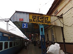 Badnera Junction with 12105 Gondia Express | |
 Badnera Location in Maharashtra, India | |
| Coordinates: 20°51′17″N77°43′46″E / 20.854632°N 77.729312°E | |
| Country | |
| State | Maharashtra |
| District | Amravati |
| Government | |
| • Type | Maharashtra State Government |
| • Body | YSP |
| Elevation | 500 m (1,600 ft) |
| Languages | |
| • Official | Marathi |
| Time zone | UTC+5:30 (IST) |
| Vehicle registration | MH-27 |
Badnera is a town in Amravati district in the Indian state of Maharashtra. [1] Amravati city, an administrative headquarter of Amravati district is nearby badnera.
Railway
- Badnera Junction railway station is a junction station on the Howrah-Nagpur-Mumbai line. There is a broad gauge line to Narkhed.
- Located around 10 km from Amravati, Badnera is an important railway junction that connects Amravati with several key locations.