This is a list of districts of Afghanistan, known as wuleswali. These are secondary level administrative units, one level below the provinces. The Afghan government issued its first district map in 1973. It recognized 325 districts, counting wuleswalis (districts), alaqadaries (sub-districts), and markaz-e-wulaiyat. In the ensuing years additional districts have been added thru splits, and a few eliminated thru mergers. In June 2005, the Afghan government issued a map of 398 districts. It was widely adopted as by many information management systems, though usually with the addition of Sharak-e-Hayratan for a 399 district total. Here is a link to a clean rendering of the 399 district set as a spreadsheet from an official Afghan source. It remains the de facto standard, as of late 2018, despite a string of government announcements of the creation of new districts.

Dushi district is located in the central part of Baghlan Province, Afghanistan. It lies on the major Kabul-Kunduz highway. The population of the district was estimated to be around 57,160 in 2004. Hazaras are around 88% of the population and make up the majority in the district, followed by small minorities of Tajiks and Pashtuns The centre of the district is Dushi.

Khinjan District is located in the southern part of Baghlan province in the Hindu Kush mountains. The capital is the town of Khenjan. The main Kabul-Kunduz highway passes through the district from south to west. Ethnic Hazara makes up around 85% of the total population while the Pashtuns, Tajeks and Uzbeks, each at 5%, makes up the remaining 15% of the population.
The Ali abad District is situated in the southern part of Kunduz Province, Afghanistan. It borders the Baghlan Province to the south, Chahar dara District to the west, Kunduz and Khan Abad districts to the north and Takhar Province to the east.
The town of 'Aliabad is the center of Ali abad District in Kunduz Province, Northern Afghanistan. It is situated in the central part of the district on 36.5222°N 68.8992°E at 425 m altitude on the main road between Kunduz and Baghlan.
Chārdara District is one of the seven districts in Kunduz Province in northern Afghanistan. It is situated in the south-west part of Kunduz Province and has borders with Qalay-I-Zal District to the north-west, Kunduz District to the north-east, Ali Abad District to the south-east, Baghlan Province to the south and Samangan Province to the south-west.
Imam Sahib District is situated in the northern part of Kunduz Province, Afghanistan. It borders with Qalay-I-Zal District to the west, Tajikistan to the north, with Archi District to the east and Kunduz District to the south. The population is 204,300 (2006) - 25% Pashtun, 25% Tajik, 45% Uzbek and 5% Turkmen. The district center is the town of Imam Sahib, located in the northern part of the district. The other main town in the district is Sherkhan Bandar, which serves as Afghanistan's main port of entry to Tajikistan.
Baghlan was a district in Baghlan Province, Afghanistan. The main town of the district was also known as Baghlan. In 2005, Baghlan was annexed into the district of Baghlani Jadid, also in Baghlan Province.
Dushi, also spelled Doshi or Dowshi, is a town in Dushi District, Baghlan Province, Afghanistan. It is the administrative center of Dushi District and is located on the major Kabul-Kunduz highway.
Qataghan Province, also spelled Kataghan, was a province of Afghanistan which became defunct in 1963, when it was divided into the current Baghlan Province, Kunduz Province, and Takhar Province. From the 19th century to 1963 Qataghan and neighboring Badakhshan Province were united into a single province called Qataghan-Badakhshan Province. It was ruled by a single governor and was divided into two separate provinces in 1963. The capital of Qataghan Province was Baghlan, now a city in the north of Baghlan Province.

Mohammad Omar was the Governor of Kunduz Province, Afghanistan. He was an ethnic Andar Pashtun from Baharak District of Afghanistan.
The Kunduz River is a tributary of the Amu Darya in northern Afghanistan. It rises in Bamyan Province in the Hindu Kush, and in its upper reaches is also known as the Bamyan River or the Surkhab River. After passing through Kunduz Province, the Kunduz River merges into the Amu Darya.
Bashir Baghlani (1931–2007), born Mohammad Yousuf, was a politician in Afghanistan affiliated with a variety of factions throughout the 1980s, 1990s, and 2000s, who filled such positions as Governor of Baghlan Province and later Farah Province.
The Khānabād River flows in the provinces of Takhar and Kunduz in northern Afghanistan. The Khanabad River is a tributary of the Kunduz River, which is in turn a tributary of the Amu River.
Qataghan-Badakhshan Province was a province located in Afghanistan. The province was originally created in 1890 when the district of Qataghan and Badakhshan was separated from the province of Afghan Turkestan. Administration of the province was assigned to the Northern Bureau in Kabul. In 1963 Badakhshan included the districts of Baghlan, Pul-i-Khumri, Dushi, Dahan-i-Ghori, Khan Abad, Andarab, Kunduz, Hazrat-i-Imam, and Taloqan. In 1963 Qataghan-Badakhshan Province was abolished and since then the territory was divided into four separate provinces - Badakhshan, Baghlan, Kunduz, and Takhar.

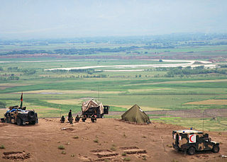
Operation Halmazag was an offensive operation by ISAF German-led troops in close cooperation with the Afghan security forces in the province of Kunduz, from 31 October to 4 November 2010, with the aim of building a permanent outpost near the village of Quatliam in the Char Dara district, south-west of Kunduz. The operation was the first German military ground offensive since World War II.