
Haridwar is a city and municipal corporation in the Haridwar district of Uttarakhand, India. With a population of 228,832 in 2011, it is the second-largest city in the state and the largest in the district.

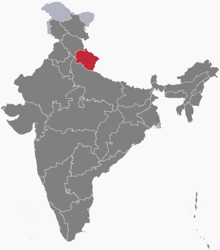
Uttarakhand, also known as Uttaranchal, is a state in the northern India. It is often referred to as the "Devbhumi" due to its religious significance and numerous Hindu temples and pilgrimage centres found throughout the state. Uttarakhand is known for the natural environment of the Himalayas, the Bhabar and the Terai regions. It borders the Tibet Autonomous Region of China to the north; the Sudurpashchim Province of Nepal to the east; the Indian states of Uttar Pradesh to the south and Himachal Pradesh to the west and north-west. The state is divided into two divisions, Garhwal and Kumaon, with a total of 13 districts. The winter capital of Uttarakhand is Dehradun, the largest city of the state, which is a rail head. Gairsain, a town in Chamoli district, is the summer capital of Uttarakhand declared on 5 March 2020. The High Court of the state is located in Nainital, but is to be moved to Haldwani in future.

Roorkee (Rūṛkī) is a city and a municipal corporation in the Haridwar district of the state of Uttarakhand, India. It is 31 km (19 mi) from Haridwar city, the district headquarter. It is spread over a flat terrain under Sivalik Hills of Himalayas. The city is developed on the banks of Ganges Canal, its dominant feature, which flows from north–south through middle of the city. Roorkee is home to Asia's first engineering college Indian Institute of Technology Roorkee, formerly known as Thomson College of Civil Engineering. Roorkee is also known for the Roorkee Cantonment, one of the country's oldest military establishments and the headquarters of Bengal Engineer Group since 1853. A freight train ran in between Roorkee and Piran Kaliyar on 22 December 1851, this was two years before first passenger trains were started between Bombay and Thana in 1853 and 14 years after first freight trains ran in Chennai in 1837.

Haridwar district also spelled as Hardwar is a district in Garhwal which is a part of Uttarakhand, India. It is headquartered at Haridwar which is also its largest city. The district is ringed by the districts Dehradun in the north and east, Pauri Garhwal in the east and the Uttar Pradesh districts of Muzaffarnagar and Bijnor in the south and Saharanpur in the west.

Ranipur Or BHEL, Ranipur is a town in Haridwar district in the state of Uttarakhand, India. It is the township developed by Public sector Bharat Heavy Electricals Limited (BHEL).

Uttarkashi, meaning Kashi of the north, is a town located in Uttarkashi district in Uttarakhand, India. Uttarkashi town is headquarters of the district. Uttarkashi is also known as Somya Kashi. Uttarkashi is a religious place for spiritual and adventurous tourism. Uttarkashi town is also called as Shivnagri. The town has number of temples and ashrams. Uttarkashi is known for its religious people, weather, education.
Laksar is a small town, near Haridwar city and Nagar Palika in Haridwar district of the Indian state of Uttarakhand, situated along National Highway 334A. It is an important sugar manufacturing destination in the state and also known for the Laksar Junction railway station (LRJ), the largest railway junction in the state, which was built in 1866.
Landhaura is a town and a nagar panchayat in Haridwar district in the Indian state of Uttarakhand.
Kankhal is a small colony in Haridwar in the Haridwar district of Uttarakhand state in India.
Roorkee Cantonment is a cantonment town, in Roorkee, Haridwar district in the Indian state of Uttarakhand, and is one of country's oldest cantonments established in 1853, and the headquarters of Bengal Engineer Group since 1853.

Gurukula Kangri is a government-funded deemed to be university u/s 3 of the UGC act 1956 located in Haridwar, Uttarakhand, India. It is fully funded by UGC. It is NAAC "B" grade accredited. Situated near the bank of the Ganges about 6 km from Haridwar and about 200 km from New Delhi. Gurukula Kangri has 25 academic departments covering Engineering, Applied Sciences, Vedic Sciences, Humanities and Social Sciences and Management programs with a strong emphasis on Vedic and Modern Sciences and technological education and research. The university has signed about 34 memorandums of understanding with industries, universities, NGOs, and institutions.

Patanjali Yogpeeth is a yoga institute located in Haridwar, Uttarakhand, India. Founded in 2006 and named after the Rishi Patanjali, the purpose of the institute is to practice, research, and develop yoga and ayurveda. The institute is the flagship project of the yoga teacher and entrepreneur Ramdev.

The State Industrial Development Corporation of Uttarakhand Limited (SIDCUL) is a government of Uttarakhand enterprise which promotes industries and develops industrial infrastructure in the State. It also provides tax incentives for companies establishing plants on its industrial estates presently at Haridwar, Pantnagar and Sitarganj.
Piran Kaliyar is the dargah of 13th-century Sufi saint of Chishti Order, Alauddin Ali Ahmed Sabir Kalyari also known as Sarkar Sabir Pak and Sabir Kaliyari, situated at Kaliyar village, near Haridwar on the banks of Ganga Canal, 7 km. from Roorkee. It is one of the most revered shrines for Muslims in India and is equally revered by Hindus and Muslims. The dargah shrine was built by Ibrahim Lodhi, an Afghan ruler of Delhi.

Shivalik Nagar is a city in the Haridwar district of Uttarakhand, India, at the edge of Bharat Heavy Electrical Limited, Ranipur township and the SIDCUL industrial estate of state government, and 10 km away from the Hindu pilgrimage city of Haridwar.
Bhagwanpur is a Town, Tehsil, and Taluka in Haridwar district in the state of Uttarakhand, India. It is 57 km far from Dehradun which is the capital of Uttarakhand. It is the commercial centre of Ghad Chhetra. It was founded by Bhagwana in the old age Zamindara. It is one of Uttarakhand's industrial zones.
Salempur Rajputana is a census town in the Roorkee Municipal Corporation of Roorkee in Haridwar district of the Indian state of Uttarakhand. It is a area in Roorkee, Ramnagar. Salempur Rajputana is famous for its ameliorative, productive and progressive industrial area. This is a town with Hindu majority most people here are of Gaddadiya, Daharia and Rada gotra and are part of Saini community.
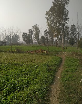
Belra is a village which is located in Roorkee tehsil of Haridwar district in Uttarakhand, India. It is spread over a flat terrain with the grand spectacle of the Himalayas ranges flanking it in the East and the North east. Roorkee is the nearest town to Belra(Belda) village. Belra(belda) is situated on National Highway 8. It is 10 km from Roorkee and 25 km from Haridwar.
Uttarakhand Sanskrit University is an Indian State university located in the city of Haridwar, Uttarakhand. Established in 2005, the university offers certificate courses, diplomas, undergraduate education, postgraduate education, doctoral programmes and master of philosophy courses in various disciplines.
The following outline is provided as an overview of and topical guide to Uttarakhand:

