
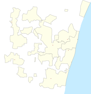
The Puducherry district, also known by its former name Pondicherry district, is one of the four districts of the union territory of Puducherry in South India. The district occupies an area of 290 square kilometres (110 sq mi), spread over 11 non-contiguous enclaves lying on or near the Bay of Bengal within a compact area in the state of Tamil Nadu. According to the 2011 census, the district has a population of 950,289.

The Puducherry Legislative Assembly is the unicameral legislature of the Indian union territory (UT) of Puducherry, which comprises four districts: Puducherry, Karaikal, Mahé and Yanam. The legislative assembly has 33 seats, of which 5 are reserved for candidates from scheduled castes and 3 members are nominated by the Government of India. 30 out of 33 Members are elected directly by the people on the basis of universal adult franchise.
Bahour is a town, Commune, Taluk and Assembly Constituency in the Union Territory of Puducherry, India. It consists of four non-contiguous areas, including three of the nine true enclaves of Puducherry. It is home to the second largest and perhaps the oldest irrigation lake in the region- the Bahour Eri. The lake has been in existence since the Chola period. Bahour also has reports of lignite deposits but it is not exploited due to its close proximity to the sea and the likelihood of seeping seawater, adulterating the ground water. It is a major access point for villages south of Puducherry and forms the southern border to the Union territory. The city is also known as the ‘rice bowl of Puducherry’ since the area is suitable for Paddy (rice) cultivation.
Korkadu is a panchayat village in Nettapakkam Commune in the Union Territory of Puducherry, India. It is also a revenue village under Nettapakkam firka.
Karikalampakkam is a panchayat village in Nettapakkam Commune in the Union Territory of Puducherry, India. It is also a revenue village under Nettapakkam firka. If splitting the Name of Karikalampakkam and translating into English it will give the reason of village name by how it came. Kari - Dark; akalam - Non Leaving; pakkam - the place or location. So when the Pondicherry under French rule, this place identified by the other village people by noticing the full darkness; occupying entire area of the village even at day time, because this village covered fully by big trees and it won't allow the light passing inside.
Manamedu is a village in Bahour Commune of Bahour taluk in the Union Territory of Puducherry, India. It is one of the 11 Enclaves of Puducherry. Manmedu serves as a gateway to Pondicherry - Nellikuppam route. It lies on the banks of Pennaiyar River
Kaduvanur is a village in Bahour Commune of Bahour taluk in the Union Territory of Puducherry, India. It is one of the 11 Enclaves of Puducherry district. Kaduvanur is a part of Manamedu Village Panchayat.
Kuruvinatham is a village in Bahour Commune of Bahour taluk in the Union Territory of Puducherry, India. Kuruvinatham serves as a gateway for all buses going between Villupuram - Cuddalore via Thirubuvanai. It lies on the southwestern tip of Bahour Enclave of Puducherry district.
Soriyankuppam is a village in Bahour Commune of Bahour taluk in the Union Territory of Puducherry, India. Soriyankuppam serves as a bypass for Puducherry - Panruti route via Savadi. It lies on southern tip of Bahour Enclave of Puducherry district.
Parikkalpattu is a village in Bahour Commune of Bahour taluk in the Union Territory of Puducherry, India. It lies on southern border of Bahour Enclave of Puducherry district.
Seliamedu is a village, sub-taluk in Bahour Commune of Bahour taluk in the Union Territory of Puducherry, India. It lies on north side in the Bahour Enclave of Puducherry district.
Aranganur is a village in Bahour Commune of Bahour taluk in the Union Territory of Puducherry, India. It lies on north side in the Bahour Enclave of Puducherry district. Aranganur village is a part of Seliamedu Village Panchayat.
Kudiyiruppupalayam is a village in Bahour Commune of Bahour taluk in the Union Territory of Puducherry, India. It lies on north side in the Bahour Enclave of Puducherry district.
Pillaiyarkuppam is a village in Bahour Commune of Bahour taluk in the Union Territory of Puducherry, India. It lies 2 km east of NH-45A.
Kirumampakkam is a village in Bahour Commune of Bahour taluk in the Union Territory of Puducherry, India. It lies on Cuddalore road (NH-45A) at a distance of 15 km from Pondicherry.
Pannithittu is a village in Bahour Commune of Bahour taluk in the Union Territory of Puducherry, India. It lies east of NH-45A at a distance of 2 km from it. River Malattar joins Bay of Bengal at Pannithittu.
Manappattu is a village in Bahour Commune of Bahour taluk in the Union Territory of Puducherry, India. It lies east of NH-45A at a distance of 2 km from it.
Pudukuppam is a village in Bahour Commune of Bahour taluk in the Union Territory of Puducherry, India. It lies east of NH-45A at a distance of 2 km from it.
Krishnavaram is a village in Bahour Commune of Bahour taluk in the Union Territory of Puducherry, India. This is the last village of Puducherry district to lie on NH-45A between Puducherry-Cuddalore. In other words, Krishnavaram is the gateway to Puducherry from Cuddalore. There exists an Arch at this village which is mentioned as Mullodai Arch as it lies near Mullodai. Krishnavaram is also known by the name Mathi Krishnapuram. An ancient Vishnu temple in dilapidated condition exists in this village which needs immediate attention from the devotees.
After merger of French settlements into Indian Union, a new assembly, named as Pondicherry Representative Assembly has been created by Government of India. After the de facto merger and before the legal integration with the Indian Union on August 16, 1962, general elections to the assembly were held in 1955 and 1959.
