The Puducherry district, also known by its former name Pondicherry district, is one of the four districts of the union territory of Puducherry in South India. The district occupies an area of 290 square kilometres (110 sq mi), spread over 12 non-contiguous enclaves lying on or near the Bay of Bengal within a compact area in the state of Tamil Nadu. According to the 2011 census, the district has a population of 950,289.

The Central Asian Flyway (CAF), Central Asian-Indian Flyway, or Central Asian-South Asian Flyway is a flyway covering a large continental area of Eurasia between the Arctic Ocean and the Indian Ocean and the associated island chains. The CAF comprises several important migration routes of waterbirds, most of which extend from the northernmost breeding grounds in Siberia to the southernmost non-breeding wintering grounds in West Asia, India, the Maldives and the British Indian Ocean Territory.

Bahour is one of 5 Communes in Pondicherry district in the Indian territory of Puducherry. Bahour Commune comes under Bahour taluk of Puducherry district. Nettapakkam is another commune under Bahour taluk.

Nettapakkam is one of five communes in the Pondicherry district in the Indian territory of Puducherry. Nettapakkam is under the Bahour taluk of Puducherry.
Bahour is one of the 3 Firkas of Bahour taluk in Pondicherry (North) Revenue Sub-division of the Indian union territory of Puducherry.
Nettapakkam is one of the three firkas of Bahour taluk in Pondicherry (North) revenue sub-division of the Indian union territory of Puducherry.
Bahour is a town, Commune, Taluk and Assembly Constituency in the Union Territory of Puducherry, India. It consists of four non-contiguous areas, including three of the nine true enclaves of Puducherry. It is home to the second largest and perhaps the oldest irrigation lake in the region- the Bahour Eri. The lake has been in existence since the Chola period. Bahour also has reports of lignite deposits but it is not exploited due to its close proximity to the sea and the likelihood of seeping seawater, adulterating the ground water. It is a major access point for villages south of Puducherry and forms the southern border to the Union territory. The city is also known as the ‘rice bowl of Puducherry’ since the area is suitable for Paddy (rice) cultivation.
Bahour (East) is a village in Commune in the Union Territory of Puducherry, India. It consists of few areas of Bahour and the entire part of Bahourpet.
Karaiyamputhur is a village in Bahour Commune of Bahour taluk in the Union Territory of Puducherry, India. It is one of the 11 Enclaves of Puducherry. Karaiyamputhur serves as a gateway to Puducherry - Panruti route. It lies on the southwesternmost tip of Puducherry district.
Panayadikuppam otherwise known as Panaiyadikuppam or Panaiyadikkuppamis is a village in Bahour Commune of Bahour taluk in the Union Territory of Puducherry, India. It lies on the north part of Karaiyamputhur Enclave of Puducherry. Panayadikuppam serves as a gateway to Nettapakkam from Bahour. Panayadikuppam is a part of Karaiyamputhur Village Panchayat.
Manamedu is a village in Bahour Commune of Bahour taluk in the Union Territory of Puducherry, India. It is one of the 11 Enclaves of Puducherry. Manmedu serves as a gateway to Pondicherry - Nellikuppam route. It lies on the banks of Pennaiyar River
Kuruvinatham is a village in Bahour Commune of Bahour taluk in the Union Territory of Puducherry, India. Kuruvinatham serves as a gateway for all buses going between Villupuram - Cuddalore via Thirubuvanai. It lies on the southwestern tip of Bahour Enclave of Puducherry district.
Soriyankuppam is a village in Bahour Commune of Bahour taluk in the Union Territory of Puducherry, India. Soriyankuppam serves as a bypass for Puducherry - Panruti route via Savadi. It lies on southern tip of Bahour Enclave of Puducherry district.
Parikkalpattu is a village in Bahour Commune of Bahour taluk in the Union Territory of Puducherry, India. It lies on southern border of Bahour Enclave of Puducherry district.
Seliamedu is a village, sub-taluk in Bahour Commune of Bahour taluk in the Union Territory of Puducherry, India. It lies on north side in the Bahour Enclave of Puducherry district.
Manappattu is a village in Bahour Commune of Bahour taluk in the Union Territory of Puducherry, India. It lies east of NH-45A at a distance of 2 km from it.
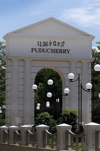
Krishnavaram is a village in Bahour Commune of Bahour taluk in the Union Territory of Puducherry, India. This is the last village of Puducherry district to lie on NH-45A between Puducherry-Cuddalore. In other words, Krishnavaram is the gateway to Puducherry from Cuddalore. There exists an Arch at this village which is mentioned as Mullodai Arch as it lies near Mullodai. Krishnavaram is also known by the name Mathi Krishnapuram. An ancient Vishnu temple in dilapidated condition exists in this village which needs immediate attention from the devotees.

The Karaivetti Bird Sanctuary is a 4.537-square-kilometre (1.752 sq mi) protected area and Ramsar site, located in the Ariyalur District of the state of Tamil Nadu, India. The sanctuary is about 25 kilometres (16 mi) from Thanjavur. This freshwater lake is fed by Pullambadi, Kattalal canal and attracts thousands of birds every year. This lake was declared as a sanctuary in 1999 by the Government of Tamil Nadu and in 2024, it became a Ramsar site. About 200 birds are species recorded from this sanctuary. Karaivetti Bird Sanctuary is one of the Important Bird Areas (IBA's) of Tamil Nadu.

Ousteri Lake is a lake shared between the union territory of Puducherry, and the state of Tamil Nadu. This lake is also called as Ossudu Lake as it is located in the village named Ossudu.


