Sultanpur district is a district in the Awadh region of the Indian state of Uttar Pradesh. This district is a part of Ayodhya division of the state. The administrative headquarters of the district is Sultanpur city. The total area of Sultanpur district is 2672.89 Sq. km.

Hardoi district is a district situated in the center of Uttar Pradesh, India. The district headquarters is in the city of Hardoi. Hardoi is the third largest district of Uttar Pradesh. It falls under Lucknow division in the historical region of Awadh State.

Lucknow district is a district located in the state of Uttar Pradesh in northern India. The city of Lucknow is the district headquarters and the district is part of Lucknow Division. It is also the capital city of Uttar Pradesh. Lucknow is bounded on the east by Barabanki district, on the west by Unnao and Hardoi districts, on the south by Raebareli district and in the north by Sitapur district.

Nibi is a village in Sareni block of Raebareli district, in Uttar Pradesh state in northern India. It is known for Agnihotri Zamindars. The village hosts a market on Wednesdays and Saturdays, and the main staple foods are wheat and rice. As of 2011, the population of Nibi is 1,708, in 306 households, and it has one primary school and no healthcare facilities. It serves as the headquarters of a nyaya panchayat that also includes 17 other villages. Agriculture is an important part of the local economy.

Balamau is a village in Kachhauna block of Hardoi district, Uttar Pradesh, India. It is located about a mile from the left bank of the Sai river, 25 miles from Hardoi and 4 miles southwest of the namesake Balamau station, which is actually in Kachhauna. Balamau was historically the largest settlement in the area, serving as the seat of a pargana since the reign of Akbar. As of 2011, its population is 4,749, in 1,022 households.
Juggaur or Jugor is a village in Chinhat block, Lucknow district, Uttar Pradesh, India. As of the 2011 Census of India, the population of the village is 9,478, in 1,590 households. The village code is 0297. It is part of Lucknow tehsil. It is the seat of a gram panchayat.
Bakas, also spelled Bakkas, is a village in Gosainganj block of Lucknow district, Uttar Pradesh, India. As of 2011, its population is 8,171, in 1,444 households. It is the seat of a gram panchayat.
Gauria Kalan is a village in Gosainganj block of Lucknow district, Uttar Pradesh, India. As of 2011, its population is 3,963, in 717 households. It is the seat of a gram panchayat.

Panhan, also called Panhan Khas, is a small village in Purwa block of Unnao district, Uttar Pradesh, India. Located due south of Purwa and a bit to the west of the Loni River, it historically was the seat of a pargana. As of 2011, the village's population is 545 people, in 104 households.

Ajgain is a village in Nawabganj block of Unnao district, Uttar Pradesh, India. It is located northeast of Unnao, near the main Lucknow-Kanpur road. It has a railway station on the Lucknow-Kanpur line, lying between Sonik and Kusumbhi. It holds a market on Mondays and Fridays, with grain and vegetables being the main items of trade. As of 2011, the population of Ajgain is 8,926, in 1,481 households.

Rampur Sudauli is a village in Bachhrawan block of Rae Bareli district, Uttar Pradesh, India. One of the main villages in the historical pargana of Bachhrawan, Rampur Sudauli is located at the corner of three districts: Raebareli, Lucknow and Unnao This spot is 15 km from Bachhrawan, at the point where the Sai river first enters the district.

Kumhrawan is a village in Shivgarh block of Rae Bareli district, Uttar Pradesh, India. Formerly a pargana headquarters, it consists of a main village and several scattered hamlets. As of 2011, Kumhrawan has a population of 2,441, in 426 households.

Inhauna is a village and corresponding in Singhpur block of Rae Bareli district, Uttar Pradesh, India. As of 2011, its population is 13,049, in 2,021 households. Located at the junction of the Raebareli-Rudauli and Lucknow-Jaunpur roads, Inhauna is an old town that once served as the seat of a pargana as well as (briefly) a tehsil, and it has the ruins of an old fort built under the Nawabs of Awadh. The old marketplace, known as Ratanganj, was built in 1863 by the tahsildar Ratan Narain. Markets are held twice per week, on Mondays and Thursdays, and most of the trade is in livestock.

Rahi is a village and corresponding community development block in Rae Bareli district, Uttar Pradesh, India. It is located 7 km from Rae Bareli, the district headquarters, which according to one folk etymology is named after the village. Rahi was formerly the seat of a pargana before Rae Bareli replaced it in that capacity. As of 2011, Rahi has a population of 7,536 people, in 1,373 households. It has one primary school and one medical clinic.

Kahinjar is a village in Sareni block of Rae Bareli district, Uttar Pradesh, India. It is located 20 km from Lalganj, the tehsil headquarters. Kahinjar historically served as the headquarters of a mahal since at least the time of Akbar, before being merged into the pargana of Sareni under the Nawabs of Awadh. As of 2011, Kahinjar has a population of 2,099 people, in 354 households. It has one primary school and no healthcare facilities. It belongs to the nyaya panchayat of Rasulpur.

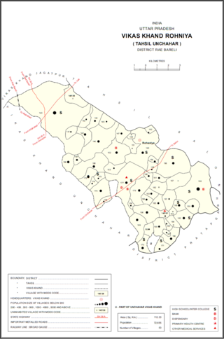
Rasulpur is a village in Rohaniya block of Rae Bareli district, Uttar Pradesh, India. One of the largest villages in the historical pargana of Salon, it is located 48 km from Raebareli, the district headquarters. As of 2011, it has a population of 7,671 people, in 1,379 households. It has one primary school and no healthcare facilities.

Rokha is a large village in Dih block of Rae Bareli district, Uttar Pradesh, India. Historically the namesake of a pargana, Rokha is a predominantly agricultural village consisting of many hamlets. It is located 28 km from Raebareli, the district headquarters. The large village of Mau also borders Rokha to the north. Rokha is connected by road with Nasirabad and Jais to the northeast and Suchi to the southwest.

Nisgar is a village in Sareni block of Rae Bareli district, Uttar Pradesh, India. It is located on the bank of the Ganges, 23 km from the tehsil headquarters at Lalganj. Nisgar is mentioned in the late 16th-century Ain-i-Akbari as the seat of a mahal in the sarkar of Lucknow. It was later merged into the pargana of Sareni under the Nawabs of Awadh in the 1700s.

Singhaur Tara is a village in Sareni block of Rae Bareli district, Uttar Pradesh, India. It is located on the bank of the Ganges, 18 km from the tehsil headquarters at Lalganj. Singhaur Tara is probably identical with the mahal called "Tara Singhaur" Ain-i-Akbari in the late 16th century. This mahal was in the sarkar of Lucknow. It was later merged into the pargana of Sareni under the Nawabs of Awadh in the 1700s.

Paho, also spelled Pahu, is a village in Khiron block of Rae Bareli district, Uttar Pradesh, India. It is located near the road from Raebareli to Mauranwan and Unnao, close to the border with Unnao district. It is 18 km away from Lalganj, the tehsil headquarters. As of 2011, Paho has a population of 5,620 people, in 1,088 households. It has two primary schools and no healthcare facilities, and it hosts a weekly haat but not a permanent market. It is the seat of a nyaya panchayat which also includes 7 other villages.


