Amethi is a city situated in the Indian state of Uttar Pradesh. Gauriganj is the administrative headquarters of the Amethi district. This district is a part of Ayodhya division in the Awadh region of the state. Amethi was 72nd district of Uttar Pradesh which came into existence on 1 July 2010 by merging three tehsils of the erstwhile Sultanpur district namely Amethi, Gauriganj and Musafirkhana and two tehsils of the erstwhile Raebareli district, namely, Salon and Tiloi. The town is part of the Amethi Lok Sabha constituency and Amethi Assembly constituency, which became reputed as a stronghold of the Indian National Congress party. The Congress leaders belonging to Nehru-Gandhi family won several elections from Amethi during 1980–2014. In 2019, Smriti Irani of Bhartiya Janta Party won this seat.

Faizabad is a city located in Ayodhya district in the Indian state of Uttar Pradesh. It is situated on southern the bank of the River Saryu about 130 km east of state capital Lucknow. Faizabad was the first capital of the Nawabs of Awadh and has monuments built by the Nawabs, like the Tomb of Bahu Begum, Gulab Bari. It was also the headquarters of Faizabad district and Faizabad division before November 2018. Faizabad is a twin city of Ayodhya and it is administered by Ayodhya Municipal Corporation.

Raebareli is a city in Indian state of Uttar Pradesh. It is the administrative headquarters of Raebareli district and a part of Lucknow Division. The city is situated on the banks of the Sai river, 82 km (51 mi) southeast of Lucknow. It possesses many architectural features and sites, chief of which is a strong and spacious fort. As of 2011, Raebareli has a population of 191,316 people, in 35,197 households.

Sultanpur is a city situated on the banks of holy river Gomti in the Indian state of Uttar Pradesh. It is the administrative headquarters of Sultanpur district and is a part of Ayodhya division in Uttar Pradesh, India. It is situated 135 kilometres east of state capital Lucknow.
Sultanpur district is a district in the Awadh region of the Indian state of Uttar Pradesh. This district is a part of Ayodhya division in Uttar Pradesh. The administrative headquarters of the district is Sultanpur city. The total area of Sultanpur district is 2672.89 Sq. km.

Barabanki district is one of the five districts of Ayodhya division in the central Awadh region of Uttar Pradesh, India. Barabanki city is the administrative headquarters of Barabanki district. Total area of Barabanki district is 3891.5 Sq. km.

Firozabad district forms one of the western districts of the Indian state of Uttar Pradesh, which has Firozabad city as its district headquarters. The district is a part of the Agra division.
Haidergarh is a town and a nagar panchayat in the Barabanki district in the Indian state of Uttar Pradesh.
Jagdishpur is a town in Amethi in the Indian state of Uttar Pradesh.

Musafirkhana is a town and tehsil in Amethi district in Indian state of Uttar Pradesh. The word "Musafirkhana" means "Sarai," or "Dharamshala". Musafirkhana is located 32 km northwest of Amethi, 20 km from Jagdishpur. Gauriganj and Amethi are accessible from Musafirkhana via roadways; the nearest railway station is the Musafirkhana railway station on the Lucknow–Varanasi rail route via Sultanpur, and the nearest airport is the Amausi airport. It is surrounded by more than 100 villages. The town is between 26.37° north latitude and 81.8° east longitude at a height of 102 metres (434 feet) above mean sea level.
Nanpara is a town & municipal board in Bahraich district in the Indian state of Uttar Pradesh. It is a region along the Nepal Border and includes tracts of dense forests. It is a city surrounded by many villages.

Gauriganj is a city, tehsil and administrative headquarters of Amethi district in Ayodhya division, Uttar Pradesh, India. It is situated about 126 km from Lucknow, the capital of Uttar Pradesh. It is located in Eastern Uttar Pradesh. Before July 2010, Gauriganj was part of Sultanpur district and then taking Gauriganj, Amethi, Jais, Jagdispur and Salon, formed a new district called Chatrapati Sahuji Maharaj Nagar, later named Gauriganj and now Amethi. Gauriganj is connected with State Highway 34 and National Highway 128.

Harchandpur is a village and corresponding community development block in Raebareli district, Uttar Pradesh, India. It is located on the Baiti river, which is a tributary of the Sai, and it is northeast from the district headquarters on the road to Lucknow. Particularly since the coming of the railway in the 1800s, Harchandpur serves as one of the main commercial centres for the surrounding region; it is also a major exporter of local goods. As of 2011, its population is 4,348 people, in 833 households.
Kurebhar is a town in Sultanpur district of the Uttar Pradesh state in India. Kurebhar is 20 km north of district headquarters Sultanpur city.

Amethi district is the 72nd district of the state of Uttar Pradesh in northern India. This district is a part of Ayodhya division in the Awadh region of the Uttar Pradesh. It covers an area of 2329.11 km2. Gauriganj is the administrative headquarters of the district.
Goshainganj, also known as Gosainganj, is a town and nagar panchayat in the Ayodhya district of the Indian state of Uttar Pradesh. Located 32 km from the district headquarters Ayodhya, Goshainganj has one of the oldest markets of the district.
Jaswantgarh is a town that comes in Ladnun tehsil of Nagaur district under Ajmer Division of Rajasthan, India. situated about 210 km from Jaipur and around 35 km from Salasar. The headquarter Nagaur district is just 96km away. The distance between India's capital New Delhi from Jaswantgarh is 380km. Nearest airport is Jaipur International Airport(Sanganer). Jaswantgarh is also known as "Land of Bhamashahs" includes well known billionaire plastic tycoon non-executive director and chairman of Supreme Industries and Taparia tools named Bajrang Lal Taparia and Toshniwals.

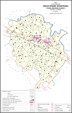
Mohanlalganj is a tehsil and community development block in Lucknow district, Uttar Pradesh, India. It has historically constituted part of the village of Mau.

Ajgain is a village in Nawabganj block of Unnao district, Uttar Pradesh, India. It is located northeast of Unnao, near the main Lucknow-Kanpur road. It has a railway station on the Lucknow-Kanpur line, lying between Sonik and Kusumbhi. It holds a market on Mondays and Fridays, with grain and vegetables being the main items of trade. As of 2011, the population of Ajgain is 8,926, in 1,481 households.
Kohra is a village in Amethi tehsil of Amethi district in the Indian state of Uttar Pradesh. Kohra was historically the seat of a large taluqdari estate held by a leading branch of the Bandhalgoti Rajputs. As of 2011, it has a population of 4,407 people, in 786 households.