Bairia village

Last updated

Bairia
Village
India Bihar location map.svg
Red pog.svg
Bairia
Location in Bihar
Coordinates: 27°06′29″N84°27′50″E / 27.108°N 84.464°E / 27.108; 84.464 Coordinates: 27°06′29″N84°27′50″E / 27.108°N 84.464°E / 27.108; 84.464
CountryFlag of India.svg  India
State Bihar
District West Champaran district
Government
  Type Panchayati raj (India)
  Body Gram panchayat
Languages
  Official Hindi
Time zone IST (UTC+5:30)
ISO 3166 code IN-BR

Bairia is a village in West Champaran district in the Indian state of Bihar.
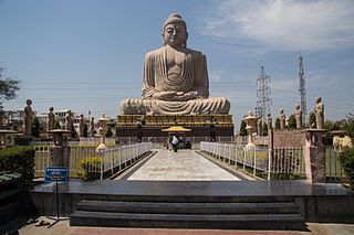
Bihar State in Eastern India

Bihar is an Indian state considered to be a part of eastern, northern, and north-central India. It is the thirteenth-largest Indian state, with an area of 94,163 km2 (36,357 sq mi). The third-largest state by population, it is contiguous with Uttar Pradesh to its west, Nepal to the north, the northern part of West Bengal to the east, with Jharkhand to the south. The Bihar plain is split by the river Ganges, which flows from west to east. Three main regions converge in the state: Magadh, Mithila, and Bhojpur.

Demographics

As of 2011 India census, Bairia had a population of 1479 in 240 households. Males constitute 52.87% of the population and females 47.12%. Bairia has an average literacy rate of 47.87%, lower than the national average of 74%: male literacy is 62.14%, and female literacy is 37.85%. In Bairia, 23.52% of the population is under 6 years of age. [1]

Census Acquiring and recording information about the members of a given population

A census is the procedure of systematically acquiring and recording information about the members of a given population. The term is used mostly in connection with national population and housing censuses; other common censuses include agriculture, business, and traffic censuses. The United Nations defines the essential features of population and housing censuses as "individual enumeration, universality within a defined territory, simultaneity and defined periodicity", and recommends that population censuses be taken at least every 10 years. United Nations recommendations also cover census topics to be collected, official definitions, classifications and other useful information to co-ordinate international practice.

Related Research Articles

Pali, Hardoi Town in Uttar Pradesh, india

See Pali (disambiguation) for other uses

Bairia, West Champaran Village in Bihar, India

Bairia is a village in West Champaran district in the Indian state of Bihar.

Banwaria Village in Bihar, India

Banwaria is a village in West Champaran district in the Indian state of Bihar.

Barnihar Village in Bihar, India

Barnihar is a village in West Champaran district in the Indian state of Bihar.

Bhabhta Village in Bihar, India

Bhabhta is a village in West Champaran district in the Indian state of Bihar.

Bishunpurwa (census code 216586) Village in Bihar, India

Bishunpurwa is a village in Narkatiaganj block of West Champaran district in the Indian state of Bihar.

Chanki, Bihar Village in Bihar, India

Chanki is a village in West Champaran district in the Indian state of Bihar.

Dakahwa Village in Bihar, India

Dakahwa is a village in West Champaran district in the Indian state of Bihar.

Dhumnagiar Village in Bihar, India

Dhumnagiar is a village in West Champaran district in the Indian state of Bihar.

Durgaulia Village in Bihar, India

Durgaulia is a village in West Champaran district in the Indian state of Bihar.

Harpur, Bihar Village in Bihar, India

Harpur is a village in West Champaran district in the Indian state of Bihar.

Indarwa Village in Bihar, India

Indarwa is a village in West Champaran district in the Indian state of Bihar.

Jaimangalpur Village in Bihar, India

Jaimangalpur is a village in West Champaran district in the Indian state of Bihar.

Jamunia village Village in Bihar, India

Jamunia is a village in West Champaran district in the Indian state of Bihar.

Khiria Village in Bihar, India

Khiria is a village in West Champaran district in the Indian state of Bihar.

Maga Rahi Village in Bihar, India

Maga Rahi is a village in West Champaran district in the Indian state of Bihar.

Malda, Bihar Village in Bihar, India

Malda is a village in West Champaran district in the Indian state of Bihar.

Marhia Village in Bihar, India

Marhia is a village in West Champaran district in the Indian state of Bihar.

Mujauna, Shikarpur Village in Bihar, India

Mujauna is a village in West Champaran district in the Indian state of Bihar. It comes under the Shikarpur panchayat of Narkatiaganj block.

Nankar Village in Bihar, India

Nankar is a village in West Champaran district in the Indian state of Bihar.

References

  1. "Census of India 2011" . Retrieved 12 March 2014.