Related Research Articles

The Eastern Ghats are a discontinuous range of mountains along India's eastern coast. The Eastern Ghats pass through Odisha, Andhra Pradesh to Tamil Nadu in the south passing some parts of Karnataka as well as Telangana. They are eroded and cut through by four major rivers of peninsular India, viz., Mahanadi, Godavari, Krishna, and Kaveri. Deomali with 1672 m height is the tallest point in Odisha. Arma Konda/Jindhagada Peak with 1680 m is the highest point in Andhra Pradesh. BR hill range located in Karnataka is the tallest hill range in Eastern Ghats with many peaks above 1750 m height. Kattahi betta in BR hills with the height of 1822 m is the tallest peak in Eastern Ghats. Thalamalai hill range in Tamil Nadu is the second tallest hill range. Araku range is the third tallest hill range.

The Satpura Range is a range of hills in central India. The range rises in eastern Gujarat running east through the border of Maharashtra and Madhya Pradesh and ends in Chhattisgarh. The range parallels the Vindhya Range to the north, and these two east-west ranges divide Indian Subcontinent into the Indo-Gangetic plain of northern India and the Deccan Plateau of the south. The Narmada River originates from north-eastern end of Satpura in Amarkantak, and runs in the depression between the Satpura and Vindhya ranges, draining the northern slope of the Satpura range, running west towards the Arabian Sea. The Tapti River originates in the eastern-central part of Satpura, crossing the range in the center and running west at the range's southern slopes before meeting the Arabian Sea at Surat, draining the central and southern slopes of the range. Multai, the place of Tapi river origin is located about 465 kilometer far, south-westerly to Amarkantak, separated across by the hill range. The Godavari River and its tributaries drain the Deccan plateau, which lies south of the range, and the Mahanadi River drains the easternmost portion of the range. The Godavari and Mahanadi rivers flow into the Bay of Bengal. At its eastern end, the Satpura range meets the hills of the Chotanagpur Plateau. The Satpura Range is a horst mountain and is flanked by Narmada Graben in the north and much smaller but parallel Tapi Graben in the south.

Valmiki National Park is a Tiger Reserve in the West Champaran District of Bihar, India. It is the only national park in Bihar. Valmiki Tiger Reserve covers 898.45 km2 (346.89 sq mi), which is 17.4% of the total geographical area of the district. As of 2018, there were 40 tigers in the Reserve.

The Eastern Highlands moist deciduous forests, presently known as East Deccan moist deciduous forests, is a tropical and subtropical moist broadleaf forests ecoregion in east-central India. The ecoregion covers an area of 341,100 square kilometers (131,700 sq mi), extending across portions of Andhra Pradesh, Chhattisgarh, Jharkhand, Madhya Pradesh, Maharashtra, Odisha, and Telangana states.
The Lower Gangetic Plains moist deciduous forests is a tropical and subtropical moist broadleaf forests ecoregion of Bangladesh and India. The ecoregion covers an area of 254,100 square kilometres (98,100 sq mi), comprising most of Bangladesh and the Indian states of West Bengal, Bihar and Tripura, and extending into adjacent states of Odisha, Uttar Pradesh and a tiny part of Assam.

Bhadra Wildlife Sanctuary is a protected area and tiger reserve as part of the Project Tiger, situated in Chikkamagaluru district, 23 km (14 mi) south of Bhadravathi city, 38 km (24 mi) 20 km from Tarikere town, northwest of Chikkamagaluru and 283 km from Bengaluru city in Karnataka state, India. Bhadra sanctuary has a wide range of flora and fauna and is a popular place for day outings. The 1,875 m (6,152 ft) above MSL Hebbe Giri is the highest peak in the sanctuary.
The Bori Wildlife Sanctuary is a wildlife sanctuary in Hoshangabad District of Madhya Pradesh state in central India.

Sunabeda Wildlife Sanctuary is a wildlife sanctuary and a proposed tiger reserve located in the Nuapada district of Odisha, adjoining Chhattisgarh. It has a total area of 600 km2 (230 sq mi). The sanctuary harbours a great diversity of wildlife habitats, with a vast plateau, multiple valleys, gorges and magnificent waterfalls. The sanctuary forms the catchment area of the Jonk River, over which a dam has been constructed to facilitate irrigation. The Indra nullah and Udanti River lies to the south of the sanctuary. The important vegetation of the site comprises dry deciduous tropical forest.
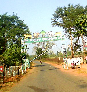
Nuagan is a town in Nayagarh district of Odisha state of India.

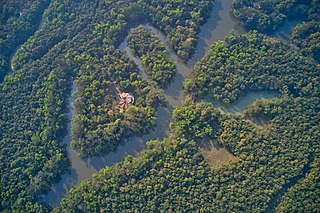
Dashapalla, also known as Daspalla, is an archaeologically important site situated in Nayagarh district, Odisha, India.
Karlapat Wildlife Sanctuary is a wildlife sanctuary located in Kalahandi district and a popular tourist attraction of Odisha in India. Karlapat Wildlife Sanctuary is about 15 km from Bhawanipatna, the district headquarters of Kalahandi district.

Satkosia Tiger Reserve is a tiger reserve located in the Nayagarh district of Odisha, India covering an area of 988.30 km².
Kondakameru Wildlife Sanctuary is a wildlife sanctuary in Malkangiri district, Odisha, India.
Balimela Wildlife Sanctuary is a wildlife sanctuary in Malkangiri district, Odisha, India.

Hadgarh Wildlife Sanctuary wildlife sanctuary situated Keonjhar district in Odisha, India, covering an area of 191 km2 was established in 1978. The sanctuary lies in the catchment of Salandi river, a major tributary of the river Baitarani. Besides the Salandi river, the other perennial and seasonal streams are Mukta stream, Ghagara stream, Pitanau stream, Andheri stream, Suranga stream, Chakratirtha stream and Bentokholi stream. A large stagnant water body of river Salandi, called as Hadagarh reservoir is found inside the Sanctuary and is the important wetlands of this Sanctuary that attracts a variety of water birds both migratory and resident. Hadgarh sanctuary is linked to Similipal tiger reserve and Kuladiha wildlife sanctuary.
The Lakhari Valley Wildlife Sanctuary is located in Ganjam District, Odisha, India.
The Kuldiha Wildlife Sanctuary is situated in the Balasore district of Odisha, India. The sanctuary is spread across 272.75 km2 (105 sq mi) in the Chota Nagpur Plateau region. It is linked with Simlipal National Park via the Sukhupada and Nato hill ranges. It is classified as an Eastern Highlands moist deciduous forests ecoregion.
Kapilasa Wildlife Sanctuary or Kapilash Wildlife Sanctuary is situated in Dhenkanal district of Odisha state in India. It is spread across 125.5 km2 (48 sq mi) in the Chota Nagpur Plateau region. It is classified as an Eastern Highlands moist deciduous forests ecoregion.
Kotgarh Wildlife Sanctuary is situated in the Baliguda subdivision of Kandhamal district of Odisha state in India. It is classified as an Eastern Highlands moist deciduous forest. Around 52 tribal villages such as Kutia Kondh and Desia Kondh inhabit the sanctuary.
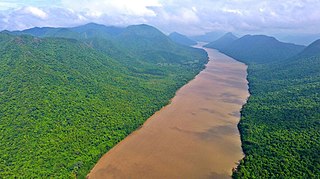
Satkosia Gorge is a gorge in eastern Odisha, India, carved by the Mahanadi River. The gorge is located within the Satkosia Tiger Reserve which is a United nations Protected area.It is also a Ramsar site designated in 2021.
References
- ↑ "Baisipalli Sanctuary (map)". Nayagarh.nic.in.
- ↑ "Baisipalli Sanctuary (map)". Nayagarh.nic.in.
- 1 2 "Mahandi Wildlife Division, Nayagarh". District Portal Nayagarh. Archived from the original on 10 February 2014. Retrieved 2 August 2014.
- ↑ Negi, Sharad Singh (1993). Biodiversity and Its Conservation in India. Indus Books. p. 241.
- ↑ "Baisipalli PA :: Odisha Wildlife Organisation". www.wildlife.odisha.gov.in. Retrieved 17 May 2021.