Baiwada

Last updated

Baiwada
Village
India Gujarat location map.svg
Red pog.svg
Baiwada
Location of Baiwada on the map of Gujarat
India location map.svg
Red pog.svg
Baiwada
Baiwada (India)
Coordinates: 24°21′18.5″N72°10′05.2″E / 24.355139°N 72.168111°E / 24.355139; 72.168111 Coordinates: 24°21′18.5″N72°10′05.2″E / 24.355139°N 72.168111°E / 24.355139; 72.168111
Country India
State Gujarat
District Banaskantha
Government
  Type Panchayati Raj
  Body Gram Panchayat
Population (2011)
  Total 4,835
Languages
  Official Hindi, Gujarati
Time zone IST (UTC+5:30)
PIN 385535
Area code(s) 02744
Vehicle registration GJ 08
Website gujaratindia.com

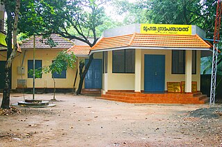
Baiwada is a village located in Banaskantha district in the state of Gujarat, India.The village is located at about 10 km from the Deesa. The village follows the Panchayati raj system. The village has undergone a transformation under the panchayat.

Gujarat State in India

Gujarat is a state in Western India and Northwest India, a coastline of 1,600 km (990 mi) – most of which lies on the Kathiawar peninsula – and a population in excess of 60 million. It is the sixth largest Indian state by area and the ninth largest state by population. Gujarat is bordered by Rajasthan to the northeast, Daman and Diu to the south, Dadra and Nagar Haveli and Maharashtra to the southeast, Madhya Pradesh to the east, and the Arabian Sea and the Pakistani province of Sindh to the west. Its capital city is Gandhinagar, while its largest city is Ahmedabad. The Gujarati-speaking people of India are indigenous to the state. The economy of Gujarat is the third-largest state economy in India with 14.96 lakh crore (US$210 billion) in gross domestic product and a per capita GDP of 157,000 (US$2,200).

Deesa city in Gujarat, India

Deesa is a city and a municipality in the Banaskantha district in the state of Gujarat, India.

Panchayati raj

The Panchayat raj is a South Asian political system found mainly in India, Pakistan, Bangladesh, Sri Lanka, and Nepal. It is the oldest system of local government in South Asia, and historical mentions date to the c. 250 AD period. The word raj means "rule" and panchayat means "assembly" (ayat) of five (panch). Traditionally panchayats consisted of wise and respected elders chosen and accepted by the local community. However, there were varying forms of such assemblies. Traditionally, these assemblies settled disputes between individuals and between villages.

Contents

Demographics

The Baiwada village has population of 4835 of which 2468 are males while 2367 are females as per Population Census 2011.

In Baiwada village population of children with age 0-6 is 794 which makes up 16.42% of total population of village. Average Sex Ratio of Baiwada village is 959 which is higher than Gujarat state average of 919. Child Sex Ratio for the Baiwada as per census is 864, lower than Gujarat average of 890. [1]

Education system

There is one primary school in Baiwada. The school drop-out rate is zero in Baiwada.

Water system

The panchayat arranging Drinking water for all villagers. The village also has a proper sanitation and drainage system.

Sanitation public health conditions related to clean drinking water and adequate disposal of human excreta and sewage

Sanitation refers to public health conditions related to clean drinking water and adequate treatment and disposal of human excreta and sewage. Preventing human contact with feces is part of sanitation, as is hand washing with soap. Sanitation systems aim to protect human health by providing a clean environment that will stop the transmission of disease, especially through the fecal–oral route. For example, diarrhea, a main cause of malnutrition and stunted growth in children, can be reduced through sanitation. There are many other diseases which are easily transmitted in communities that have low levels of sanitation, such as ascariasis, cholera, hepatitis, polio, schistosomiasis, trachoma, to name just a few.

Drainage natural or artificial removal of surface and sub-surface water from an area

Drainage is the natural or artificial removal of a surface's water and sub-surface water from an area with excess of water. The internal drainage of most agricultural soils is good enough to prevent severe waterlogging, but many soils need artificial drainage to improve production or to manage water supplies.

Related Research Articles

Meghraj city in Gujarat, India

Meghraj is a census town in Aravalli district in the Indian state of Gujarat.

Nallur, Kanyakumari Town in Tamil Nadu, India

Nallur (Nalloor) is a panchayat town in Kanniyakumari district in the Indian state of Tamil Nadu.

Thondi or Tondi is a Panchayat town in Ramanathapuram district in the Indian state of Tamil Nadu. It is believed to be an ancient port site of Pandiyan kingdom. The famous Sri Sarvatheertheswarar Temple at Marungur, Theerthandathanam is located little northerly to Thondi.

Shahpur, Burhanpur Town in Madhya Pradesh, India

Shahpur is a town and a nagar panchayat in Burhanpur district in the Indian state of Madhya Pradesh.

Kodamthuruth village in Kerala, India

Kodamthuruth is a village in Alappuzha district in the Indian state of Kerala. This is a panchayat which come under the Aroor Assembly constituency.

Tikota Taluka in Karnataka, India

Tikota is a taluka place in the southern state of Karnataka, India. It is located in the  Bijapur District in Karnataka.

Kerura City in Karnataka, India

Kerur is a City in Bagalkot district in Karnataka, which located on NH 218. It has an average elevation of 617 meters (2024 feet). Its a birthplace of Jagadish Shettar, a former Chief Minister of Karnataka. Kerur is a Town Panchayat city in district of Bagalkot, Karnataka. The Kerur city is divided into 16 wards for which elections are held every five years. The Kerur Town Panchayat has population of 19,731 of which 9,929 are males while 9,802 are females as per report released by Census India 2011.

Bhayavadar, Gujarat Village in Gujarat, India

Bhayavadar is a village in Amreli district in the Indian state of Gujarat. The majority population of the village are Patels.
Vatav village in Gujarat state, India

Vatav is a small village located in the Petlad Taluka in Anand district, Gujarat, India. With a population of 2,484, Vatav is the 20th least populous village in the Petlad sub-district. The nearest town is Petlad which is located 4 km from Vatav, and is the sub-district's headquarters. The total geographical area of Vatav Village is 2.7 km2, making it the 13th smallest village by area in the sub-district. The population density of the village is 927 persons per km2 The pin code of Vatav Village is 388450. The village comes under Vatav panchayat. The district headquarters is Anand, which is 15 km away.

Puduvoyal Suburb in Tiruvallur, Tamil Nadu, India

Puduvoyal is a village panchayat located in the Thiruvallur district of Indian state of Tamil Nadu.

Tilkhoja Place in West Bengal, India

Tilkhoja is a village and Gram Panchayat located in Moyna Tehsil/ Block of Purba Medinipur district in the Indian state of West Bengal hosting 1318 families. Moyna is the nearest town.

Bheduasole Place in West Bengal, India

Bheduasole is a medium sized Gram Panchayat and Village in Indpur Block in Bankura District of the Indian state of West Bengal. It is located in Burdwan Division. It is located 23 KM towards west from District head quarters Bankura and 187 KM from State capital Kolkata.

Makaji Meghpar Village in Gujarat, India

Makaji Meghpar is a village and former chiefdom of Hardhrol Jadeja chieftains in the Jamnagar district of Gujarat, India. It was founded in 1754 by Makanji Jadeja of Dhrol State. Gujarati writer Harilal Upadhyay is from the village. The peoples are mainly Jadeja Rajputs with some Brahmins, Patels and Shudras.
Ngaikhong Khullen Village in Manipur, India

Ngaikhong Khullen is a large village located in Bishnupur district, Manipur, India, with a total of 1084 families residing.

Bagoran Village in Punjab, India

Bagoran also spelled as Baghoran is a village in Shaheed Bhagat Singh Nagar district of Punjab State, India. It is located 2.7 kilometres (1.7 mi) away from postal head office Mukandpur, 11.2 kilometres (7.0 mi) from Banga, 16.8 kilometres (10.4 mi) from district headquarter Shaheed Bhagat Singh Nagar and 92.5 kilometres (57.5 mi) from state capital Chandigarh. The village is administrated by Sarpanch an elected representative of the village.

Sotran Village in Punjab, India

Sotran is a village in Shaheed Bhagat Singh Nagar district of Punjab State, India. It is located 9.2 kilometres (5.7 mi) away Mukandpur, 1.8 kilometres (1.1 mi) from Banga, 12 kilometres (7.5 mi) from district headquarter Shaheed Bhagat Singh Nagar and 105 kilometres (65 mi) from state capital Chandigarh. The village is administrated by Sarpanch an elected representative of the village.

Chak Guru Village in Punjab, India

Chak Guru is a village in Shaheed Bhagat Singh Nagar district of Punjab State, India. It is located 9.2 kilometres (5.7 mi) away from Garhshankar, 17.6 kilometres (10.9 mi) from Balachaur, 17 kilometres (11 mi) from district headquarter Shaheed Bhagat Singh Nagar and 87 kilometres (54 mi) from state capital Chandigarh. The village is administrated by Sarpanch an elected representative of the village.

Chaita is a village and a gram panchayat in Basirhat II CD Block in Basirhat subdivision of North 24 Parganas district, West Bengal, India with total 528 families residing. The Chaita village has population of 2390 of which 1215 are males while 1175 are females as per population census 2011.

Karol is a village and former minor Rajput princely state on the Saurashtra peninsula in the Indian state of Gujarat.

Mota Vadala Village in Gujarat, India

Mota Vadala is village located in Jamnagar District of Gujarat. The village has 902 families and a population of 4129 of which 2139 are males and 1990 are females as per Indian Population Census 2011.
References

  1. "Baiwada". 15 March 2016.