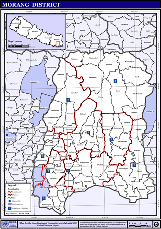
Rangeli is a Municipality and rural market town in Morang District in the Koshi Zone of south-eastern Nepal. This municipality was formed merging existing four villages i.e.Amgachhi, Babiabirta, Darbesa and Rangeli itself since May 2014.
Sangpang is a village development committee in Bhojpur District in the Koshi Zone of eastern Nepal. At the time of the 1991 Nepal census it had a population of 3567 persons living in 718 individual households.
Arkhale is a town and Village Development Committee in Khotang District in the Koshi Province of eastern Nepal. At the time of the 2001 Nepal census it had a population of 3,025 persons living in 575 individual households.

Katari is a Municipality in Udayapur District in the Koshi province of south-eastern Nepal. It lies by the Tawa river having the bridge of length 123.5m. This was established by merging two existing village development committees i.e. Triveni and Katari on 18 May 2014. At the time of the 1991 Nepal census it had a population of 7230 people living in 1410 individual households. Thirty years later, Katari had undergone rapid growth, achieving a population of 56,146 people by the 2011 census. There is a big Government school Triveni secondary school
Madi Rambeni is a village development committee in Sankhuwasabha District in the Koshi Zone of north-eastern Nepal. At the time of the 1991 Nepal census it had a population of 4741 people living in 919 individual households.
Budhabare is a village development committee in Dhankuta District in the Koshi Zone of eastern Nepal. At the time of the 1991 Nepal census it had a population of 1954.
Kechana is a village development committee in Jhapa District in the Koshi Province of south-eastern Nepal. At the time of the 1991 Nepal census it had a population of 4420 people living in 948 individual households.
Ghuski is a village development committee in Sunsari District in the Koshi Zone of south-eastern Nepal. At the time of the 2021 Nepal census, it had a population of 15,121 people living in 2,000 individual households.

Duhabi is a municipality in Sunsari District in the Koshi Zone of south-eastern Nepal. At the time of the 2001 Nepal census it had a population of 17,574. Duhabi is situated in between Itahari and Biratnagar, on the bank of Budi River. It is the center of Sunsari–Morang industrial corridor.
Gautampur is a village development committee in Sunsari District in the Koshi Zone of south-eastern Nepal. It has neighbouring villages called Ramnagar in the west, Harinagra in the south whereas Jalpapur village also lies in the North Direction respectively but nowadays jalpapur is merged into Inaruwa Municipality. At the time of the 1991 Nepal census it had a population of 3193 people living in 545 individual households.
Laukahi is a Village in Koshi Rural Municipality in Sunsari District of Koshi Province of Nepal.
Rajganj Sinuwari is a village development committee in Sunsari District in the Kosi Zone ,Koshi Province of south-eastern Nepal.Currently it lies in Dewanganj Rural Municapility. At the time of the 1991 Nepal census it had a population of 8251.

Phidim Municipality is the headquarters of the Panchthar District in the Koshi Province of eastern Nepal. Phidim old name is Pheden in Limbu langauage its means Plan land of top of hills.Phidim was capital of panthar thum of Limbuwan.Phidim was upgraded to a 'municipality' from a 'village', when a development committee merged with other VDCs - including the Phidim, Chokmagu and Siwa villages - on May 18, 2014. It offers a route for trekkers and locals, who travel to and from the Taplejung district bordering with the Tibetan Autonomous Region of China. It is also a commercial hub for the rural surroundings.

Bayarban was a village development committee in the Morang District, Koshi Zone of south-eastern Nepal. It was named for the village of Bayarban Bazar. In 2017 it was absorbed by the newly created Kanepokhari Rural Municipality.

Letang, "लेटाङ " is a municipality with 9 wards in Morang District in the Koshi Province of Nepal. It was formed by merging the existing Village Development Committees of Letang, Jante, Warrangi and Bhogateni. This municipality is situated in Hilly Region as well as Terai Region. Previously it was called Letang Bhogateni but now it's known as Letang.
Pathari Shanishchare (पथरी-शनिश्चरे) is a Municipality in Morang District in the Koshi Zone of south-eastern Nepal. It was formed by merging three existing village development committees i.e. Hasandaha, Pathari and Sanischare in May 2014.
Pokhariya is a village development committee within the Morang District, Koshi Zone, Nepal. At the time of the 1991 Nepal census it had a population of 2078 people living in 376 individual households.
Tankisinuwari is a village development committee in Morang District in the Koshi Zone of south-eastern Nepal. At the time of the 1991 Nepal census it had a population of 16,481.

Urlabari is a city and municipality in Morang District in the Koshi Zone of south-eastern Nepal. It is considered to be the second largest city in Morang District after Biratnagar. At the time of the 1991 Nepal census it had a population of 18,224. At the time of the 2011 Nepal census it had a population of 35,166 and 8,165 households.
Sundar Haraicha is a municipality in Morang District of Koshi Province in Nepal. It is centered around Biratchowk town which is the gateway to Biratnagar. It borders Itahari Sub- Metropolitan city to the west, Dharan Sub- Metropolitan city to the Northwest and Belbari municipality to the east and is connected by Mahendra Highway. It is one of the fastest growing cities in eastern Nepal and the second largest city of Morang district after Biratnagar, with 121,305 inhabitants living in 26,677 households. It consists of the town centres of Biratchowk and Gothgaun which are parts of the Greater Birat Development Area which incorporates the cities of Biratnagar-Itahari-Gothgau-Biratchowk-Dharan primarily located on the Koshi Highway in Eastern Nepal, with an estimated total urban agglomerated population of 804,300 people living in 159,332 households.


