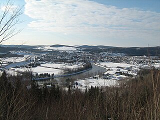
The Madawaska River flows from Lake Témiscouata in Quebec, through Degelis, Quebec, to join the Saint John River at Edmundston, New Brunswick.

The Big Black River is a river crossing the administrative region of Chaudière-Appalaches in Quebec and in Maine. From its source, in L'Islet RCM, Quebec, the river runs northeast and east across the Canada–United States border in Maine Township 14, Range 16, WELS, to the Saint John River in Northwest Aroostook T 15, R 13.
The Campbell Branch Little Black River is a short river in Quebec (Canada) and northern Maine.
The Southwest Branch Saint John River is a 62.0-mile-long (99.8 km) river in Maine and Quebec. The branch originates in "Little Saint John Lake" on the international boundary between Saint-Zacharie, Quebec and Seboomook Lake Township 5, Range 20, WELS. The branch forms the Canada–United States border as it flows northeasterly to a confluence with the Little Southwest Branch Saint John River in Seboomook Lake Township 9, Range 18, WELS. The Southwest Branch flows briefly into Quebec and then through Maine to its confluence with the Baker Branch Saint John River in Seboomook Lake Township 9, Range 17, WELS. The Southwest Branch finally joins with the Northwest Branch to form the Saint John River.
The West Branch Little Black River is a short river in Quebec and northern Maine.
The Kedgwick River is a tributary of the head of the Restigouche River, in New Brunswick, in Canada. It flows southeast in:
The Little Main Restigouche River is a tributary of the head of the Restigouche River, flowing in Madawaska County, Victoria County and Restigouche County, in Northwest of New Brunswick, in Canada.
The Southern Branch of the Kedgwick River flows into the Saint-Quentin in Restigouche County at New Brunswick, in Canada.
The West Branch Gounamitz River is a tributary of the Gounamitz River which in turn is a tributary of the head of the Restigouche River. These bodies of water flow in the Northwestern New Brunswick, in Canada.
The river Chimenticook is a tributary of the Saint John River, flowing in the canton T13 R13 Wels, in the Aroostook County, in North of Maine, in United States.
The Pocwock Stream is a tributary of the Saint John River, flowing in:
The Otter River is a tributary of the Northwest Branch Saint John River, flowing in Quebec (Canada) and in Maine. This river crosses the following administrative territories:
The Baker River North is a tributary of the Baker River, flowing in Canada:

The Branche à Jerry is a tributary of the Baker River, flowing in Canada in:
The Depot River is a tributary of the Big Black River, flowing in the townships T12 R17 Wels, T13 R16 Wels and T14 R15 Wels, in the Aroostook County in North Maine Woods in Maine, in United States.
The West Branch Pocwock Stream is a tributary of the Pocwock River flowing in:
The Boucanée River is a tributary of the lake Pohenegamook, flowing in the southern part of the Gaspé Peninsula, in the municipalities of Saint-Athanase, Quebec and Pohénégamook, Quebec, in Témiscouata Regional County Municipality (RCM), in the administrative region of Bas-Saint-Laurent, in Quebec, in Canada.
The Iroquois River is a tributary of the Saint John River emptying in New Brunswick, in Canada. This river flows into the Notre Dame Mountains, in the municipality of Dégelis, Quebec, in Temiscouata Regional County Municipality (RCM), in administrative region of Bas-Saint-Laurent, in Quebec; and in the Madawaska County, in New Brunswick, in Canada.
The Little Iroquois River is a tributary of the Iroquois River, flowing in Notre Dame Mountains, the Madawaska County, in Northwest of New Brunswick, in Canada.
The Crocs River is a tributary of the Saint John River, in Quebec and New Brunswick, in Canada. The Crocs River flows in the southern part of the Gaspé Peninsula, across the following areas:


